Baxter State Park Nordic Backcountry Tour (2018) Part 1 — The Calm Before the Storm

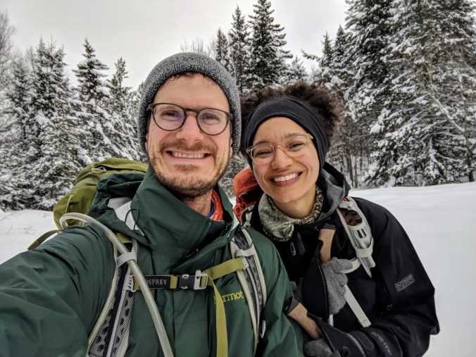
Hey all! It’s not bike touring, but we took our first ever multi-day backcountry ski tour in March, and we wanted to preserve it here on the blog. Enjoy!

Day 0, March 10: Brooklyn to Mt. Chase Lodge

Today was a driving day. I walked Ellie over to K&B’s, who had graciously offered to watch her for the week. When I got back home, I decided it was smart to move our car to the street directly in front of the apartment so we could pack more easily. Fifteen minutes later, we stumble downstairs carrying our backpacks, skis, and the rest of our gear and find a traffic cop looking curiously into our window. It was street sweeping day! Luckily, we got there just in time, and we didn’t get a ticket.

We were on the road by 7:45 or so, and the drive out of the city was blessedly uneventful. We stopped in Portland to grab some lunch around 1:30, and ate at a place called Sillys, which had tasty, but rich and heavy, meal options. However, fatty carbs are just the thing to eat for lots of energy!

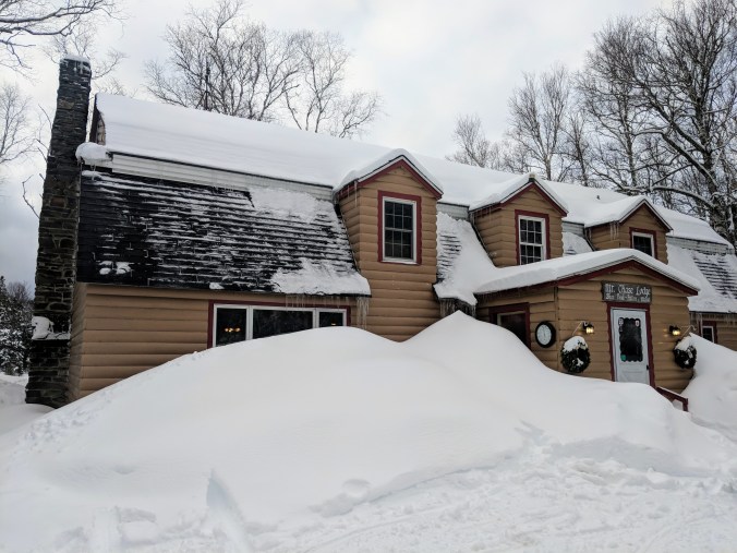
Back on the road, we made good time (in next to zero traffic) to our jumping off point: Mt. Chase Lodge, a delightful little guesthouse run by husband and wife team Lindsey and Mike. The lodge had a cozy fireplace in the lower level and the rooms, while not fancy, were everything we needed. There were several other guests there—all snowmobilers. We ate a family style meal cooked by Mike, who is a truly wonderful chef, and who made us a vegan pesto pasta and AMAZING peanut butter chocolate mini lava cakes. Holy moly.

MVIMG_20180311_082602.jpg

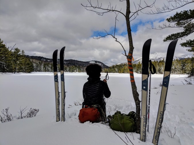
After dinner we went back up to the room, waxed the skis, organized our bags, and filled up our water. Then we boned up on our orienteering skills. This ended up being unnecessary because I had a map downloaded and we always had GPS, but better safe than sorry.

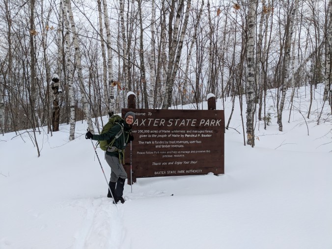
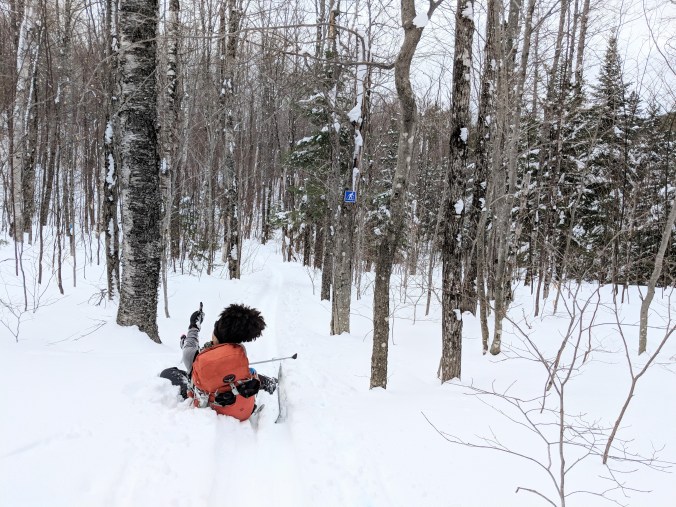
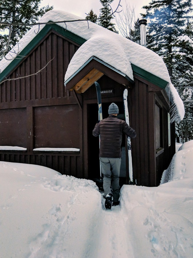
Day 1, March 11: Parking lot to South Branch Pond Bunkhouse (11.27 miles)

We woke up a little before 7 and headed for the shower before other the other guests got in our way. Dani made it. But since we only brought one small bottle of soap, I had to wait and I missed my shot.

When Dani finished showering, she pointed out that I was already in the camping mindset: of course guest house showers have soap in them.

We went down to breakfast, and Mike had made some delightful oatmeal that was vegan friendly, along with scrambled eggs, bacon, sausage, and blueberry pancakes. I asked if the pancakes were vegan, and he did that they were not, but that he was happy to whip some vegan pancakes up for us.

So we ate oatmeal and drank coffee with the leftover almond milk we brought from home, and ten minutes later we were each presented with a stack of 3 banana almond flax pancakes. Holy mother of delicious. Judging purely on looks, they were better than the non-vegan pancakes. Judging from the jealous glances of the other guests, I’m not the only one who thought so.

After some more lovely conversation with two ladies from Bar Harbor that we met last night (they told us to avoid Acadia in August and taught us about harvesting and using chaga), we whipped together our things and headed out. It was a half hour drive to the parking lot, and the entire time we were consumed with nerves. What if we got lost? What if our packs were too heavy? What if we made it 9 miles in and just couldn’t go any farther?

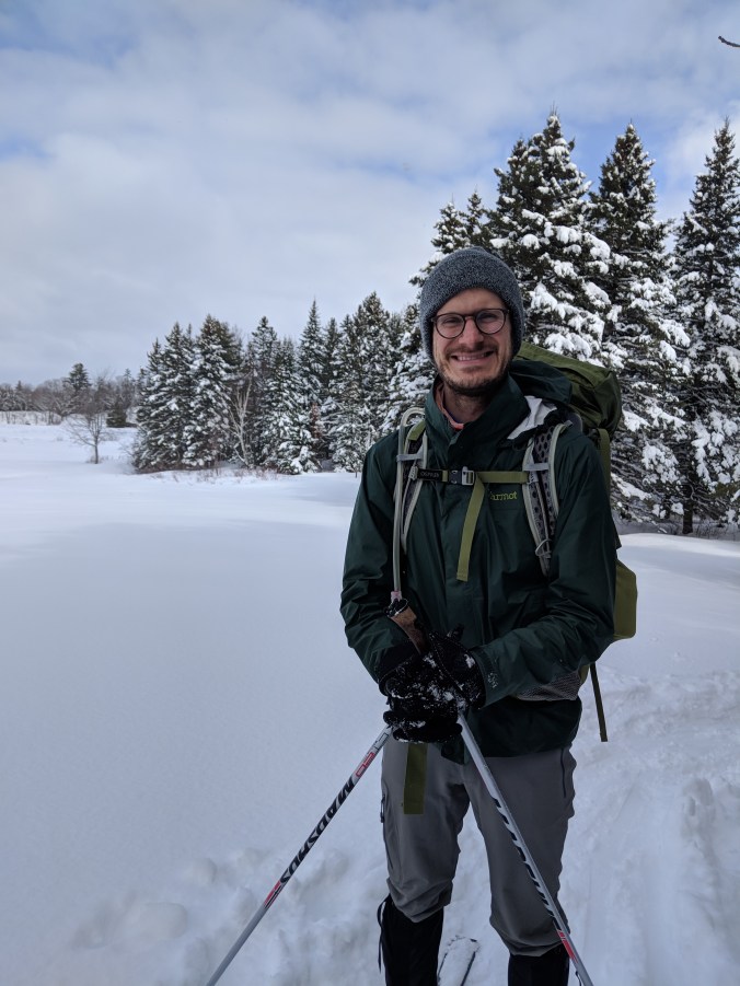
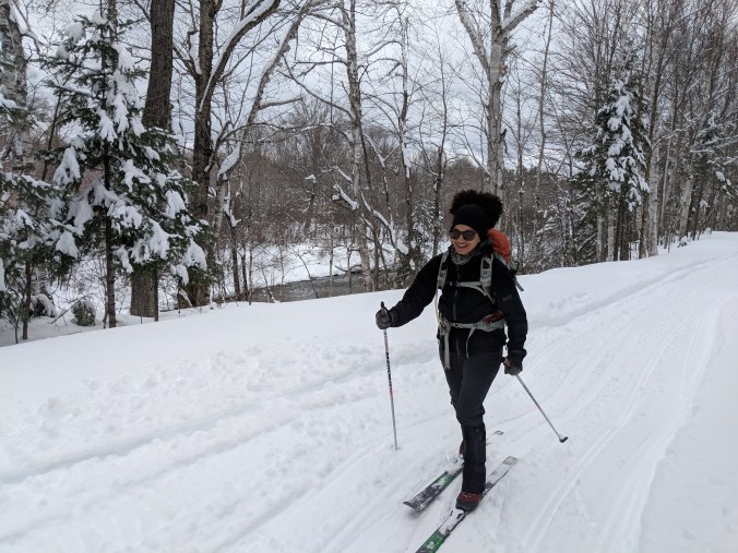
We made it to the parking area, put all of our stuff on and in our bags, and set out. And all of our nerves were for nothing. We DO love cross country skiing and we ARE in decent physical shape and while our bags were heavy, we COULD do this.

MVIMG_20180311_092744.jpg

IMG_20180311_095054.jpg
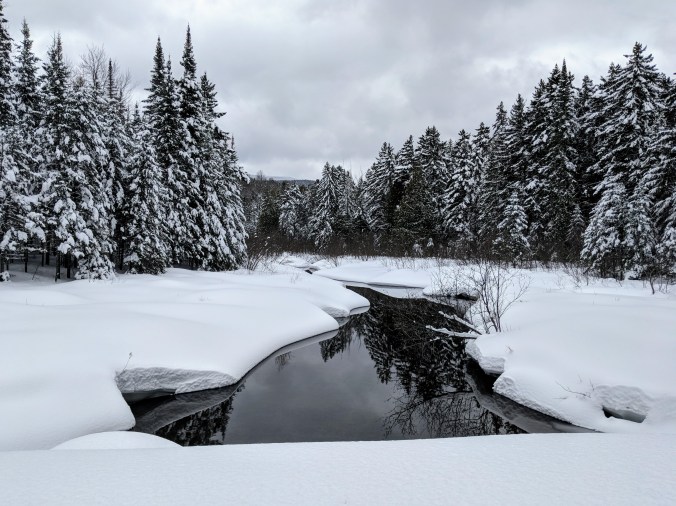
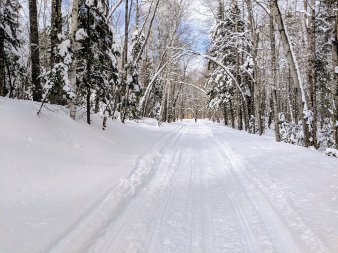
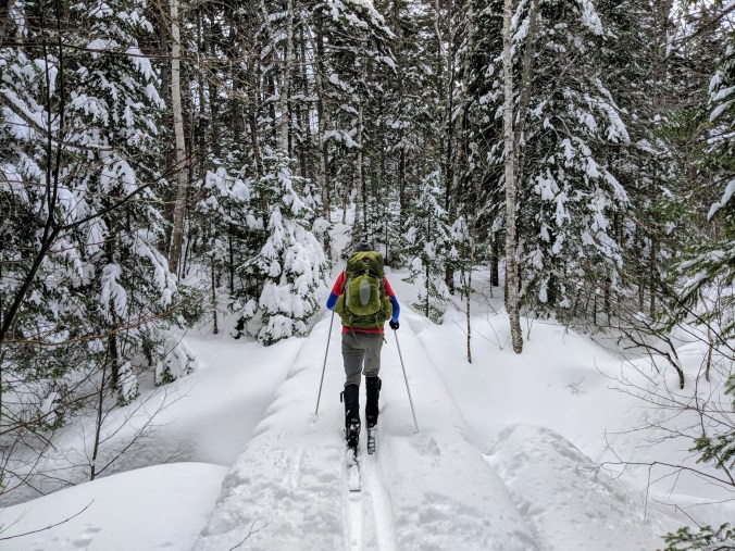
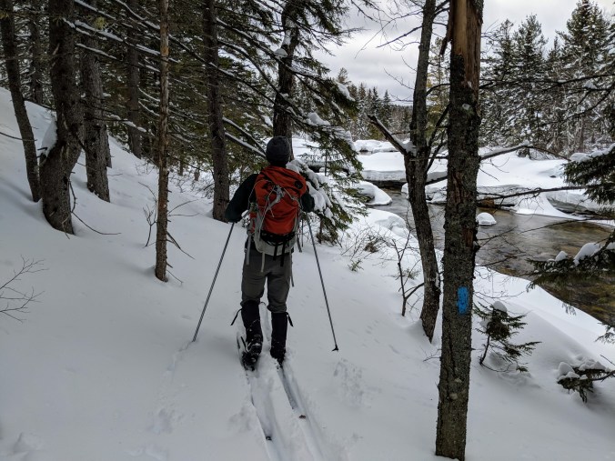
And man oh man. What a winter wonderland. Snow laden pines, frozen lakes and babbling streams. And complete solitude. Heaven.

MVIMG_20180311_101048.jpg

MVIMG_20180311_105733.jpgIMG_20180311_122522.jpg
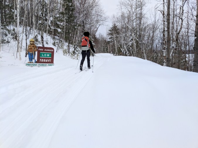
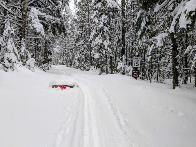
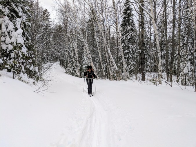
The BSP website warns people that snow travel is slower than summer travel, and advised us to plan for 1.5-2 mph. But we found ourselves making excellent time, moving at a 2.5-3 mph clip. The first 9 miles or so were on the tote road, which is the only path in the park that snowmobiles may use. This made for some bumpy, skiddy skiing, but because we didn’t know any better, we didn’t mind at all.

MVIMG_20180311_113713.jpg

00100dPORTRAIT_00100_BURST20180311120247977_COVER.jpg

IMG_20180311_113055.jpg

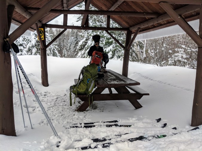
We stopped at Trout Brook farm bunkhouse about 4 miles in to have a snack (we each saved a pancake), and I had to use the restroom. While here, I lived up to my reputation I built on our bike tour and fell over when I stopped moving. Then I got lost skiing around the bunkhouse looking for the toilet. Anyways, I got myself sorted out and we set out on the road again.

IMG_20180311_110640.jpg

IMG_20180311_123034.jpgIMG_20180311_121808.jpg

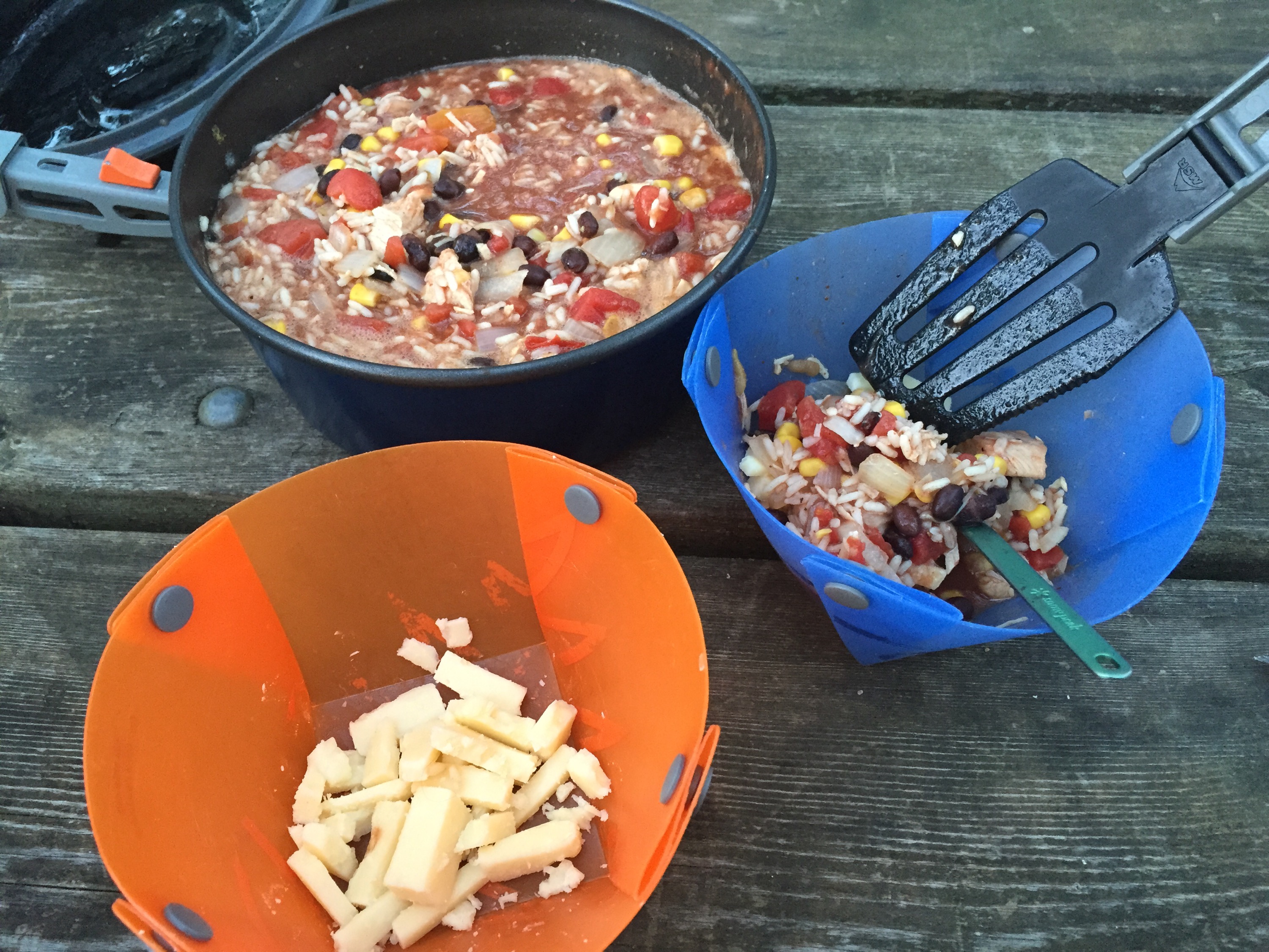
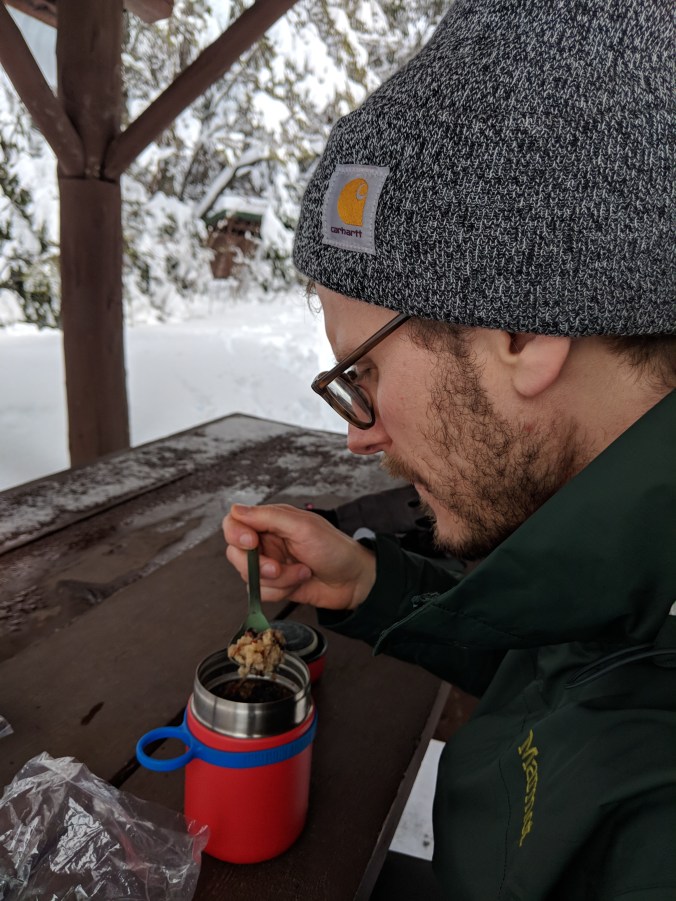
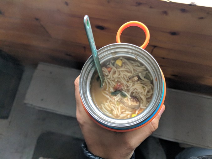
After 5 more miles (and 3.5 total skiing hours) we came to Trout Brook Crossing, which was our turnoff from the tote road. We stopped for lunch, and Dani’s idea to put hot water in a thermos full of dehydrated rice, beans, tomatoes, and spices turned out splendidly. It was so nice to have a warm meal in the middle of the day. And a cookie. The cookie was nice too.

MVIMG_20180311_132326.jpg

IMG_20180311_133410.jpgAfter lunch, we headed out toward South Branch Pond, and off the snowmobile path. This was EVEN MORE BEAUTIFUL! But it was also a climb. And the wet snow was really sticking to our skis. I had heard about how miserable this makes skiing, but I hadn’t experienced it for myself yet. And I was muttering to myself because I had noticed it before lunch and I could have applied a new layer of wax each to our skis, but I didn’t. Oh well.

IMG_20180311_135704.jpgIMG_20180311_142915.jpg

Even with the sticky snow, it was a delight of a ski, even if the first mile and change was the steepest climb of the day. At that point we came to a trail crossing that -when we looked at our map- seemed halfway between the tote road and our campsite. This was strange because we thought we to ski over 5 miles on this leg, and it didn’t make sense. that we were already at the halfway point.  But turned out we only had a little over 2 miles to ski! Bonus happy surprise!

IMG_20180311_140337.jpg

IMG_20180311_145832.jpg

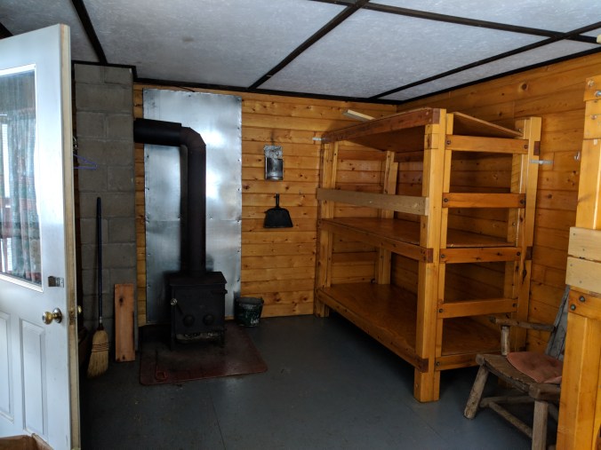
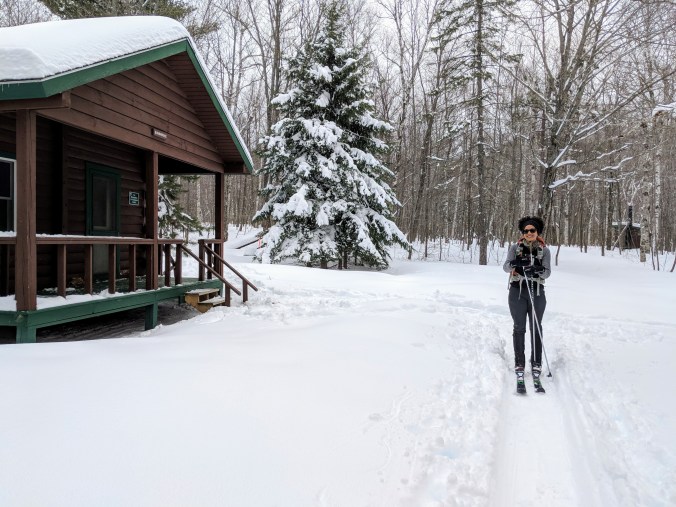
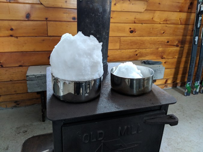
We came down a big hill to the campsite and our bunkhouse, which we were sharing with a group of five Mainers. Tom, Brent, Jeff, Bob, and Sherry. They were all friendly and delightful, and we passed the next five hours melting snow for water on the woodstove, playing cards, looking out over the pond (which is a lake to my eye), and just enjoying company.

MVIMG_20180311_145841.jpgIMG_20180311_164410.jpg

IMG_20180311_173013.jpg

MVIMG_20180311_173043.jpg

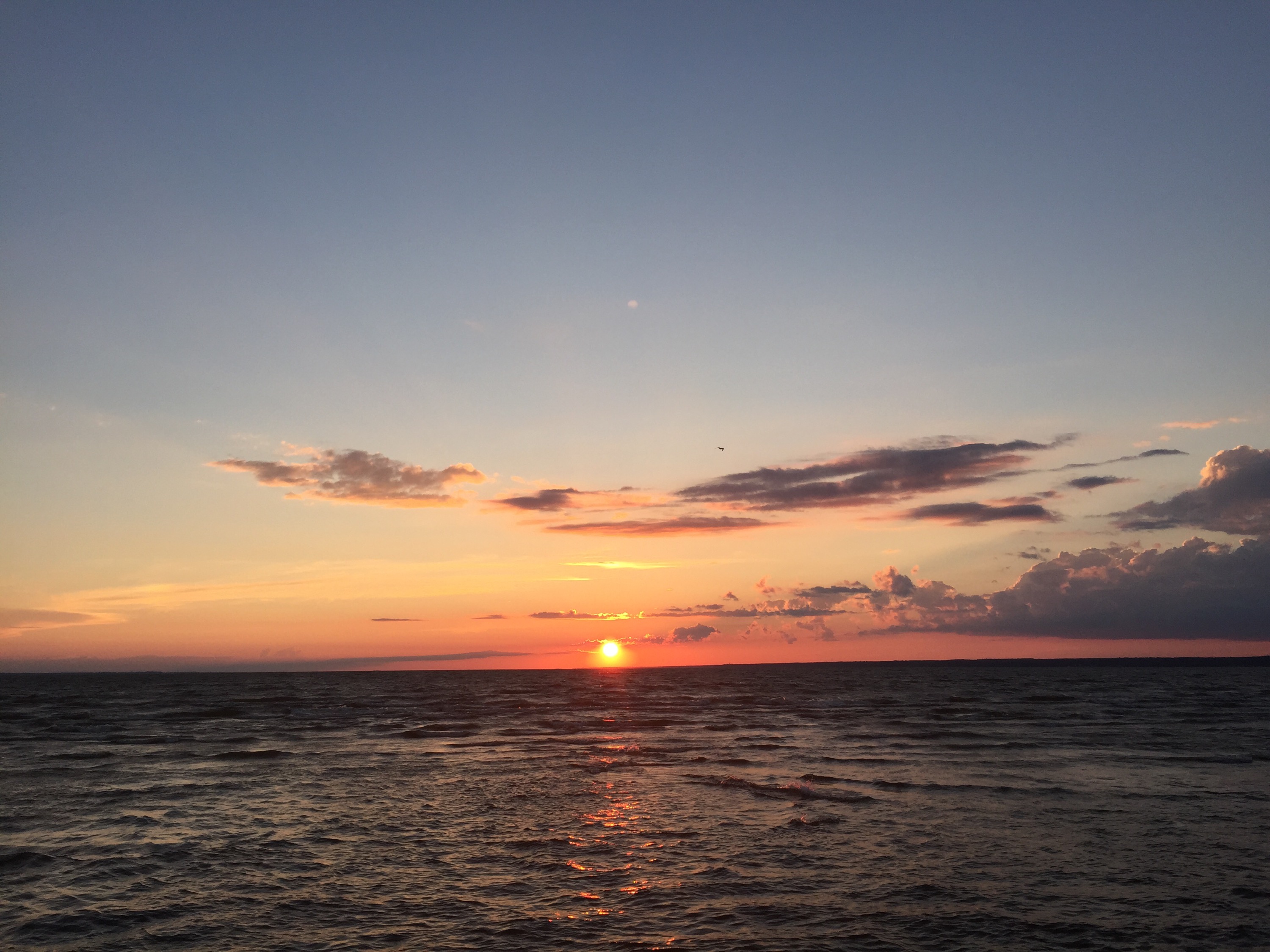
Dinner tonight was chili, which we forgot to photograph, but it was delicious and spicy. People went to bed early, around 8:30, and before we hit the hay, we went outside one last time to marvel at the sparkling Maine night sky. (And poop. I also went outside to visit the outhouse.) But those stars, friends, those stars…

Day 2, March 12:  South Branch Pond Bunkhouse to Russell Pond Bunkhouse (9.62 miles)

We woke up around 7—well, our bunkmates woke up at 7 and started packing and getting ready to go. The bunkhouse is wonderful, but sounds are amplified throughout the place. There is no sleeping in when sharing such a place.

We took our time this morning. It was a little frantic while our bunkmates were packing to leave, but then when they did it was calm and peaceful. We played an Ella and Louis album on a phone and made apple cinnamon oatmeal. After oatmeal we cleaned out our thermoses and made some coffee.  After coffee, we filled up the thermoses with our dehydrated rice and beans mix for lunch and added some hot water. It deserves mentioning again and again: Dani’s idea to buy these food thermoses and pack premade dehydrated meals in parchment bags was brilliant and, at a small risk of hyperbole, the most important (controllable) factor in us having a good trip.

IMG_20180312_094713.jpg

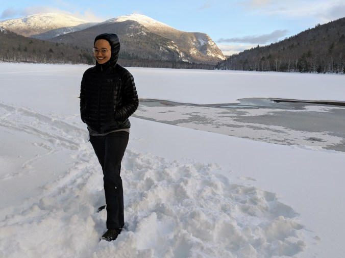
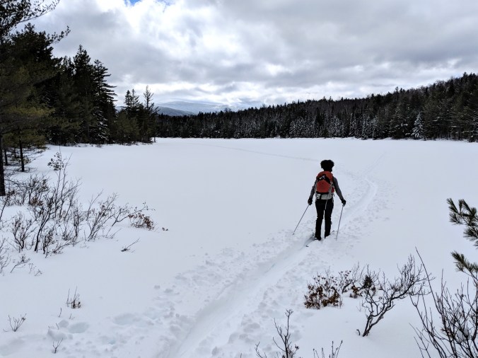
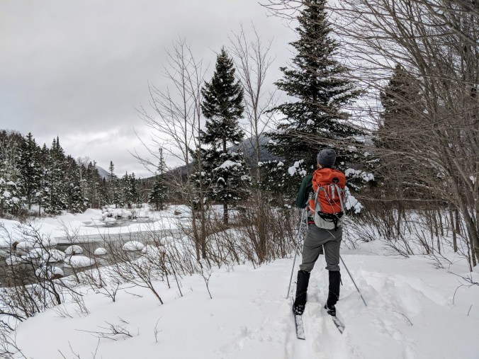
We got on the path at about 9:45. Our shoulders were sore, but we otherwise felt pretty good. The day started by skiing across Upper- and Lower- South Branch ponds. It’s a weird feeling to be skiing across a lake, but we had heard at Mt. Chase Lodge that the lakes had 24 inches of ice, so we were pretty safe. It’s also a fun perspective to see the mountains circling the lake from the middle of the lake. We were lucky to be following other people’s tracks, because it otherwise might have been a challenge to find the trail at the other side. There is a tree wrapped in some orange tape that makes the correct exit, but I’m not entirely sure we would have seen it on our own.

IMG_20180312_094951.jpgIMG_20180312_101251.jpgIMG_20180312_101628.jpg

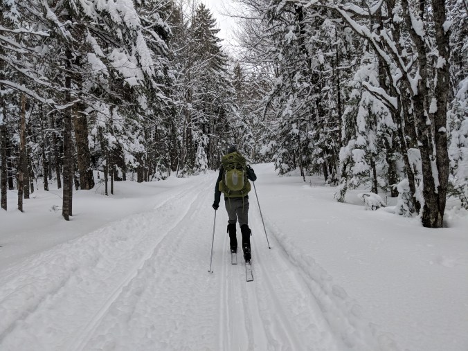
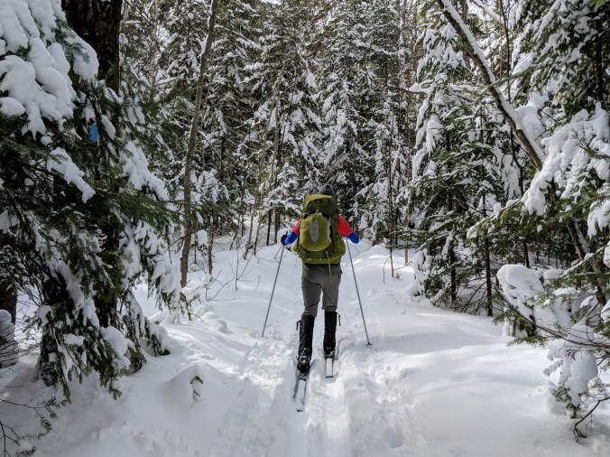
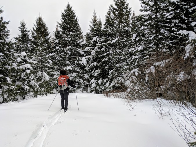
On the other side of the lake, the trail became even more beautiful, because instead of following a broader road (even the path after the snowmobile trail yesterday is a road during the summer), we were on a singletrack trail winding through an evergreen and birch forest.

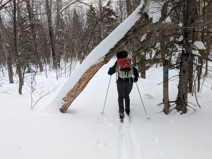
This is also where we learned that backing up on skis with a heavy backpack generally leads to falling. Although, perhaps I give at least me too much credit when I say I “learned” this, because I had to learn a few more times before I really believed it.

IMG_20180312_102414.jpgMVIMG_20180312_102717.jpg

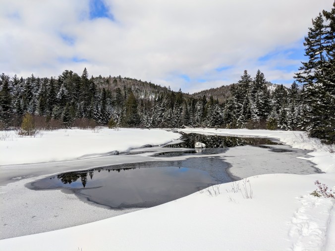
We skied for a few miles along beautiful creek. We crossed a lot of small streams, but they all had packed snow bridges that, with one exception, were no problem at all. At one point, some unfortunately-timed wind blew a branchful of snow off of it’s branch and down the back of Danielle’s shirt. Oopsie.

IMG_20180312_111051.jpgIMG_20180312_112139.jpgIMG_20180312_114037.jpgIMG_20180312_115303.jpg

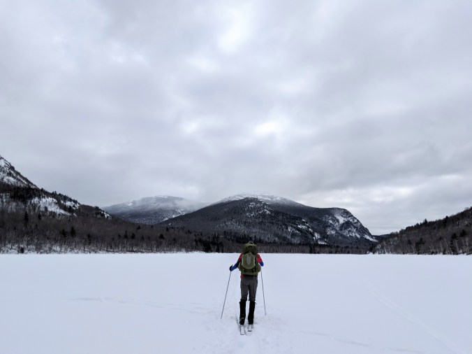
We crossed Pogy pond and stopped for lunch on the other side (about 6 miles in). We packed down some snow, and sat on our bags and ate our rice and beans while looking at Traveler Mountain. This was where our bunkmates from the night before turned around on the day prior, so the only trail we had from this point on was from two people who had done it two days before. We could still see their tracks and still benefited from the trail being broken, but there was a substantial difference in ease of skiing.

MVIMG_20180312_122520.jpgMVIMG_20180312_124452.jpg

IMG_20180312_133202.jpg00000IMG_00000_BURST20180312133512163_COVER.jpg

Oh, and there was also a substantial difference in elevation after Pogy, too. We climbed 300 or so feet over a little less than 2 miles. As we entered higher elevation, the snow was deeper and fluffier.  The blazes on some of the trees were barely above the snowpack. We saw some moose tracks that followed the trail up the hill. Danielle spent much of this part of the trail singing “A Marshmallow World.”

IMG_20180312_140556.jpgIMG_20180312_134601.jpg

After we got to high point, the snow really started sticking to our skis. At times we’d fall or almost fall because there were clumps of sticky snow essentially serving as brakes on the skis when we tried to push forward. We kept wavering between feeling frustrated because we were getting tired and unhappy and feeling annoyed at ourselves for feeling frustrated while we were in paradise.

IMG_20180312_135506.jpg

IMG_20180312_143152.jpg

9.2 miles in, we saw some buildings of the Russell Pond campsite and we got really excited because we thought we were done. Turns out, though, that the bunkhouse was on the other side of the pond, another half mile away. We got to the bunkhouse at 3:30, and immediately started a fire, but it took the bunkhouse a while to warm up.

IMG_20180312_145520.jpg

IMG_20180312_182920.jpg

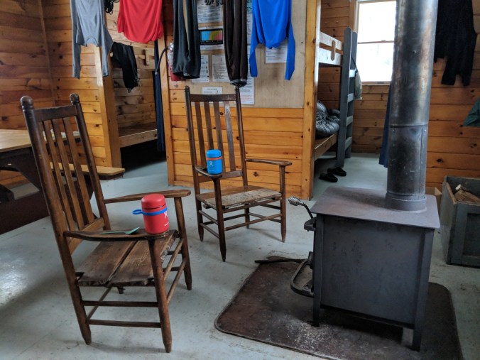
The snow at Russell was much deeper, and we had to put on skis any time we wanted to go to the outhouse. We made ourselves a second cup of coffee, and ate two dinners–ramen and a pasta primavera–and played card games. The best part of Russell Bunkhouse was that it had two nice wooden chairs (South Branch only had one), so we pulled them both up to the wood burning stove and had a cozy little heaven all to ourselves.

IMG_20180312_153122.jpg

IMG_20180312_164904.jpg

IMG_20180312_180714.jpg

Day 3, March 13: Exploring around Russell, out to Ledge Falls and back (5.04 miles)

Last night I woke up around 1 am (after going to bed around 10 or so). After peeing, I checked the woodstove and saw that the big log I put in there to last us the night had gone out.  In my sleepy haze I decided that it was critical to have a fire going to keep the cabin warm, so I pulled a bunch of bark off another log, tried to start it from the few remaining coals, and when that didn’t work, I got out the firestarter and built a whole new fire.

Then I panicked about cabin monoxide (like we didn’t have the stove going all day) and opened the window in our bedroom. In the morning, the wood had all burned up and the cold air coming in the window had chilled the entire cabin. So… Good call, Ted.

I started another fire in the stove, and started to get breakfast ready (peanut butter and banana oatmeal today). When the fire was going and the oatmeal was ready, I woke up Dani and we ate by the stove — with a quick break to ski to the toilet — and savored the feeling of the cabin warning around us.

MVIMG_20180313_083449.jpg

Finishing the oatmeal opened up our coffee cups, so Dani made us coffee and cleaned up after breakfast while I started melting snow for water.

IMG_20180312_155119.jpg

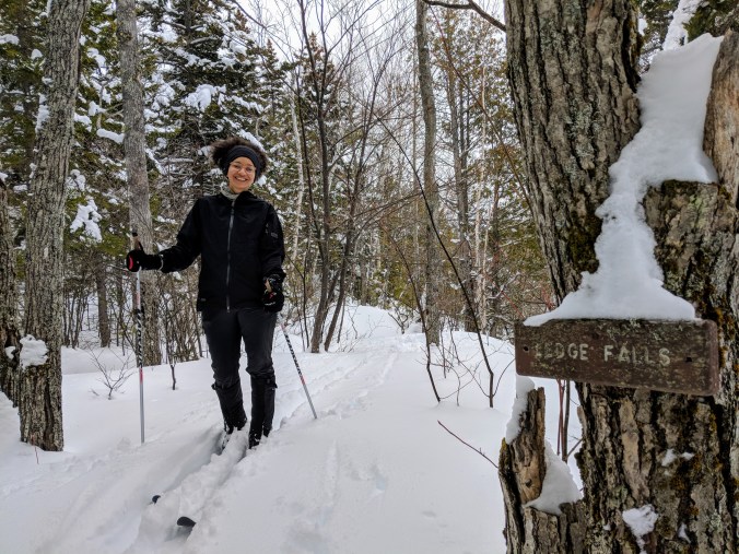
Shortly after finishing coffee, we stoked the stove to keep the cabin cozy and headed out for another day of magic. We thought we were going to Wassataquoik Lake, but I took us down the Wassataquoik Stream Trail in the other direction, and we ended up skiing to Ledge Falls. It was a lovely, happy accident.

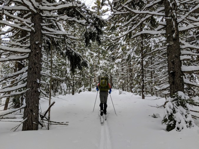
Today we had to break our own trail for the first time, and it was both difficult and amazing. We averaged about 1 mph the first two miles, but it feels more wild—even though we were still following clear blazes the entire way.

But because we had to find the next blaze and figure out how to get there, we seemed to pay more attention to the wilderness around us. And it felt like we were all alone out in the forest. Gorgeous snow laden trees, elk and moose tracks, partly frozen streams, mountains lost in clouds, and us picking our way through it all. We were higher today, so the snow base was fairly deep even before the 14+ inches of snow that came last week.

IMG_20180313_113922.jpg

IMG_20180313_115814.jpg

IMG_20180313_120338.jpg

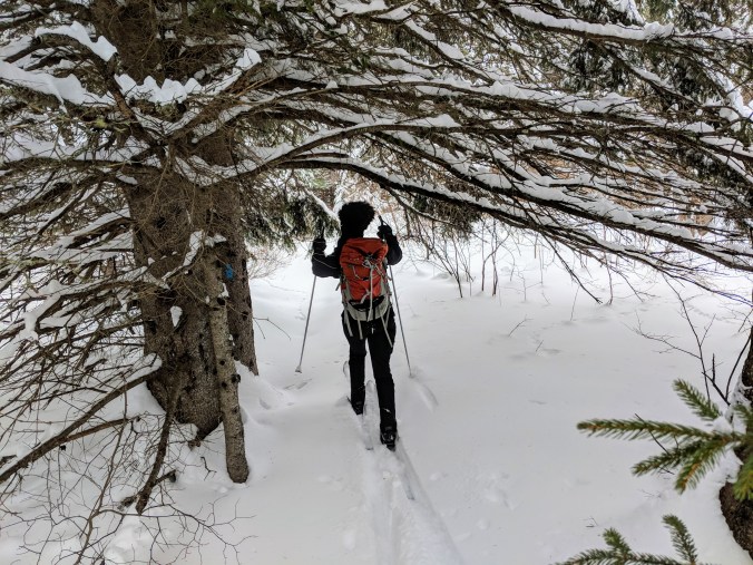
At times, we were ducking under pine boughs that I bet are a good 7 feet or more off the trail in the summer. At others we were getting weirded out by skiing through a glen where a family of elk had obviously spent the night and we were worried they’re come back and get annoyed at us for crashing.

IMG_20180313_114551.jpg

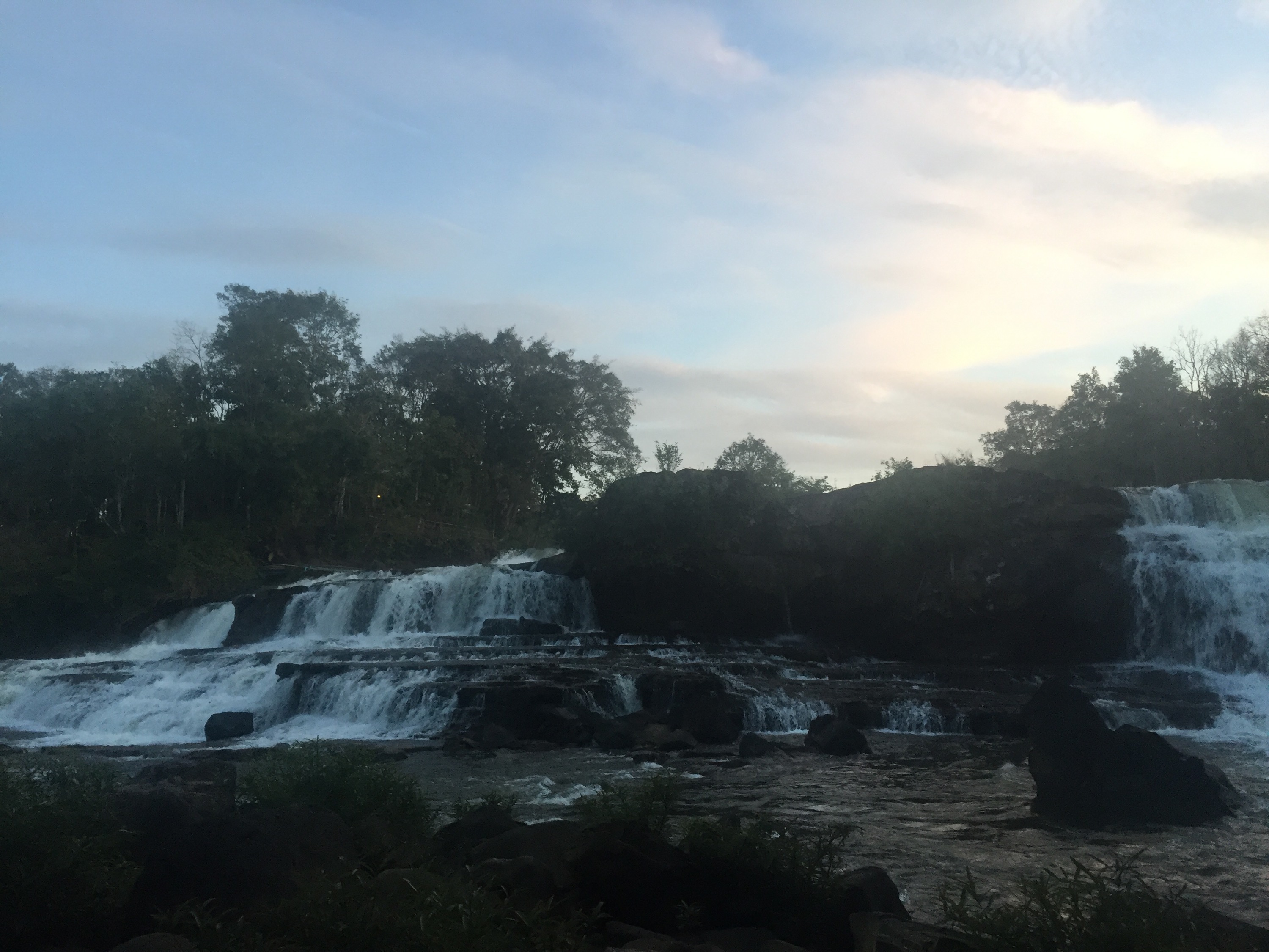
After about two miles, we came to a trail junction near the Wassataquoik Stream lean to with an amazing vista of the stream and the North, South and East Turner, and Russell mountains. We saw a sign declaring it was a half mile to Ledge Falls. This gave us a turnaround point at about the right distance, so we decided to go for it. The falls are more impressive when its not winter, I think, but the ski up to the falls traced the bank of the stream and treated us to more mind bending beauty and solitude.

IMG_20180313_124258.jpg

IMG_20180313_130615.jpg

MVIMG_20180313_131626.jpg

IMG_20180313_133846.jpg

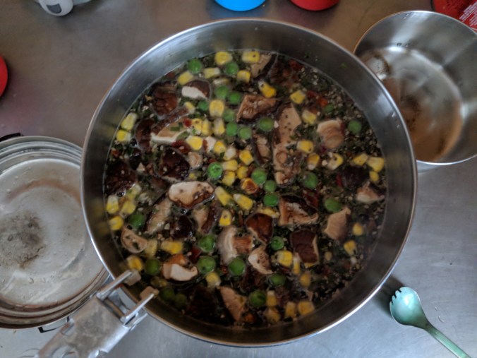
We turned around at the falls and headed home, trying to fix the scene in our heads, or at least the way it made us feel. Because we weren’t breaking trail anymore, we made it home in about half the time. We stopped at the bathroom since we already had our skis on, then returned to our extra cozy and toasty cabin, made coffee and ramen for lunch, mushroom vegetable stew with couscous for dinner, played games, and loved life.

IMG_20180313_142215.jpg

MVIMG_20180313_142823.jpg

MVIMG_20180313_144158.jpg

MVIMG_20180313_183128.jpg

IMG_20180313_161621.jpg

It started snowing soon after we got back. At the time, we had no idea that this was the beginning of a 48-hour winter storm and two days of trail breaking that made the trailbreaking today seem like we were getting towed by a snowmobile.

SE Asia Days 13-14: Luang Prabang to Tad Kuang Si 

Jan. 7, 2017

Ride map.

We woke up relatively early this morning; we had a date with some waterfalls 30km outside of town today, so we had to pack up all of our stuff. This posed just a bit of problem, because the clothes we washed two nights ago when we arrived were still damp. Humidity. It’s a kick in the hotel-bathroom-sink-laundry pants.

So we decided to wrap up the damp clothes and hope for the best. We left our bags and bikes with Eric, the delightful owner of our guesthouse. Since the ride was only 30k, we decided to take off in the afternoon, and first thing in the morning was a slow boat up the Mekong to the Pak Ou caves.

We thought about getting coffee at the shop right across from the dock, but there were no chocolate croissants there, so…yeah. After a quick jog we were back at the pier on time and ready to get on the boat.

It was really a fleet of small boats with six passengers on each. The boats had what seemed to be minivan-style bucket seats, and they were comfy and roomy.

  
Travelling upriver, we were treated to wonderful greenery on either side of the river (which, by the way, is enormous). Rolling hillsides, small villages, buffalo that somehow ended up on an island in the middle of the river. All of the sights.

wp-image-1417673857jpg.jpg

   
   After an hour or so, we stopped for fifteen minutes at “whiskey village,” a little market aimed solely at tourists on these boats. We tried a few types of locally made rice whiskey, marveled at the “medicine” whiskey (which was infused with snakes, scorpions, and all matter of yuck), and passed judgment on the tourist who threw a small fit about having to pay a quarter to use the restroom. Entitled jerk.

   
    Back in the boats, we made it up to Pak Ou. There were two caves completely full of little Buddha statues. Back when the main Laos religion was a form of nature worship, the caves were thought to house a river spirit. After converting to Buddhism centuries and centuries ago, the caves became part of the royal family’s new year ceremonies. And people still visit the caves to place new Buddha statues.

   
    wp-image-1059779543jpg.jpg

After exploring the caves, we got back on the boat and headed back to town. As soon as we got to town, we walked to our new favorite noodle soup place for lunch. The proprietor recognized us gave us a big smile for being repeat customers.

Then after lunch we suited up and got back on the bikes to ride out to Tad Kuang Si. It was a beautiful ride; I might even go as far as to say it was the prettiest ride of our trip. Verdant mountains and lovely quaint villages.

   
 It’s true that there was a significant amount of traffic (renting a motorbike or booking a van are the most popular ways to visit the falls), but it came in waves and we had stretches of time to relax and enjoy the road.

The ride had two main climbs, one in the middle and one to get up to the falls, but they weren’t too bad. It was in many ways the perfect type of ride: rolling hills with slightly more up than down every time the hills rolled (can I use the expression like that?) so we were steadily climbing but it felt like we were going as much or more down than up.

I’m not sure that made any sense at all, but if not, the main take away is that it was a pleasant ride. Except for the fact that Dani’s bike was having shifting problems and she was forced to ride up some of those hills in a harder gear than she would have liked.

We made it to the town just before the waterfall and after some confusion stemming from a complete lack of signage, we found our home for the next two nights: Vanvisa at the Falls.

   
 Vanvisa was . . . mixed. The grounds were absolutely beautiful; it sat right on a miniature version of the gorgeous waterfall we came to see. The owner was an adorably gregarious Lao woman who was friendly and charming and cooked traditional Lao family meals for all of the guests every night.

The downsides were that it was by far the most expensive guesthouse of the trip and the room was not wonderful. The whole room was damp and mildewy, there were bloodstains on the sheets, no wifi, dirt and the poop of some small animal (?) falling from the ceiling, and the temperamental shower liked to switch from freezing to scalding without any notice.

We immediately changed to go swimming, but by the time we made it down to the falls there were: (1) a family having a picnic playing loud, bad music and throwing trash into the river, and (2) four small naked Lao boys running around and jumping into the water.

I like swimming though. So I jumped in and swam around for a bit before we headed back to the room.

We had family dinner (which we found out later was also absurdly expensive), and it was decent. There wasn’t a lot of food to go around. Some so so chicken wings, beans with an egg topping, soup, and sticky rice.

After dinner, we went to bed.

Jan. 8, 2017

Today was waterfall day!

We woke up and ate a pretty good breakfast (homemade passion fruit jam!) and then we walked to the waterfall.

Kuang Si is a series of falls over limestone rocks. The water picks up calcium carbonate from the limestone, which gives the water a stunning blue color. The local story of the falls is that a wise old man dug a cave and beckoned the Earth’s water to come forth. When the water started to flow, a golden deer came and took up residence under the falls, giving the water it’s color.  Kuang Si means “deer dig.”

On the walk to the falls we went through a moon bear sanctuary. Moon bears are endangered because Chinese traditional medicine thinks that bear bile gives strength. There were some pretty terrible pictures of bile farms where bears are keep in tiny cages for years and years and harvested for bile every day.

People can be terrible.

Anyway, the falls were beautiful. A series of smaller cascades leading up to the main falls.

         Then we climbed up the top of the falls (a steep, slippery trail) and saw an amazing view of the surrounding area.

wp-image-1618676279jpg.jpg

wp-image-1039364844jpg.jpg

We continued about 3km uphill to the source of the falls and the fabled deer cave. The cave was enormous, and we were the only two people to go in so early. The man gave us a flashlights to help explore. There were beautiful sparkly stalactites and more buddhas sprinkled throughout. We went in bit by bit, but we didn’t make it the whole 100m to the back because I got claustrophobic and begged Dani to leave. I just can’t think of something more terrifying than somehow getting trapped in a cave forever.

  
Then we visited the source of the spring, which conveniently had a restaurant right next to it. The guy running the restaurant had a challenge for me: walk across the river on a log without falling in (I got two tries) and he would buy me a beer. If I fell in, I owed him a beer. I didn’t even WANT a beer, but I couldn’t turn down the challenge. He showed me how it was done and made it look so so easy. I took my turn, and it didn’t go as well.

  
Since I was already in the river, Dani joined me (she was smart enough to have her swimsuit on before she got in though) we swam for a bit. We had the whole place to ourselves and it was lovely. They even had a rope swing into the river that I used again and again and again.

   
 Then other people started showing up (I’m glad we got such an early start!), so we got out of the water, shared a plate of fried rice, and started back down.

We took a wrong turn on the way back and ended up walking to the village and not to the falls. On the way, we heard a loud, close gunshot. Dani squealed, ducked, and covered; I looked around confused. Then I almost got hit in the head by a couple of dead birds falling from the sky. A few seconds later, a smiling Lao man walked out of the woods with a shotgun and picked up his kill. So that happened.

After we got back to town, we relaxed at the hotel for a bit and then went to town where we got barbequed chicken, spicy papaya salad, and some fresh coconut juice.

Then we walked back into the park to sit and gaze at the beautiful waterfalls, which were a deeper shade of aqua in the late afternoon. 

wp-image-2067209452jpg.jpg 

 Later we ate another family dinner, with salad (with an amazing dressing), soup, and fried noodles. They brought out some offals, too, and we each took a bite expecting meat and Dani almost vomited because of the surprise of chomping into a chalky, gamey organ. Again, our most expensive dinner of the trip, and half as filling and delicious and four times the price of our favorite noodle place back in Luang Prabang. Now we know to always ask the price (and not to eat unidentified meat products)!

Tomorrow we bike back to Luang Prabang for another day before we head off to Thailand!

SE Asia Day 10: Tad Lo to Pakse

Jan. 4, 2017.

Ride map.

 Oof. That’s about what I have to say about today.

But I guess I can throw a little more detail in here, just to keep the pictures company.

We woke up bright and early, hoping to get a quick breakfast and an early start, since we had to ride 88k, or 55 miles into Pakse. We packed our things, checked out of our guesthouse, and wandered over to the place where we stopped for dinner last night. Danielle loved her vegetable omelet sandwich, so we thought we’d give it another go.

Turns out the women who runs the Fandee Guesthouse is not a morning person, so she was still in bed. We sat at the big table on the porch with Thomas, a freelance designer (originally from France, but has been in Germany for several years) who is in Laos as he waits for an order of his new design of lamps to be produced in Thailand, after which he will take them to a festival in Australia.

We told him that we were biking to Pakse today, and he told us that aside from a hill climbing out of town, it was mostly downhill the entire way.

I’m going to interrupt this narrative with a quick PSA. NEVER say something like this to a cyclist (especially if they’re touring) unless you KNOW for SURE that it’s true.

On with the program: we were shortly joined by another German traveler named Merle (which, as it turns out, is pronounced nothing like it is spelled), and since our prospective breakfast cook was still sleeping, we decided to walk back to our guesthouse and eat there. We both had omelet sandwiches, which were pretty decent, and I had a smoothie, since that seemed to be the one thing that I could eat without making myself feel ill.

Then we said goodbye to our new friends, saddled up, and hit the road around 8:45a.
Remember that “hill out of town”? Well that hill was a hot, steep, heck-of-a-climb, six-mile, thousand feet of elevation hill. Goodness gracious. About a third of the way up, I started feeling ill again. I felt like I had to vomit and like my legs had no power. I thought about just vomiting and getting it over with, but I had barely eaten anything the day before and I knew I still had over 50 miles left, and I thought that it was a better idea to try to keep the food down so my body could have a little fuel for the ride.


After the climb, we were expecting lots and lots of downhill. And we had a nice descent, which was wonderful for me, before entering into some flats/rolling hills. After about 12 miles, I was feeling absolutely miserable, so we pulled over at a gas station and sat on a bench in the shade, drank a bit of water, and tried to cool off (did I mention that this was by far the hottest riding day we’ve had so far?). I also chewed on some Tums, hoping it would quell my tummy.

While we were sitting there, the guys working the pumps at the station brought us over a big ol’ papaya and gave it to us. How nice! I wish I could have enjoyed it more, but Dani ate half of it before wrapping up the other half for later.

      The next 12 km were pretty much straight downhill (yay!) but they also gave us one of the highlights of the trip: Katu textiles.

We were cruising down the hill when we passed a sign telling us that there was a place to buy handmade textiles straight from the artisans, and we had to stop. Dani had been noticing the beautiful fabrics used by many of the restaurants on the plateau AND she loves textiles in general, so this was her dream come true. There were maybe half a dozen teenage to elderly women sitting in a hut FULL of the fabrics they were making by hand. We didn’t feel comfortable taking pictures inside, but they were using what I believe is called a “backstrap” loom, which sat on top of their legs (and around their back) as they sat on the floor.

dsc_0165

dsc_0163

Dani was in heaven, quickly compiling a significant pile of “favorites,” but the truth is that they were all beautiful. And we felt good buying them straight from the source. We probably could have haggled the prices a little bit lower, but these ladies were artists and their art was amazing, and it just felt wrong to trivialize it by trying to bargain down the price.

We rode out of there happy, and glided through the rest of the downhill. But then the downhill ended.

At this point we had ridden a little over 30 miles, and looking at our map app we had 10 miles of uphill and then 14 miles of down to finish the day. That’s right, another 10 miles of uphill during the hottest part of the day. Let’s just revisit that PSA above for a moment. We thought we were going to have a nice mostly downhill day, but we were misled (out of no animosity I’m sure, of course, but it still was pretty sad when we realized it).

So we started climbing. Slowly by slowely, stopping frequently when we found a spot of shade on the road. The miles gradually fell away until we had just 4 left, going up a steeper hill. We stopped pretty much every mile of these last four. Like I said: oof.

But then we made it to the top. We reached the intersection with Rt. 16, which would take us to Pakse, and we turned right and downhill and oh how we flew! What joy and relief! After taking an hour to ride 4 miles, we rode the next three in roughly 10 minutes, which brought us to Bachieng Café and Restaurant (the place we loved so much on the way up).

We had water and two more bowls of beef noodle stew. I was able to eat the whole bowl and I didn’t feel too shabby afterward, which was a great sign that I was on the mend. After about a half hour we sped the last 10 miles or so into town.


We struggled to find our guesthouse for a bit, but find it we did, and we were soon checked in, showered, and happy.

And hungry. I was apparently fully recovered, and my body seemed to suddenly realize that it hadn’t been eating much over the previous two days. So even though we had that bowl of stew just a couple of hours earlier, I was ravenous.

I hopped on Tripadvisor to see if I could find a good place, and strangest thing, apparently an Italian man had settled in Pakse some years ago and opened an Italian restaurant that rivaled those of his home in Tuscany.

Danielle typically does not like doing things like eating Italian food while in Laos (she once called me a traitor for suggesting something like this), but I whined and wheedled and eventually wore her down. We starting walking the 4km to the restaurant, but soon caught a tuk tuk to take us the rest of the way.

Oh my sweet delight, the bolognese was freaking amazing. Out of this world. It was $8.50, which was at least double the price of a Laos meal, but less than half of what I would pay in New York for something that would probably be less good. It was rich and flavorful… and it was generously covered with melty parmesan cheese.  Cheese. I haven’t had cheese since December 23rd. It’s still delicious.

Dani had a lovely tuna pasta and we had some homemade ice cream(!) for dessert, but—as has been the case—she seemed to be about 12-24 hours behind me in the food-poisoning progression. I was feeling completely recovered, but she was starting to feel off.

So we got the tuk tuk back to the hotel and fell asleep, hoping that Dani would feel better in the morning. We fly to Luang Prabang tomorrow.


(ps. Sorry for the long delay between posts. We got distracted by being in Luang Prabang, and then we spent the weekend in a place without wifi, we’ll try to catch up in the next few days.)

SE Asia Day 9: Thateng to Tad Lo

January 3rd, 2017

Ride map.

If there was ever a time we needed a short, no-wind, downhill day, today was that time. Dani ended up following me down the food-poisoning path last night, so we weren’t in the best of moods when we woke up.

We started very slowly. We didn’t seem to be actively suffering as much this morning (i.e., we weren’t making frequent trips to the restroom), but our bodies seriously ached. We both felt lethargic and struggled to get moving.  Doing small tasks to prepare to go was exhausting and required many breaks of lying down completely still. We had also completely lost our appetites, something that anyone who knows us knows is as common as Halley’s Comet, but forced ourselves to eat a tiny banana to have some small amount of energy for the ride.

Eventually we got ourselves out of bed and packed our things. We left around 11am, or about 3 hours later than normal.

But we were fortunate. Today was always going to be a short day, just 20 miles, and knowing that was a big reason we were able to convince ourselves to get on our bikes. But what we didn’t know is that pretty much the entire ride was downhill. Good steep downhill too. We covered the first fifteen miles in about 50 minutes, and for long stretches, we didn’t even have to pedal.

Which was a good thing, because when we DID have to pedal, my legs felt like they were about to fall off. Maybe that had something to do with throwing up (or otherwise expelling) everything I had eaten in the previous 24-48 hours.

   In any case, we made great time to Tad Lo, getting here around 12:20p. We had to find a place to sleep, and we were quickly sold on a guesthouse with cute rooms and a PORCH with HAMMOCKS for $8.50.

Then we lay in the hammocks for an hour or so.


At this point we felt like we had to go exploring, both because we came here to check out the waterfalls in town and because no matter how we were feeling, we really had to eat something.

So we decided that if we were leaving our happy place, we might as well see some of the waterfalls the town is named for (I might be wrong about this, but I’m pretty sure “Tad” means waterfall Lao). We crawled out of the hammocks, got ourselves together, and walked for about twenty minutes to the southern Tad Lo falls. Longest twenty minutes ever. They were nice, and to our chagrin, they were swimmable. It looked like nice swimming too. But neither of us had our suits (Dani asked if we should wear them, and I confidently said no), and even if we did, I don’t think we would have felt up for swimming anyway.

 So we walked down a little path from the falls that let us out at Tad Lo Lodge, the swankiest place in town. We didn’t really enjoy the milieu, but we liked the deck overlooking the river, and we were wary of food in general, so we thought swanky was a safe bet. Also, pro tip: we saw this in Costa Rica too, but if you go to a touristy-type swanky place in foreign country and then order traditional food of said country, the price is actually pretty reasonable. So our meals were about a third as expensive as the western food on the menu.

But, we were both feeling so queasy that, for the first time in my memory, neither of us finished our food. Dani has instilled in me a strong “clean plate club” ethic. But today we just couldn’t. Ugh.

After lunch, we walked back to our hotel and got back into the hammocks, lazily looking out on a field where a family herded their cattle.

After a few more hours, we felt a little better, so we decide to venture out once again. We walked across the river, checked out the northern falls, and stopped in at a cute little guesthouse for a fruit smoothie and an vegetable omelet sandwich.

 Then we made it back to the hotel for the night, watched a movie on our laptop (sick day! And Dani let me choose, so obviously it was a Disney movie), and hunkered down for bed just before 9p.

Tomorrow is a long day for us. 55 miles, and I don’t think we’ll have the same downhill luck.  But we have a plane to catch the next day, so we don’t really have any option except to make it. So hopefully a few meals and another good night of sleep will carry us through.

SE Asia Day 4: Don Khong to Champasak

December 29th, 2016

Ride Map

Danielle woke me up this morning at 5:45 to watch the sun rise over the Mekong.

How beautiful.

We watched at first from the large terrace on the second floor of the guesthouse and then moved to Mali’s patio across the street, right on the river.

It felt like our vacation was just then starting. Siem Reap had its ups and downs, but we came to explore Laos, and now we were just getting started.

After the sunrise, we packed up our things and then rushed downstairs to have one more amazing meal with Mali. This morning it was an omelet with fresh vegetables and mushrooms grown by Athalo and Mali themselves (“I come here to detox, I want to know what is going into the food I eat”), a fresh baguette, and local Laos coffee. Also, Mali brought out her personal stash of Nutella to share with us. So kind!

After breakfast, we filled up all of our water bottles from the water cooler in the kitchen. This wasn’t insignificant, because tap water isn’t always safe to drink, so filling up 5+ liters of water saved us from buying 5+ liters of water on the road.  This was yet another act of kindness from Mali (“Don’t thank me, thank your personality”).

And then, in the biggest, MOST AMAZING act of kindness yet, Mali and Athalo offered to drive us from their guesthouse to the main road on the mainland, saving us from the choice of either spending money and dealing with the hassle and delay of finding a boat to take us across the river or adding an additional 15k to what was already the longest ride of the trip.

We gratefully accepted, and at the end of the ride they gave us big hugs and watched us ride away, waving at us and smiling like they were our adopted parents.

Ok. Enough about Mali. We’re finally riding! This was supposed to be a bike tour after all!

Like I said, this was the biggest ride of the trip. We were hoping to ride 106k, or about 66 miles. That would have been nothing at the end of our last tour, but neither of us have been riding a lot lately.

The beginning of the day was just lovely. We lucked out and had a relatively cool day (in the mid seventies instead of the upper eighties), so we weren’t suffering too much… at least not from heat. We were facing a consistent headwind all day, but it was pretty gentle; it was nothing at all like those headwinds in eastern Montana.

The road (Route 13, the main/only north/south road in southern Laos) is in great condition, and traffic was incredibly light. We probably had to deal with more cows than cars in the road for the first 20k or so.

The countryside reminded us a lot of Zambia. There were fields and rice paddies, and a few fish ponds too. There were very few large trees, and large numbers of roadside shops all selling the same things.


We also saw an interesting mix of housing. Often more run down houses were side by side with newer, beautiful french colonial houses. The traditional style of house here is built on stilts, and often families were gathered in the shade underneath their houses, processing their crops and sometimes just hanging out.


Every time we passed a group of people they would smile and wave. Children would run after us, waving and yelling “sabaideeeee”, which means both hello and goodbye (noteworthy because the kids who chose to greet us in English often went with”goodbye,” and watching a kid run out to greet you yelling “goodbye, Goodbye, GOODBYE!!!” was pretty entertaining).

I love riding my bike through a new area!

After we rode about 40 miles, we decided to stop for lunch in a small town named Huay Keua. We pulled over at a restaurant looking place (although they also sold clothes and cut hair), and when the proprietor spoke to us in Lao, Dani greeted her and then mimed eating out of a bowl. The lady smiled broadly, and a few short minutes later we had a couple of big, steaming bowls of delicious chicken pho.


As we chowed down, the owner came out of the back with her toddler son, who had apparently just been given a bath by his grandmother. He was our entertainment for the rest of the meal. He was very interested in us, running up to touch us on the leg and then running away as if on a dare. He also tried to take a swig from a bottle he filled with rocks and spent a while playing with a stool and pushing it around the patio. Who needs toys when you have all these random objects to play with?

*****

After lunch, we had about 23 miles to get to our ferry across the Mekong, and like they always say, the last 23 miles are the hardest miles.

It was hotter, the road started going uphill, we were more tired, and traffic had picked up (although most drivers were incredibly considerate, at times following us at 10 mph for minutes until it was safe to pass). And our butts hurt.

So we rode slower, complained more, and took more breaks. But eventually we made it to our turn off to go down to Ban Muang, where we could catch our ferry. What sweet relief this side road was. No headwind, no traffic, and downhill to the Mekong.

We rode into town and straight past our turnoff, but some kind townies shouted at us and let us know where to go. We went down to the edge of the Mekong, where the people shocked us by telling us that the ferry crossing was 70,000 kip (~$9) each.

Or so we thought. Turns out the Lao word for twenty sounds a lot like the English word seventy. So the ride cost $2.50 each. Much better.

The ferry ride was an old rickety boat with the operator, us, our bikes, and one other passenger.

It only took us about 7 minutes to get across, and then, after pushing or bikes up the hill, we set off find our guesthouse. Turns out it was in the wrong location on the map we had, but a kind lady selling street food stopped me before I tried to enter what was–in retrospect–obviously a private residence.

A mile or so later, and 67.5 miles in total (kinda, that counts the ferry), we found our actual guesthouse, Khamphouy, where we paid $10 for a basic room that had everything we needed, but not much more.

We showered (hot showers was one of the things we decided we needed), and then headed out to find food before collapsing in bed around 9pm.

Tomorrow we explore Vat Phou, a thousand-year-old temple built at the base of a mountain just off the Mekong.

ps. Dani made a video! Check it out for a taste of our trip so far. It has a few clips from today. . . and from tomorrow – time travel!

SE Asia Day 2: Angkor Wat by bike

December 27th, 2016

Well, it turns out that jet lag is a real thing.

Danielle had heard that the way to avoid jet lag is to survive the first day and go to sleep at a normal time the first night. We did that (we went to bed at 9:45p), so I thought I was fine. But then I woke up at 2:45a clear eyed and wide awake.

So that was a bummer.

It wasn’t actually all that bad though, because our alarm was set for 4:45a; we were waking up early so we could watch the sun rise at Angkor Wat.

Many (most?) people pay someone to take them around the various temples, either in a tuk tuk or in a van, but we’re here on a bike tour, so we rode our bikes!

We were on our way by about 5a, and we joined the stream of traffic heading north out of Siem Reap. And I mean it was a stream. Lots and lots of people.

The ticket office for Angkor Wat used to be right off the main road, but apparently it was recently moved to a new location 3K east of said road. In a fit of logic and common sense, we decided to listen to the giant sign on the side of the road and not what we read on the internet. We (mostly I) don’t always make smart decisions, but we got this one right.

After the 6K detour to buy tickets, we rode the rest of the way up to Angkor Wat, arriving right as the sky was starting to lighten. We walked into the temple complex and found a place to stand among the hundreds of other people.

This paragraph might overstate things a bit. I think that sunrise at Angkor Wat used to be a peaceful, spiritual experience. It wasn’t very crowded (it became a national monument relatively recently; it was for quite some time just sitting, ignored, in the Cambodian countryside), and I can see how watching a sunrise here could be magical. I mean, there wasn’t even a spectacular multicolored sunrise on the day we were there, but the sillouette of the temple and palm trees against the rising sun was stunning.

But it is hard to find the magic in the midst of all of this:

It was still beautiful, don’t get me wrong, but I’m getting old and grumpy, and I don’t like being around this many people.

This was a theme for much of the day: too many stinking people. But here are a few pictures of Angkor Wat without people in them.


After exploring the Angkor Wat temple for a bit and choking down some horrid, overpriced egg sandwiches, we set off to the next big temple area: Angkor Thom. Here’s Dani about to enter the city (you can see the gates ahead) alongside an elephant.

Bayon Temple was originally built as a Buddhist temple, but was used by later kings to suit their own religious preferences. It is known for the many large, smiling faces looking out in all directions from the temple towers.


Baphoun might have been my favorite temple, and maybe that was because it was so much less crowded. It is currently being restored, but we were able to climb all the way up to the top and were rewarded with some amazing views.


After climbing back down, we walked through the woods to see a few other ruins, and then came upon the elephant terrace. This was where the great Khmer kings received important visitors to the capitol city.

Then we got back on our bikes and rode east. By this time, it was getting very hot, and since I hadn’t slept a lot the night before, I was starting to struggle.


We stopped on the way and has passion fruit smoothies and a fresh pineapple. I love passion fruit. Love it enough to occasionally spend $3 on one tiny little guy at our co-op. So you can imagine my delight at getting a large cup of essentially passion fruit juice blended with ice for fifty cents.


As we sipped this sweet nectar of the gods, we decided to go to one last temple before heading home: Ta Phrom of Tombraider fame (full disclosure: I haven’t actually seen Tombraider. But the temple is referred to as the Tombraider temple, so I guess it was a location in that movie).

This temple was REALLY cool but oh my goodness was it crowded. Walls of people being directed along tight temple corridors like cows headed to the slaughter. When we found a spare moment with a little breathing room, we were able to appreciate the awesomeness of an ancient temple being slowly taken over by nature, with silk-cotton and strangler-fig trees growing over the walls and around the buildings. But then the moment passed, and we were surrounded once again. (Although you’ll notice that Danielle did a fabulous job of finding ways to take pictures that made it look like were alone. Looking at these pictures, I’m starting to second guess my own memory.)

    
After Ta Phrom, we headed back toward our hotel. The ride could have been very pleasant, but the traffic was insane. Motorbikes, tuk tuk, vans, buses…. We were always being passed by something, and ended up spending almost the entire ride home sucking down exhaust fumes.

We made it back to the hotel around 1p and decided that we were done with the traffic, the noise, and the exhaust-and-burning-plastic smell of Siem Reap. So we spent the rest of our last day at the hotel. We swam, ate some delicious red curry by the pool for lunch, enjoyed some out of this world passion fruit smoothies (we each ended up having two and a half smoothies today; the ones at the hotel were so delicious!), took a little nap, prepared for our trip out of Cambodia, and went to bed early. It was a lovely, relaxing way to spend the second half of the day.

Next up: Laos!

We bought tickets!

Hi all!

It’s been almost a year since we finished our coast-to-coast tour. I can’t say that we woke up the next morning wanting to get back on our bikes, but at some point in the last year, we got the itch to get out and go exploring again.

And we’re happy to report that we bought our tickets for our next adventure!

Laos, here we come!  (Well not RIGHT now, but soon!)

We’re going to start here:

angkor_wat

(that’s in Cambodia, but we felt like we couldn’t go to Southeast Asia without visiting Angor Wat)

We’ll hop on a bus to the Laotian border, and explore here and there and over there:

mount-phou-asa-pakse

tad-fan-waterfalls

dsc_0720-version-31

tr-luang22031_2859706a-large

Then, because we’ll have earned it, we’re going to finish up with a few days here:

world___thailand_sandy_beach_in_the_resort_of_hua_hin__thailand_061796_

Here are the screen shots of the two legs we expect to bike, from the boarder to Savannakhet, and from Vientiane to Luang Prabang:

Screen Shot 2016-07-13 at 5.58.50 PMScreen Shot 2016-07-13 at 6.00.27 PM

We’re going to be doing this trip on our Bromptons, so we’ll keep everyone posted about the process of traveling with and touring on our folding bikes.

We hope those of you that enjoyed reading about our cross-country trip will follow along as we take on our first international bike tour. Stay tuned for planning posts, packing lists, and other updates! We’re so excited!

Day 59: The day we missed the ACA

Day 59, 8/11, Clyde, NY to Verona Beach State Park, NY: 71.4 miles, 2,023 ft elevation gain, 13.6 mph average speed.

Trip Totals: 3,741.9 miles (74.8 mile daily average), 137,602 ft elevation gain, 12.5 overall average speed.

We slept in this morning, in part because we had a relatively short day ahead of us, in part because we like to get our money’s worth when we stay in a motel, and in part because Mark said he’d prefer to take us to breakfast later (the breakfast part of the Erie Mansion B&B is him taking us out to a diner in town).

The first thing on my agenda was to fix my yet-again-flat tour tire. I don’t think I mentioned this in my last post, but the dollar bill I put in my tire in Traverse City lasted a week until it was eaten through right before we made it to Niagara-on-the-Lake. I replaced that one with a combination of duct tape and a new dollar bill, confident that I could get through another week to make it home. Turns out I was wrong. The other dollar bill was eaten through now, so I replaced that along with my tube.


Dani packed up our stuff as I was changing my tire, and it was time for breakfast when I finished. Mark drove us the few blocks to the diner in an antique rat rod, and we were disappointed to see that he had a Confederate flag sticker in the back. He didn’t seem the type, but I guess some people surprise you. That also brings New York’s Confederate flag count up to four, challenging Michigan (six) for the title. It’s crazy, but we didn’t see a single one in the six states before Michigan.

  
Anyway, the diner in town is called the Hillbillies Paradise Diner [sic], and we were served breakfast by the seven year old child of the proprietor. Breakfast was typical diner fare, but if I had suggested to Dani before this trip that we go eat at a place called Hillbillies Paradise, she would have laughed in my face.

   
 We were eager to get on the road after breakfast, but our plans were temporarily derailed when we discovered that our jar of salsa exploded in our food bag. Salsa everywhere. Yeesh.

We finally did get started around 10:30. We decided to follow the on-road New York state bike route because we didn’t think massive thunderstorms and flooding would make for pleasant riding on the dirt and crushed stone canal path. We found out later that our fears were justified and that riding on the path after the storm was like “riding through peanut butter,” according to a bike tourist we will meet tomorrow. 

The only problem with following an on-road bike route is that you’re on the road with cars and variable shoulders. So the riding was a lot less relaxing today than it had been the past few days. We rode through Weedsport, and then turned a bit north and bypassed Syracuse. We stopped for lunch at the beginning of Baldwinsville, and ended up eating at Subway because we were hot and sticky and wanted to take a break someplace with air conditioning.

   
   Lunch was fine, but then, only a few miles later, we saw our first Chipotle of the entire trip. We love Chipotle. We were already feeling a bit down and stressed out because the shoulder had been minimal and poorly maintained for a while, but the knowledge that we missed our first opportunity for Chipotle was actually pretty devastating. It seems so ridiculous for something so small to have such a big emotional effect, but it did. At least there was a Wegman’s across the street, so we were able to recover a bit while we shopped for dinner food.

Then came some truly terrible and frightening riding. A few miles of no-shoulder, three-lane, strip mall traffic. Cars buzzing by us at very unsafe distances. We’ve met a few people who are plotting their own route instead of using the ACA maps, and I can’t help but think that’s a terrible decision. Yes the maps are a bit expensive, but comparing our experience today to our time following the maps, I think the peace of mind that comes with knowing you won’t be riding on horribly dangerous roads is worth it.

We made it through the scariest section and started the last 30 miles of the day. We were feeling a bit drained and it was later in the day than I would have liked with that much distance left, but luckily we had a great tailwind pushing us along and we were able to average around 16 mph all the way until five miles from our campsite, where my tire went flat AGAIN! Turns out that I was wrong to assume this morning’s flat was the result of the dollar bill failing. There were actually several small metal pin-like things embedded in my tire, and one was poking through the inside wall just enough to puncture the tire. We removed everything we could find, and hopefully NOW it will last until we make it home.

   
   After changing the tire, we hustled to the campsite (with a brief cold drink stop at a convenience store) at Verona Beach State Park on Oneida Lake. It was a lovely campsite, and we saw a magnificent sunset over the lake. Dani made spicy chicken soup for dinner and then we washed up, showered, and hopped into the tent.

   
 Tomorrow we’ll approach century territory again, hopefully for the last time!

Day 57: Low bridge, the day we joined the Erie Canal.

Day 57, 8/9, Niagara-on-the-Lake, ON, CA to Holley, NY: 79.7 miles, 1,558 ft elevation gain, 11.4 mph average speed.

Trip totals: 3,597.4 miles (74.9 mile daily average), 133,803 ft elevation gain, 12.5 mph overall average speed.

Spending the last two days hanging out with my family was amazing. The days weren’t necessarily action packed, but I wouldn’t have wanted them to be. We spent time relaxing on the back patio, drinking coffee and reading the newspaper. We took long walks with my parent’s dogs, Maddie and Nelson. We explored downtown Niagara-on-the-Lake, visited the peach festival, and ate ice cream and peach pie. We watched a few races at a regatta, went swimming in Lake Ontario, and took a family ride on a carousel. We visited a winery and a brewery.

And we ate. And ate. Or to be more accurate and less polite, we stuffed ourselves like Vitellius on my dad’s amazing cooking. We started with spaghetti, as Dani mentioned, but we also had steak, roast chicken, grilled salmon, and a host of accompaniments. Going back for thirds and fourths was worth all of the work to build up a bike-tour appetite.  


image


But all good things must come to an end, and today we had to get back on the bikes. It’s been a wonderful two days off, but we still have 530 or so miles to ride, and have seven days to do it in. On the bright side, that means that we only have to ride around 75 miles each day, instead of the 95+ mile days we’ve been pulling over the last week.

We slept in this morning. We just couldn’t bring ourselves to get an early start when we were sleeping in a super comfy bed and we just had two days off. We woke up at around 8:45 and started pulling all of our things together and getting packed. My family was also leaving this morning to go back to Pittsburgh, so they were packing as well. We got all loaded up, said our goodbyes, and got on the road around 10:30.

Canada has been impressing us the whole time we were here, and I guess it wanted to send us out on a good note. Our entire time in Canada this morning was along a dedicated bike trail that followed the Niagara River. The trail was well-maintained, and it offered a series of stellar views of the blue river winding its way along the bottom of a steep gorge.

   
        As we approached the rainbow bridge, we passed a couple riding road bikes right before a steep climb. A few minutes later, as we were climbing, we noticed the gentleman of the couple mashing up the hill gaining ground on us. Now, even with our heavy, loaded bikes, Dani hates being passed, especially by someone she just passed, and I have a competitive streak of my own, so we both, without any sort of communication, put a little more energy into our climbing so we didn’t get passed. Thank goodness we had just rested for two days.

I tell this story because shortly after the climb, the guy on the road bike caught up to me and said, “My wife wants to know if you guys have motors on your bikes.” He then made another comment about how he wasn’t sure if we were carrying giant battery packs in our panniers. I know we’ve been getting stronger, but it made us feel great for a couple of serious road cyclists to be surprised by how fast we ride fully loaded.

We pulled into the Canadian Niagara Falls and it was madness. My family had warned, but it was just crazy. So much traffic. So many casinos.

   
 It took us a little bit to figure out how to make it to the Rainbow Bridge, and then we were disappointed to learn that cyclists aren’t allowed to use the pedestrian walkway, but have to ride on the road. The Rainbow Bridge has an excellent view of the falls, but we weren’t really able to appreciate it too much because we were making sure that motorists weren’t so distracted by the view that they forgot to see us. Dani did manage to take a photo, though. 

  
We stood in line with the cars at the border crossing at the far side of the bridge, and after a 10-15 minute wait, it was our turn. We handed over our passports to the border patrol agent, who started through the normal litany of questions. But he didn’t really make it past the first question, because when we told him that we were just passing through Canada on a coast-to-coast bike trip, his mind was blown. It was one of the most entertaining reactions of the trip, in part because he was so serious when the conversation started. But after we told him about our trip, his stern, professional demeanor was replaced with baffled amazement. WHAT were we doing? Why? For how long long? And we enjoyed it?

In the course of this, he forgot to ask us the rest of the standard questions other than how we know each other, gave us back our passports and shook his head at us as he waved us on our way.

America! New York! We’re almost home. Almost, but the kind of almost where we still have seven days of riding to cover 500 miles.

   
 We thought that Canadian Niagara Falls was crazy. Oh my. I never want to go back to Niagara Falls again. Too many people. And remember that I say that as a person who works a block away from the Empire State Building and is used to masses of people.

We weaved our way through lines of traffic and groups of wandering people to see the falls. We saw them. They’re there. There are a bunch of casinos right behind them. We struggled to find an open space to get a picture of us/our bikes, but when we did we ended up right next to EJ Manuel, quarterback for the Buffalo Bills!


Confession time. We had no idea who he was. We figured out he was famous when some other guy came up to him and started gushing over him. Then I took a really awkward sneaky picture of him, which Danielle later sent to her family and her brother figured out who it was. Thanks Chris!

  
Anyways, we were eager to get away from the madness. We ended up getting a little turned around on our way out, but we eventually figured out which way to go. The original plan for the day was to find a cool diner or something for second breakfast/early lunch, but there was nothing cool. There was just craziness. So we rode on.

The area just east of Niagara Falls is not the greatest ride for a couple of people who just spent a week being impressed by Canada. It was a rough and run down area. Lots of abandoned buildings, lots of evidence of poverty and hardship. Lots of crappy roads with impolite drivers. We wanted to just turn around and settle on Lake Erie, but that would have involved going back through Niagara Falls, so there was no option but to ride on.

One last (maybe) Canada vs. US comparison: in Canada we ate solely in cute cafes and coffee shops, back in the states we ate at KFC. Bleh.

We followed New York State bike route 5 out of Niagara and toward Lockport, where we would meet up with the Erie Canal Trail. New York state bike routes generally follow state highways, but have huge shoulders. That was true through part of this section of our ride. The other parts were on a four-lane road through strip malls with no shoulder at all. Not fun.

  
We made it to Lockport, and it was not a cute town. We immediately passed a barber shop called Sanitary Barber Shop because apparently the thing the owners want to convey with their name is that they meet the absolute most basic criterium for a decent barber shop. There might have been a cuter main street area, but if so, we missed it as we headed straight for the Canal Trail. The Erie Canal Trail will be our home for the next few days. It’s a packed dirt trail that rides alongside the Erie Canal for several hundred miles.


 Our options for the night were a) have a short day and stop at Middleport, or b) ride later than usual and finish at Holley. Both towns offered free camping right on the canal, so it was mostly a question whether we wanted today to be a hard day or if we wanted to put the hard day off until tomorrow.

We rolled up to Middleport, and it quickly became a question of whether or not we wanted to set up camp underneath the Confederate flag that was flying from the house next to the park. Turns out that wasn’t appealing to us, so we pushed on. We ride more slowly on dirt surfaces, so the miles didn’t tick away as quickly as we were used to, despite the flat terrain. 


 They did tick away though, and we made it to Holley just before 8:00p, and the campground there was absolutely adorable. Right on the canal, complete with showers, and free. Our kind of place. We dashed over into town, split a sandwich at Subway, drank some chocolate milk and Perrier water, and headed back to camp to shower and sleep.


The only problem with this campsite was a couple of teenage kids who were riding around the park, smoking sickly-fruity smelling ecigarettes, and blowing an air horn at random. I guess that’s what passes for making trouble in Holley, NY. Thankfully, they stopped around 10, and we were able to sleep undisturbed.

Day 53: The day of a most enjoyable century ride

Day 53, 8/5, New Glasgow, ON, CA to Peacock Point, ON, CA: 112 miles, 1,743 ft elevation gain, 13 mph average speed.
Trip totals: 3,517.7 miles (74.7 mile daily average), 131,620 ft elevation gain, 12.5 mph overall average speed.

One day behind schedule.

Today was another big mileage day. We’re hurrying to meet my family in Niagara-on-the-lake, and we’ve been piling up the miles to get there on time. Including today, we’ve ridden 597 miles in the last six days, an average of 99.5 miles per day. Our bodies are holding together remarkably well, but we’re definitely looking forward to having a couple days off!

We woke up this morning feeling a little sticky. We’ve been fortunate on this bike tour to almost always have an option of a shower, a sink, a lake, or something to wash off the grime of the day’s ride. Mornings like this make us grateful for that. The feeling of pulling on clean bike shorts over a dirty body, while it isn’t terrible in the grand scheme of things, isn’t particularly fun. But being a bit sticky was a price we were willing to pay for getting to camp for free and right next to the route.

And even though we were sticky, today might have been my favorite day of riding of the entire trip. The day started with eleven miles on Ontario Rt 3 before we turned off the main road and headed down toward the coast. We rode for the rest of the day on generally smooth, sparsely trafficked roads.

      We covered the 30 miles to Port Stanley by about 9:45a, where we continued our recent tradition of stopping for coffee and second breakfast at a cute coffee shop/cafe. With one or two exceptions in touristy towns, we didn’t see any sort of cute coffee shops between Central Washington and Fargo, ND. And only recently have they become frequent enough for us to count on seeing them in most decent sized towns. It’s probably good for our budget that this wasn’t always an option, but we’re loving it now that it is.

Anyway, the coffee shop of choice this morning was the Village Square Coffee House. We split a french press of coffee and ordered two breakfast sandwiches and two pecan caramel rolls. Then we sat outside, next to Port Stanley’s coffee shop breakfast club. They seemed to know every single person who walked, drove, or rode past their corner table. Our favorite conversation we overheard was when they greeted someone who had just returned from Portugal by saying, “Oh! So you came back?” and the lady responded, “Well how couldn’t I since we live in paradise?” It speaks highly of a place like Port Stanley that the people who live here feel that way, and that conversation might have been the spark of Dani thinking that the Canadian shore of Lake Erie would be the perfect place for us to retire. Or just live.

We finished our pastries and sandwiches and decided that we were still hungry, so I headed back inside to order two more breakfast sandwiches. The girl behind the counter laughed at me when I ordered; I guess our bike tour diet is a little surprising to some people.

After breakfast we climbed a shockingly steep, but mercifully short hill out of the Port Stanley’s river valley. This was a harbinger of the terrain for the day. We had long stretches of almost perfectly flat riding, punctuated by short steep descents into towns and short steep ascents back out. It was perfect. The hills were far enough apart and just steep enough to make us grateful for how pleasant it was to ride over the long stretches of flat terrain between the towns. 

  
Fifty-five miles into the day we rolled into Port Burwell, where we got our first real broad view of Lake Erie. I visited Erie, PA once when I was little, and I have a foggy memory of the lake being dull and gray. Or maybe it was just a dull and gray day. In any case, the lake we saw on our ride today was nothing like the lake of my memory. Sparkling turquoise blue water. Beautiful.

After taking in the view we headed back to the ice cream shop we passed entering town. Dani got some ice cream, I got a root beer, and we split the raspberries that we bought from a farm stand earlier on. That’s another thing that we’re really enjoying about Canada. There are farm stands everywhere. We’ve seen more farm stands in two days in Canada than we saw everywhere else. It’s great to be able to get some fresh fruit as we ride. And so tasty!

   
    After raspberries and ice cream we got back on the road. The twenty miles between Port Burwell and Port Rowan might be my favorite stretch of the trip thus far. It was mostly flat, the roads were in great condition, we had mostly favorable winds, there was almost no car traffic, and we were treated to gorgeous views of Lake Erie. I feel like I need to include a more detailed description about something that I’m claiming was my favorite riding of the trip, but it wasn’t really spectacular or extraordinary in any particular way. It was just a lovely lovely stretch of road for cycling.


We stopped about halfway between the two ports to read a series of informative signs about the wind turbines we’ve been riding past (and using as an indication of wind direction and speed) for the last day and a half. Ontario has recently invested upwards of $150 million into wind turbines near the Lake Erie coast, and we learned a lot about wind energy. We also learned (from other placards and signs along the road) that there is a group of people who are really unhappy about the turbines being near their homes. I personally have trouble understanding exactly why wind turbines make people so upset, but apparently a lot of people are quite unhappy.

We cruised into Port Rowan (77 miles into the day) and stopped at the grocery store to pick up some cold drinks, fresh pineapple, and cinnamon rolls. Then we walked across the street to the library so we could use their WiFi to plan the rest of our day. We sat on a bench near the library for a half hour or 45 minutes before we headed back onto the road.

The riding got a little harder from there on out. We were heading northeast instead of southeast, and the wind was a little more in our faces. And while the basic idea of the terrain was the same, the towns were much closer together, which meant that the flat stretches were much shorter. And the hills were, if possible, even steeper. Maybe the steepest hills of the trip. But they were still short, and the towns we rode through were adorable little fishing towns with awesome old architecture. We also saw our first full-blown mansion of the trip. Mansions make Dani a little angry. She thinks they are a waste of excellent real estate and perfectly good building materials and that there is no family on the planet that could justify building such a large home. 


Another 20 miles brought us to Port Dover, where we stopped and ate at a burrito shack on the pier. The burritos were fantastic. We both had piccadillo burritos, which included a mixture of seasoned ground beef, potatoes, carrots, and cilantro along with rice, beans, and cheese. Then we split a giant plate of nachos. Good food makes us so happy.

   
 We sat on the pier for a little while, but it was getting late and we still had 20 miles to get to our campsite. So we saddled up and got on the road. We made it for about a half mile before we were stopped at a draw bridge, where we sat for 10 or so minutes watching a parade of sailboats coming back into the harbor. Then the bridge went down and we continued on our way. Our route turned slightly more eastward, so we weren’t fighting the wind as much as before, but we did have a mile stretch going straight upwind that really took it out of us. The worst part of it though was that we were unexpectedly passed by another cyclist, who heard Dani groaning in exhaustion and me singing a song from Mulan to keep me going. Oops. Perhaps we’ve become too accustomed to no one being around to hear us most of the time.


In any case, we made it to the Conservtion Area where we were planning on camping, and no one was around. The office had closed a half hour earlier, and there were no instructions for self-registration and no campground map. We wandered around aimlessly for close to 15 minutes before asking a family walking through the park for directions. With their help, we found our way to the primitive campgrounds, all the way at the back of the campground and we set up camp. We couldn’t figure out who, how, or where to pay, so we didn’t. We showered and got in the tent, excited to make it to Niagara-On-The-Lake tomorrow where we’ll meet up with my family!