Day 9: The day we slept in

Today we took an actual rest day at the Bacon Bike Hostel.

The Bacon Bike Hostel was created by Shelly and Barry Bacon, a couple who spent several years living and working as medical missionaries in Africa before deciding to settle in near Colville, WA to raise their family.

They built a beautiful house, and they also built a four-bedroom, cyclists-only hostel for people biking the Northern Tier route. It has everything a person could possibly want (except for wifi), including hot showers, comfy beds, and complimentary laundry.

Anybody riding the Northern Tier should plan their trip around spending a night (or two!) here.  The location is perfect for a rest day after climbing all of those passes!

OLYMPUS DIGITAL CAMERA

OLYMPUS DIGITAL CAMERA

OLYMPUS DIGITAL CAMERA

OLYMPUS DIGITAL CAMERA

OLYMPUS DIGITAL CAMERA

OLYMPUS DIGITAL CAMERA

Day 8: The last pass (until the continental divide)

Day 8, Republic to the Bacon Bike Hostel: 60.6 miles, 4,873 ft. elevation gain, 10.3 mph average speed
Trip totals: 430.9 miles (53.9 daily average), 29,785 ft. elevation gain, 10.6 mph overall average speed

Map and stats here.

Whoever planned the Adventure Cycling Association’s Northern Tier route designed the first week or so of the trip as a test of merit. We have climbed five mountain passes in the last five days (with over 20,000 ft. of total elevation gain), and we are pooped. Our leg muscles are crying out for rest, and, more frighteningly, our knees are hinting that we might just be overusing them a bit.

Now we’ve passed the test. We’re finished with the large passes of the Northern Cascades, and we’re thrilled to move on to some flatter rides.

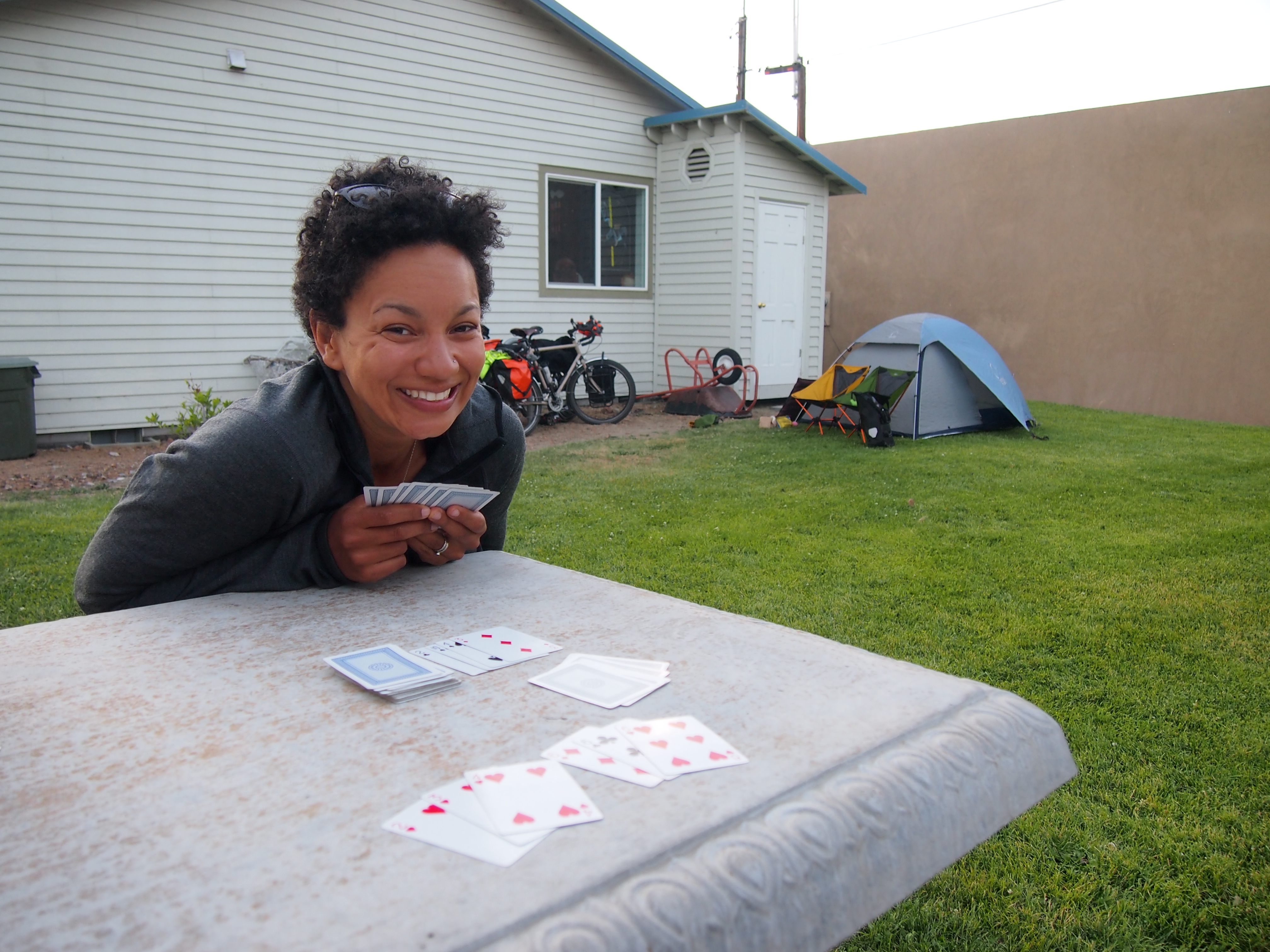
The day started when we woke up well later than we intended, only to find and amazing breakfast waiting for us: eggs, bacon, huckleberry coffee cake, and huckleberry smoothies. Again, we were floored by Patty and Rob’s generosity. I don’t know if life will ever bring us back to Republic, WA, but I certainly hope to see them again.

The ride out of Republic was downhill for the first half mile to a mile, which we resented a bit because we knew that every foot of elevation lost would only have to be gained again to get to the top of Sherman Pass. Nevertheless, we were happy to spend a mile or two on a lovely paved bike path paralleling the road before we started our climb in earnest.

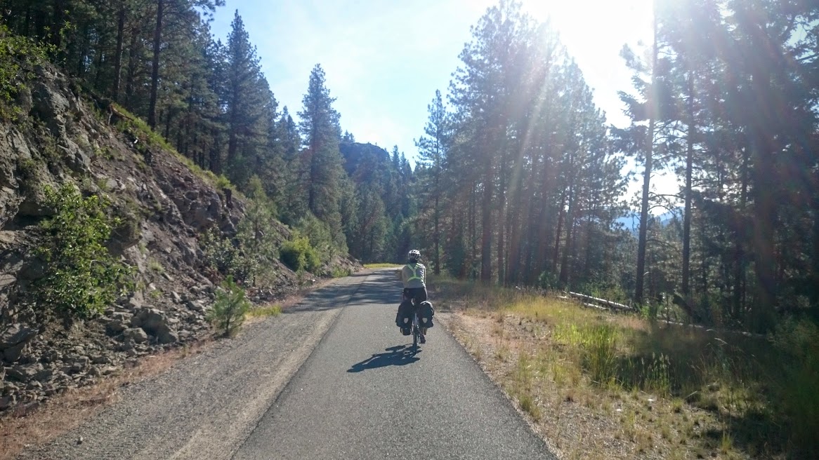
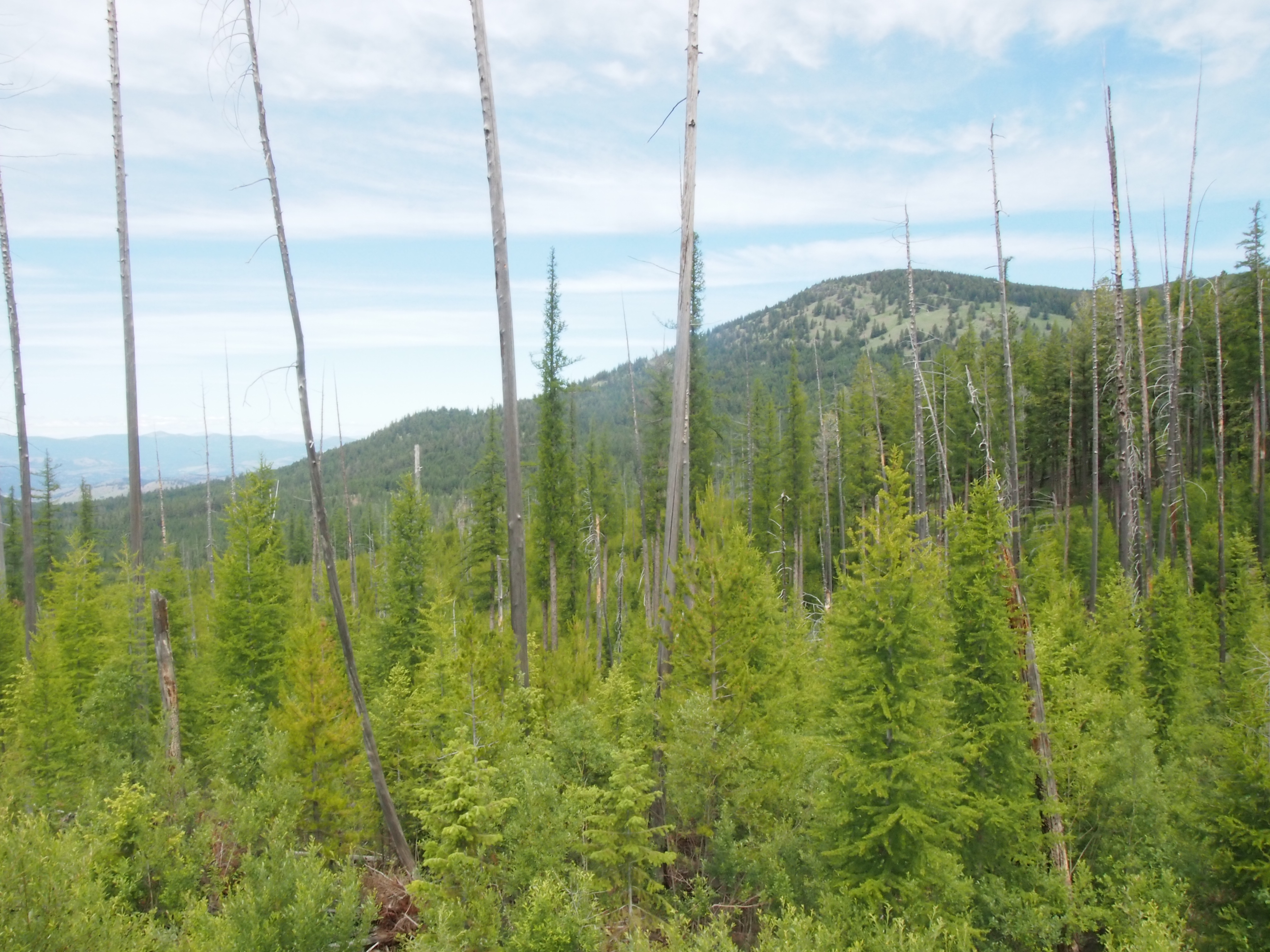
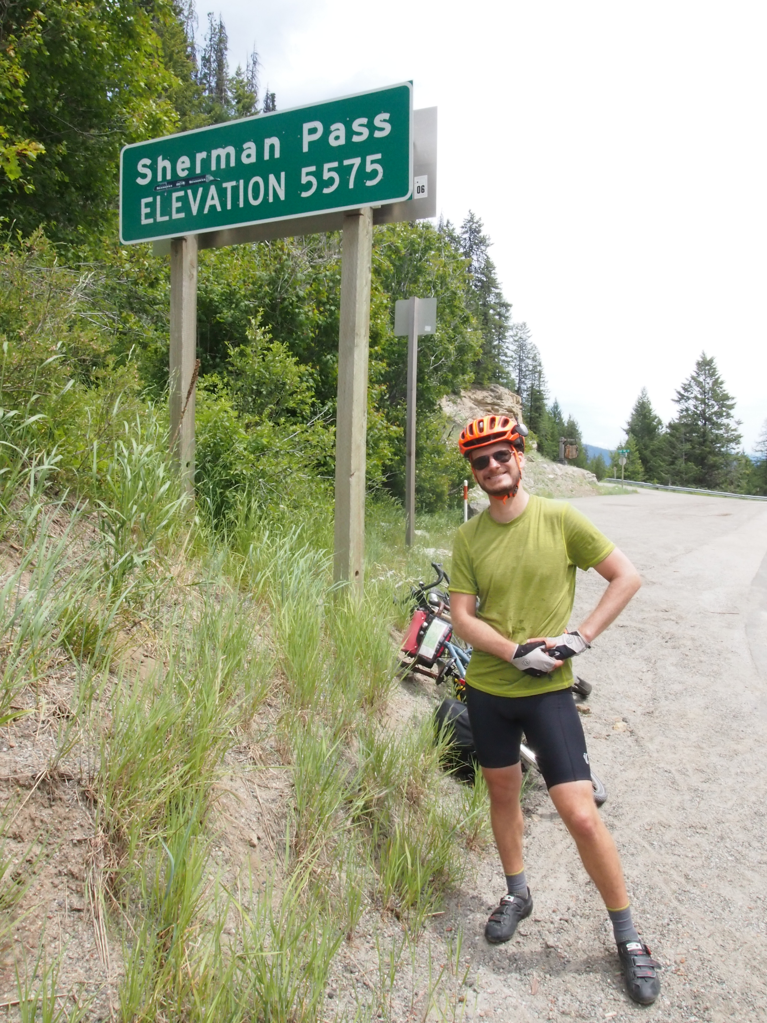
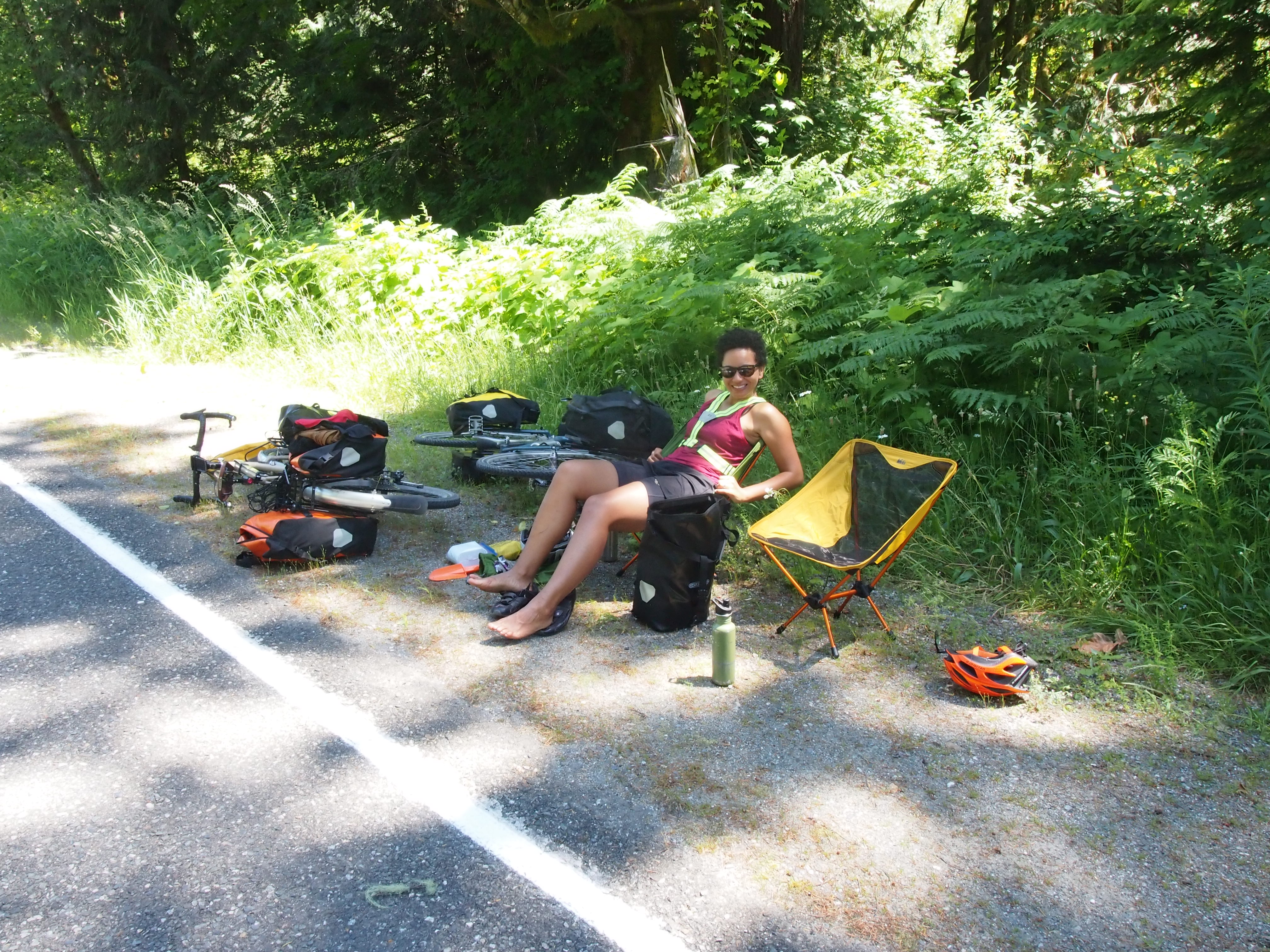
The first couple of miles of Sherman Pass were the steepest, but the climb was unremitting for 14.5 miles. I think that the length of these passes was the most difficult adjustment, mental and physical, that we had to make. We climbed steeper hills and had higher total daily elevation gains on our tour through Southwest Colorado, but we have never tackled such a consistent incline over such a long distance. Climbing over the passes has been at least as mentally exhausting as it has been physically exhausting. We struggled to maintain morale after an hour of punishing effort during which we covered only a little over four miles. Our general response in these situations was to lay our bikes (and ourselves) down in one of the “Slow vehicle turnouts” on the side of the road until we managed to gather up the motivation to start again.

OLYMPUS DIGITAL CAMERA

OLYMPUS DIGITAL CAMERA

It took us four hours to get the top of Sherman Pass, and we were thrilled to have finished our last big pass in Washington. We sat at the top and had a snack lunch of potato chips, rye chips, apples, plums, peanut butter-filled pretzels, trail mix, cookies, and brownies (Patty, thank you so much). And then we started down.

OLYMPUS DIGITAL CAMERA

OLYMPUS DIGITAL CAMERA

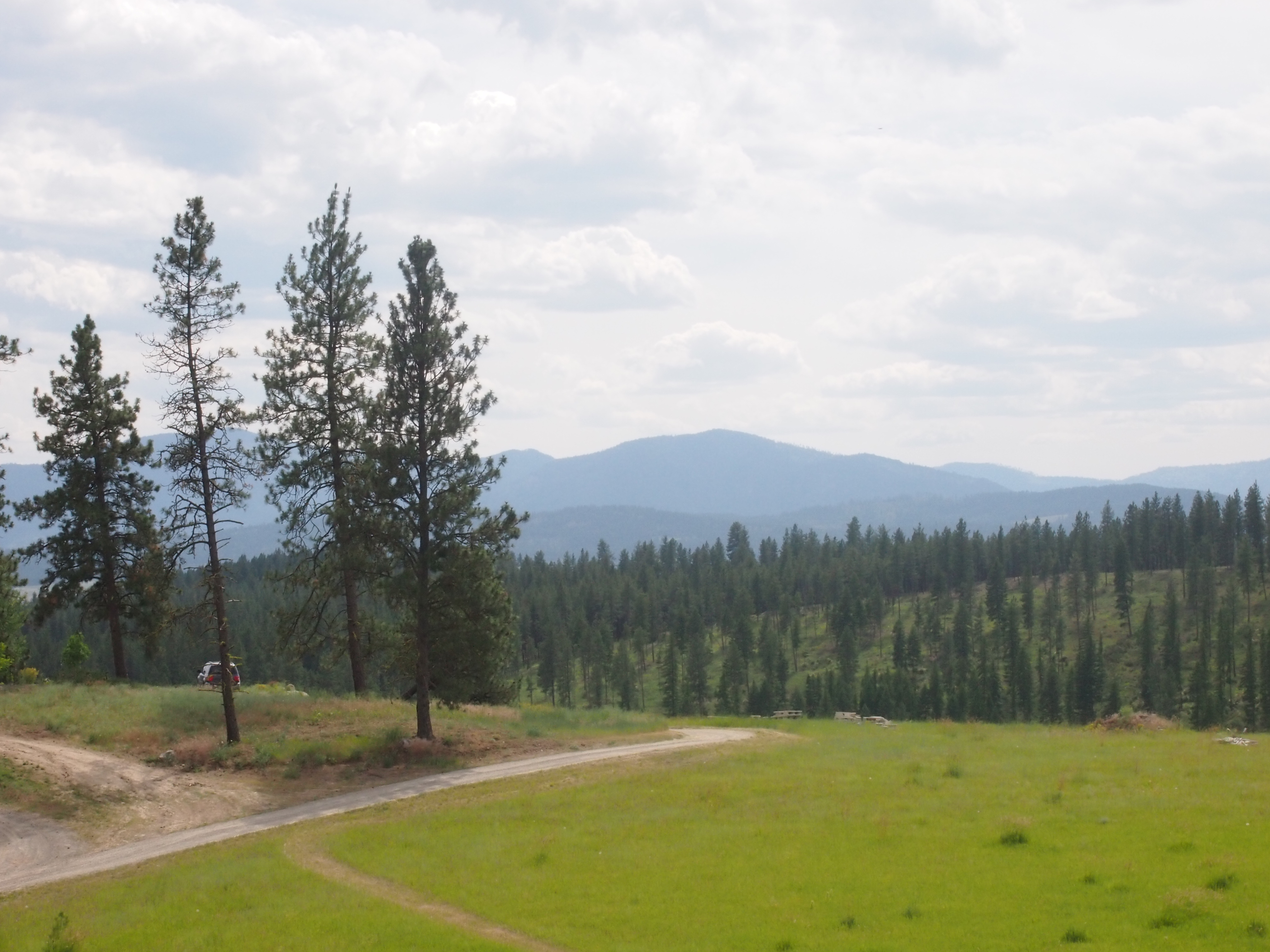
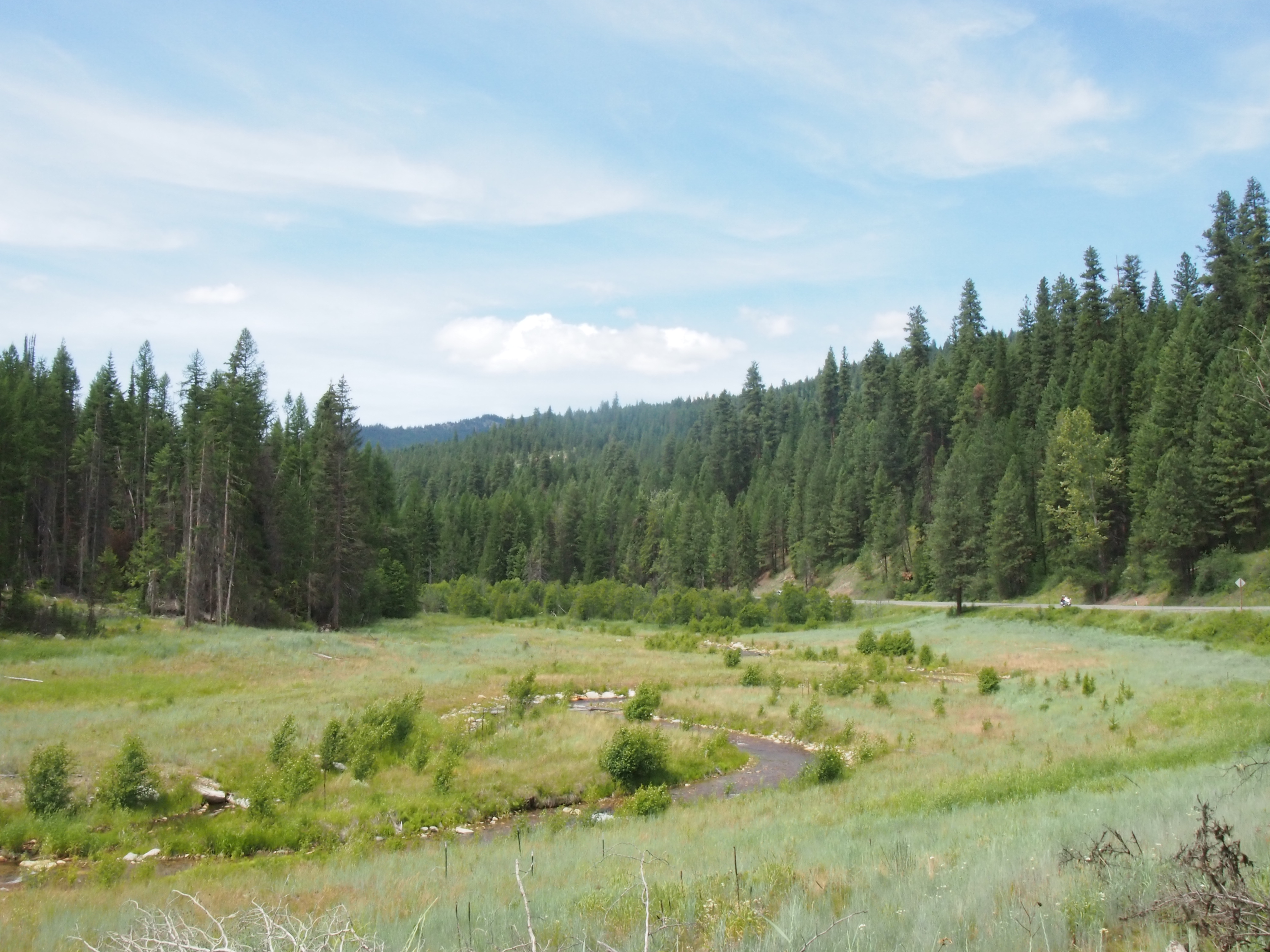
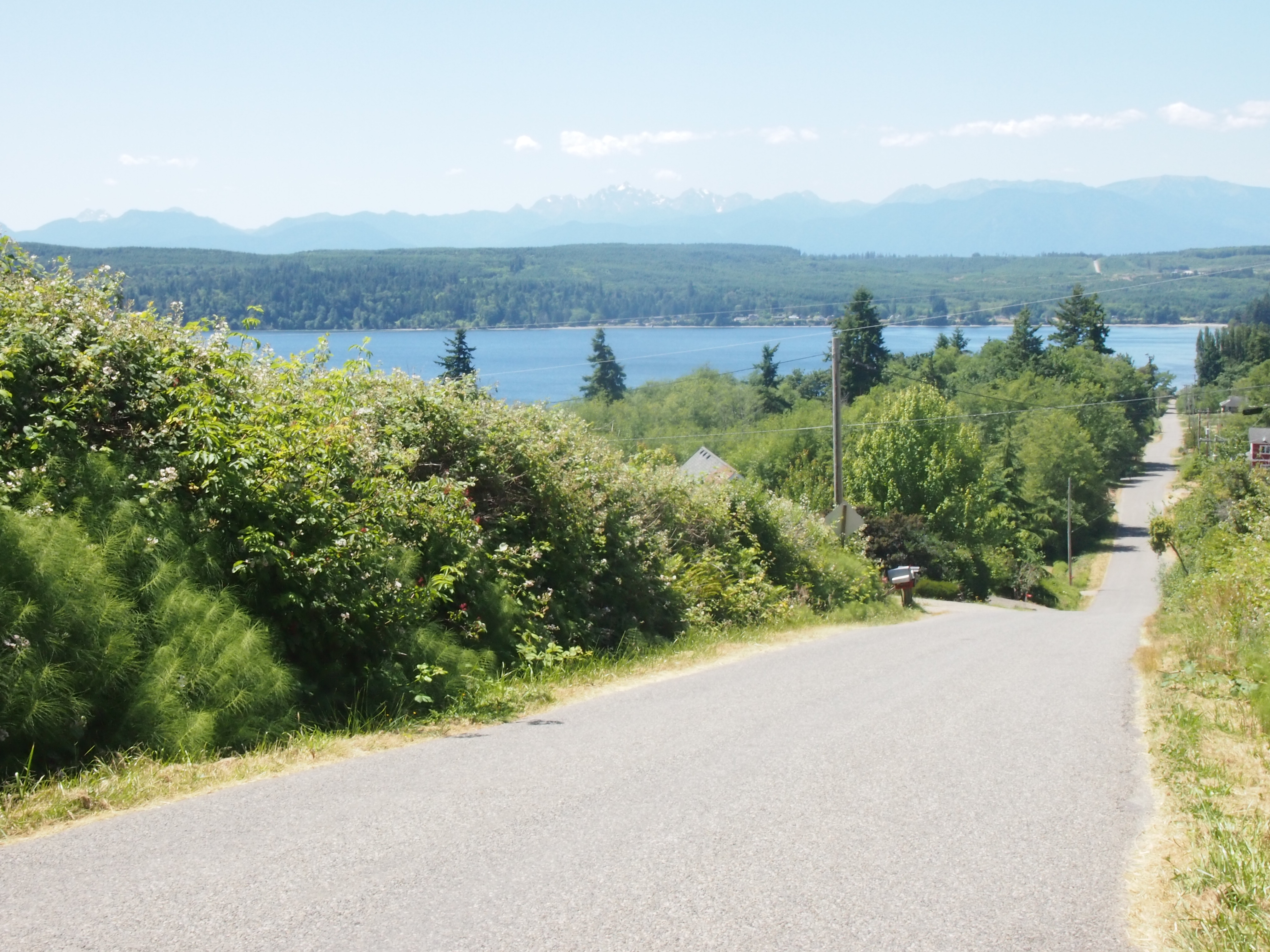
The descent was even longer than the climb, and it passed through a lovely evergreen forest, tracing a creek down the mountain. It was a very enjoyable descent, but I’ve decided that even the thrill of zooming along at 35-40 mph for 20+ miles is not worth the misery of the over 20-mile climb on the other side. Give me rolling hills and flats, please.

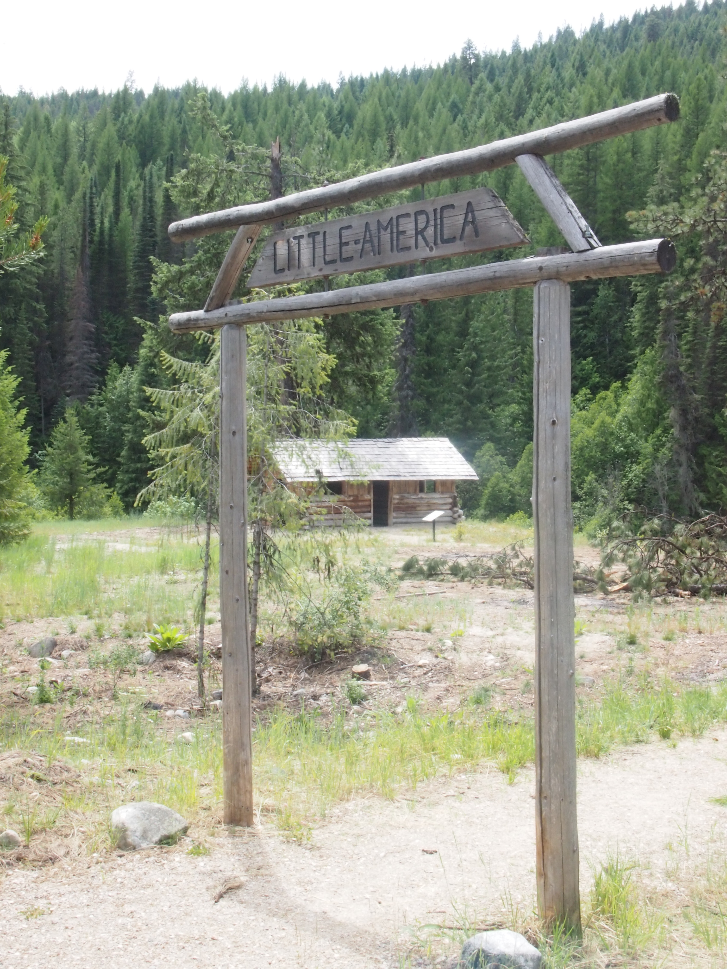
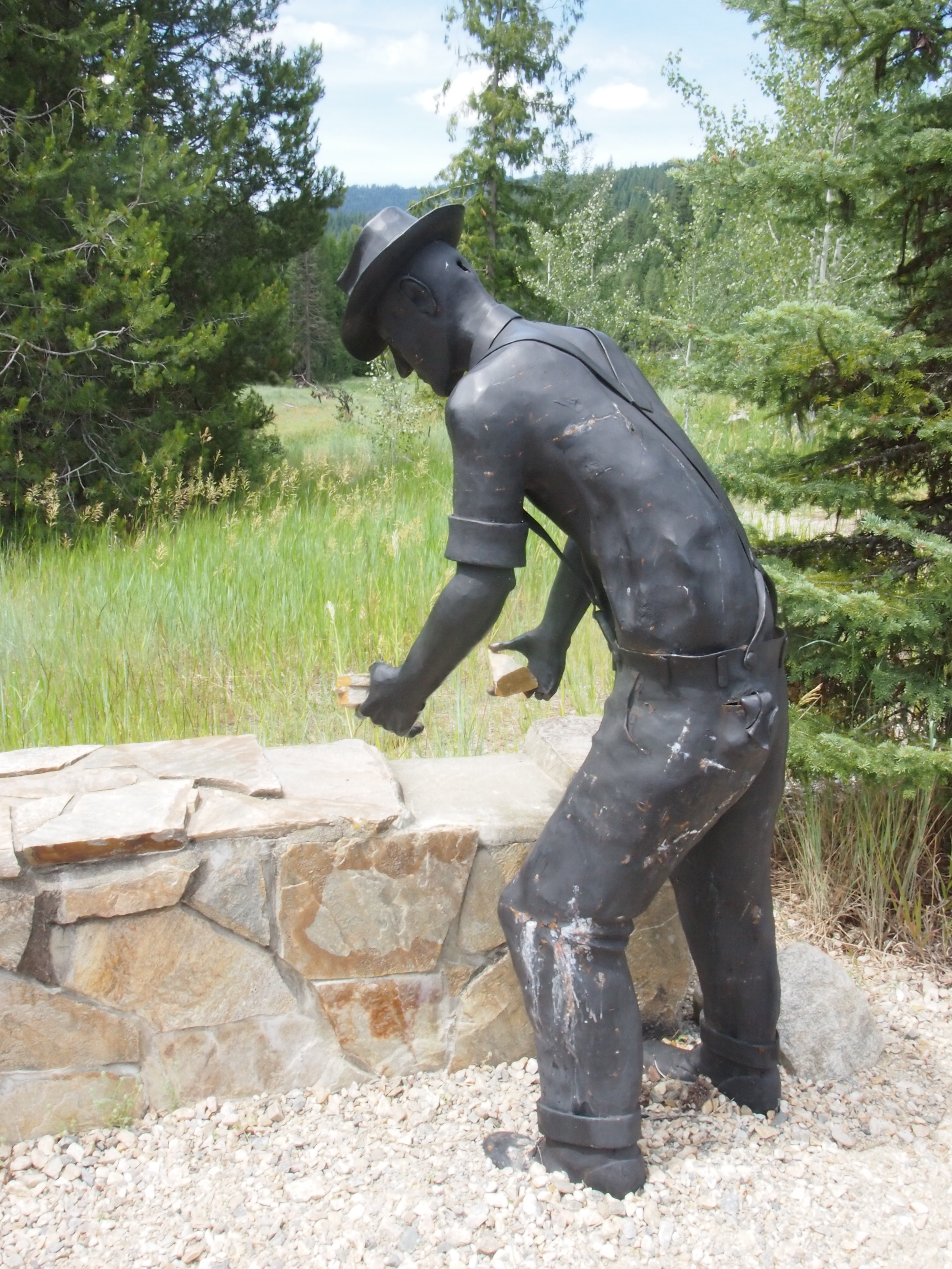
Along the way, we stopped at a historic site commemorating the FDR’s Civilian Conservation Corps, which employed out of work young men during the height of the depression to build roads, trails, and dams, primarily in the national forests. They were provided with room, board, clothing, and a salary of $1 a day, but they had to agree to send $25 dollars a month back home to their families. The historic site was well designed and informative, AND it had a much needed toilet.

OLYMPUS DIGITAL CAMERA

OLYMPUS DIGITAL CAMERA

OLYMPUS DIGITAL CAMERA

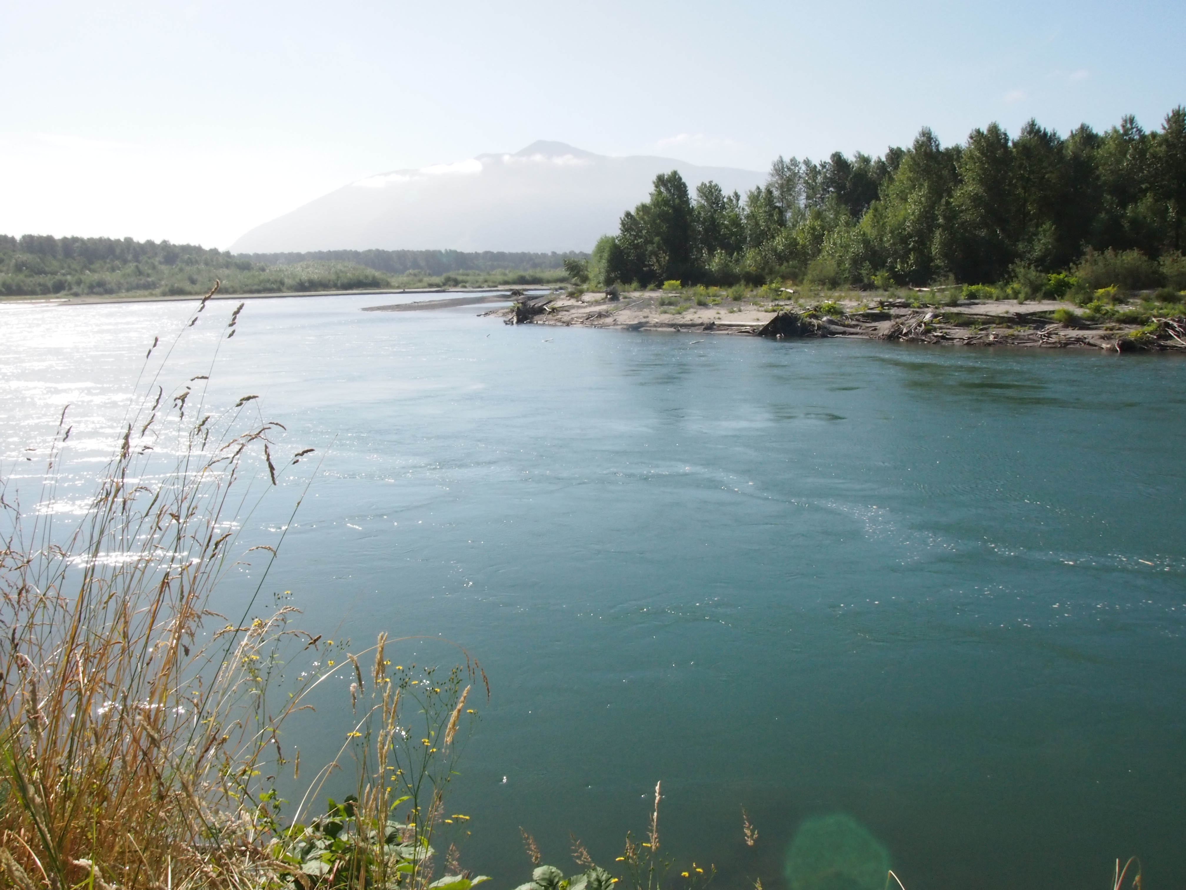
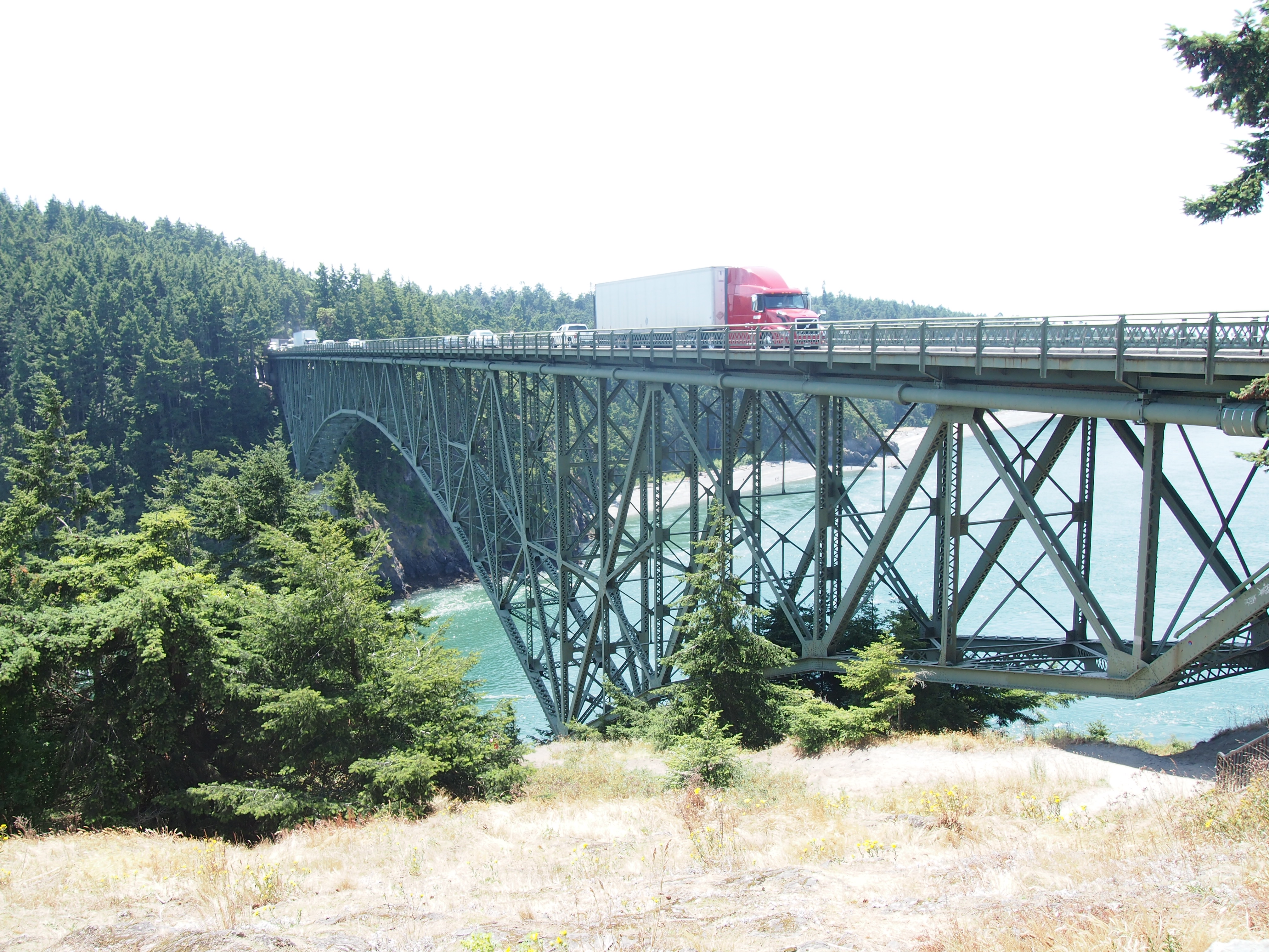
At the end of the descent we crossed the Columbia River. The views were stellar, but since we were on a bridge without even a hint of a shoulder, pictures were out of the question. We took back roads through Kettle Falls and pushed through to Colville, where we stopped at Safeway, which was by far the biggest grocery store we’ve seen so far.

There were a number of hills between the Columbia River and Colville. Some were larger than others, and some had accompanying descents. But we took offense at all of them. It didn’t seem fair that we had to climb still more hills after summiting five passes in five days.   But apparently the world doesn’t give a hoot about what we think is fair.

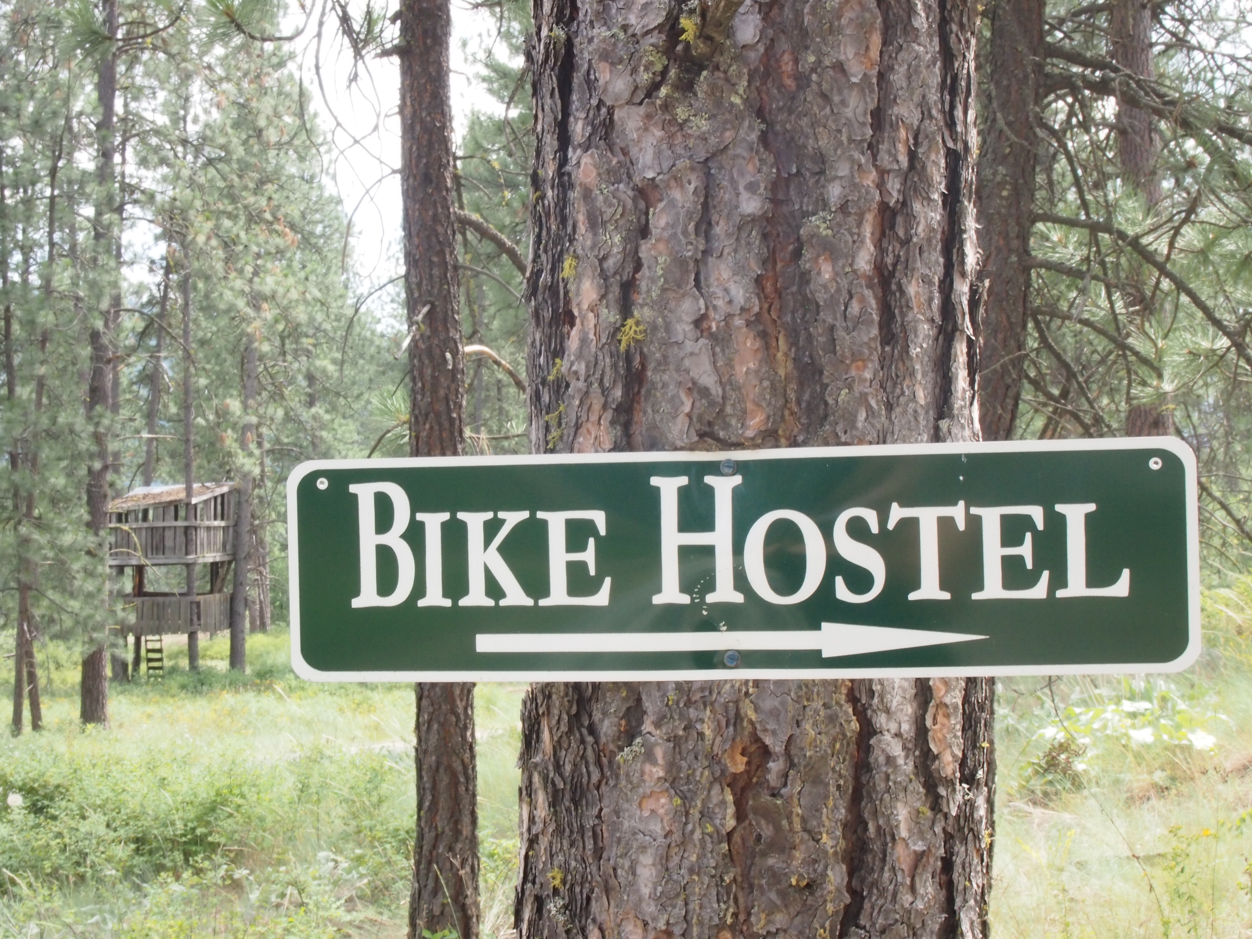
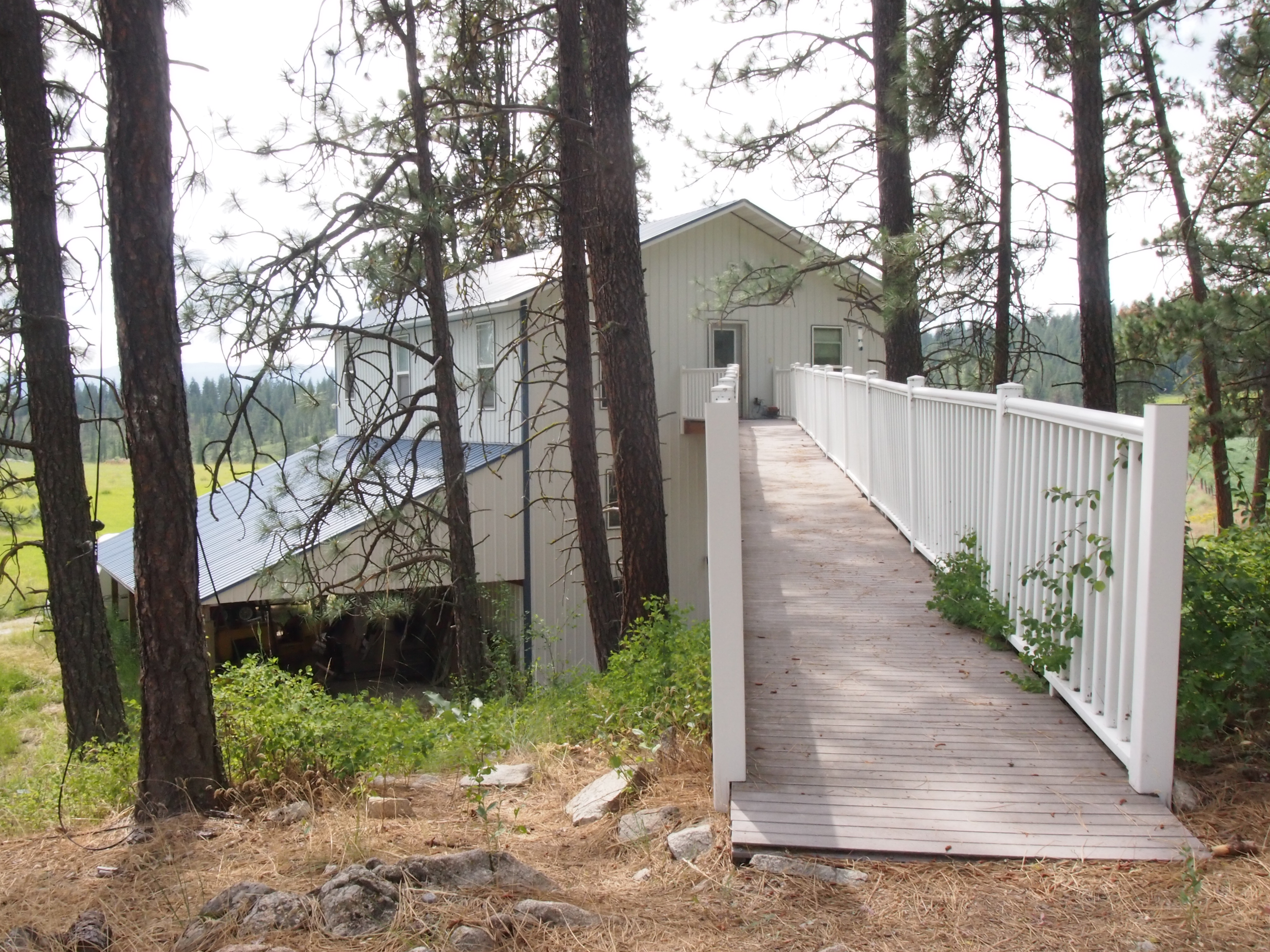
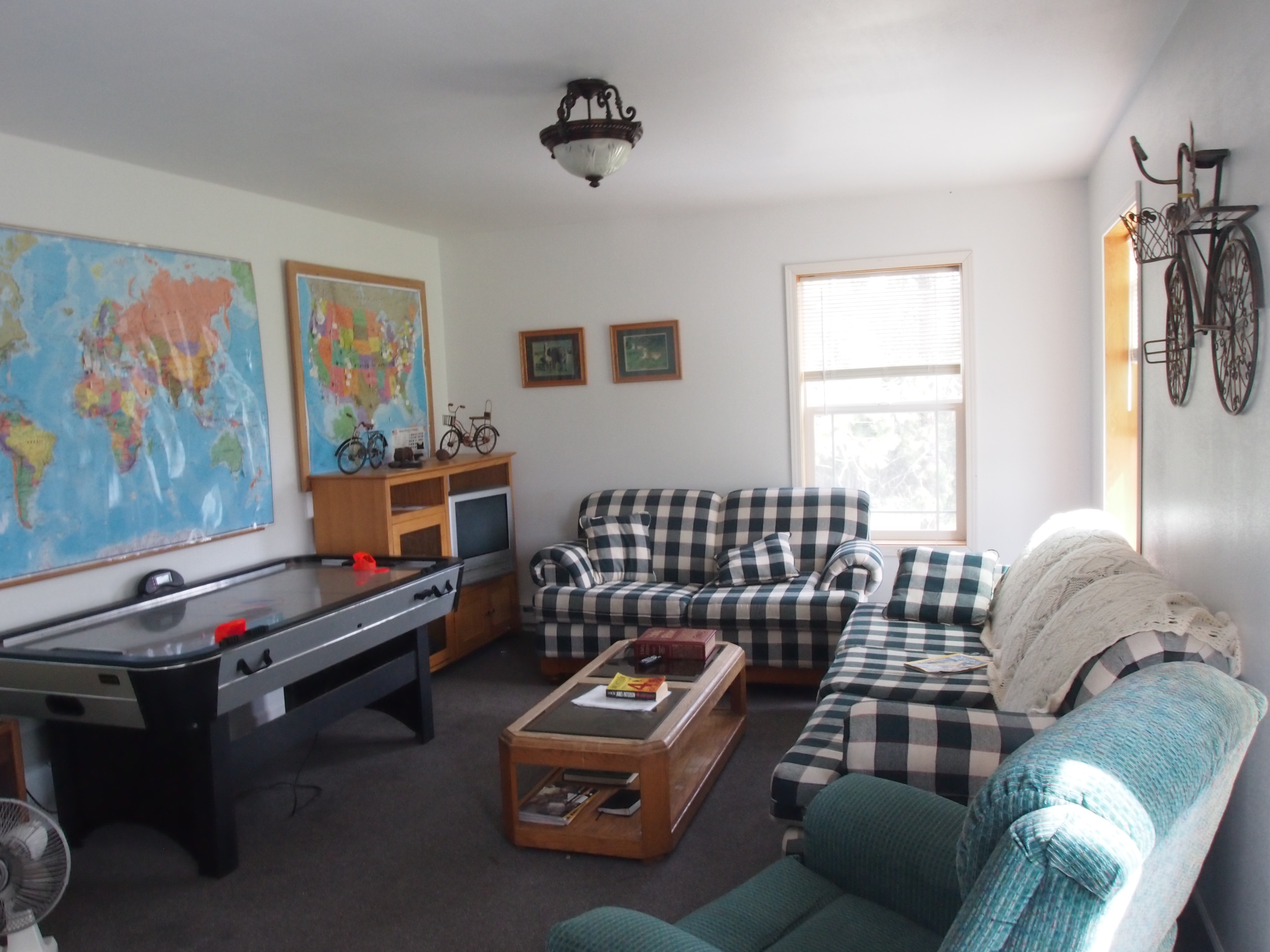
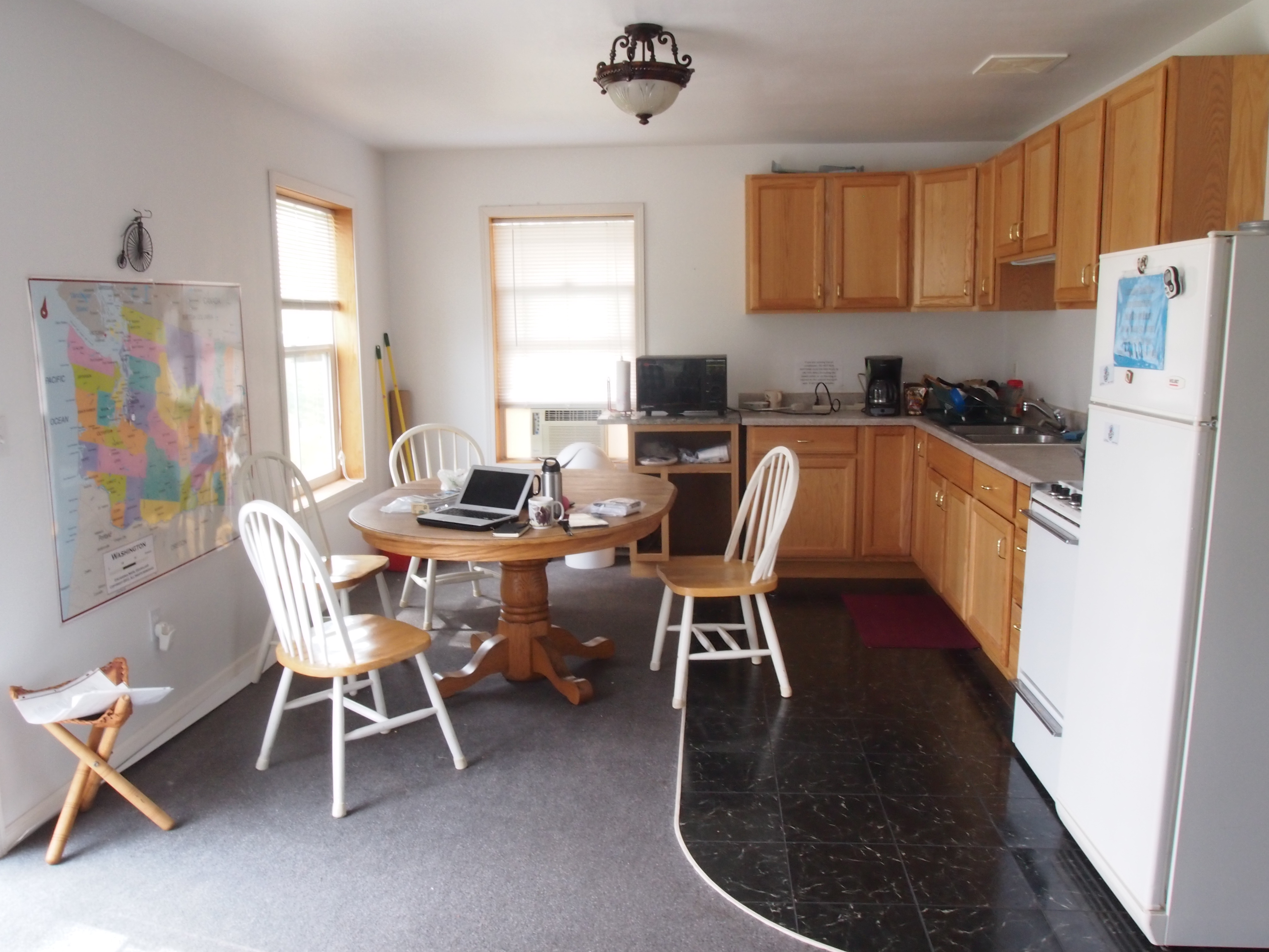
In any case, after stocking up at Safeway we headed out to our final destination: the Bacon Bike Hostel (more on that in the next post). It was only about six and a half miles out of town, but they were all uphill. We were 3 miles in when a car moving in the other direction screeched to a halt and the driver leaned out of the window to talk to us.

“Are you all going to the bike hostel?”

“Yes, we are.”

“How tired are you? Are you tired enough to want a ride?”

At this point, I’d like to tell you that we hesitated. That we thought our current exhaustion was less important than the goal of riding every single mile between Seattle and New York City. But the truth is that our answer was both affirmative and immediate.

Our rescuer, whose name was either “Stevens County Troy” or Max, depending on the day, was driving a modified two-door Honda Civic with the rear and top cut out and replaced by a roll cage. Troy is a self-proclaimed “collector of things” and the car was pretty stuffed, but he was determined to make it work. We placed both of the bikes vertically through the top hole in the roll cage and stuffed our bags wherever we could find space among the wide variety of things he was carrying (e.g., car parts, bear skin rugs, loaves of bread, bulk paper towel packs, freshly picked cherries). Then Dani sat in the front seat and I climbed in with the bikes and crouched down to rest my armpits on the roll cage bars.

And away we went, zooming up a few miles of hills in a fraction of the time it would have taken us to ride. We arrived safely at the bike hostel and Troy helped us unload our bikes and bags, and left us with a bag of freshly-picked Washington cherries. Thank you Troy, for providing another random act of kindness that made our day!

OLYMPUS DIGITAL CAMERA

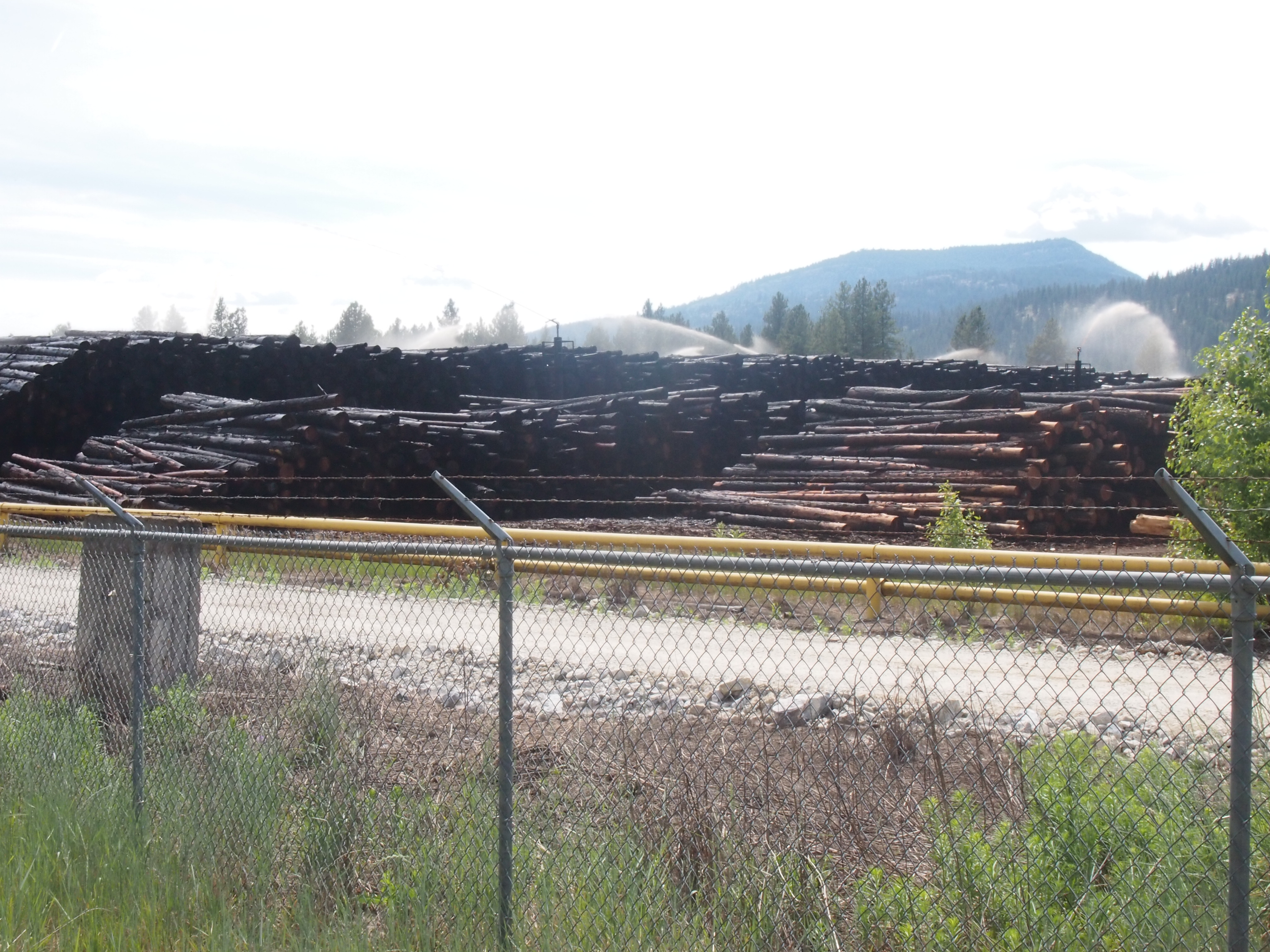
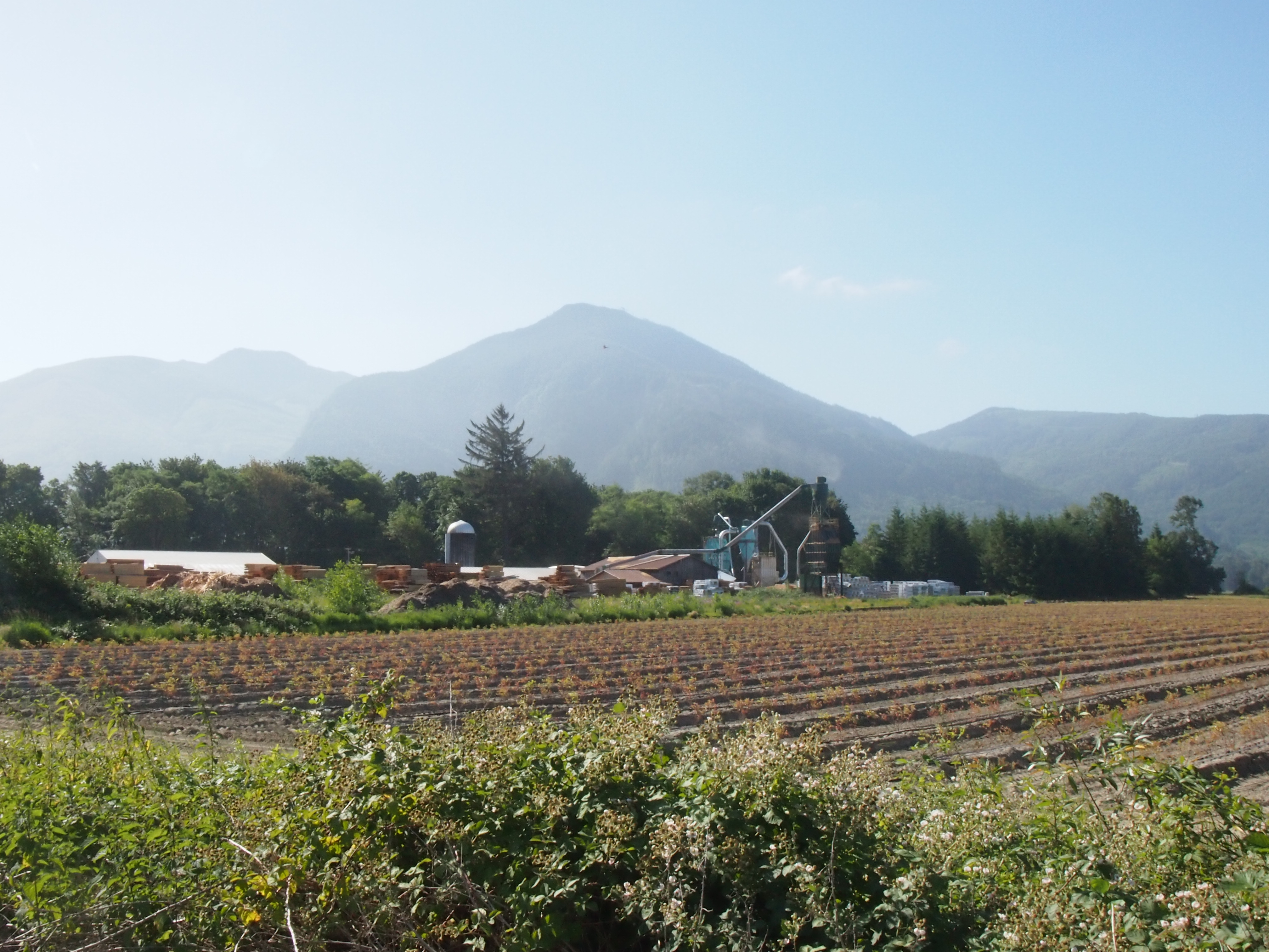
We’ve seen a few giant fields of cut trees being soaked by dozens of sprinklers.

Cascades Mountain Pass Superlative Awards:

Rainy Pass: Most Interminable
Washington Pass: Most Gratifying View at the Top
Loup Loup Pass: Most Enjoyable
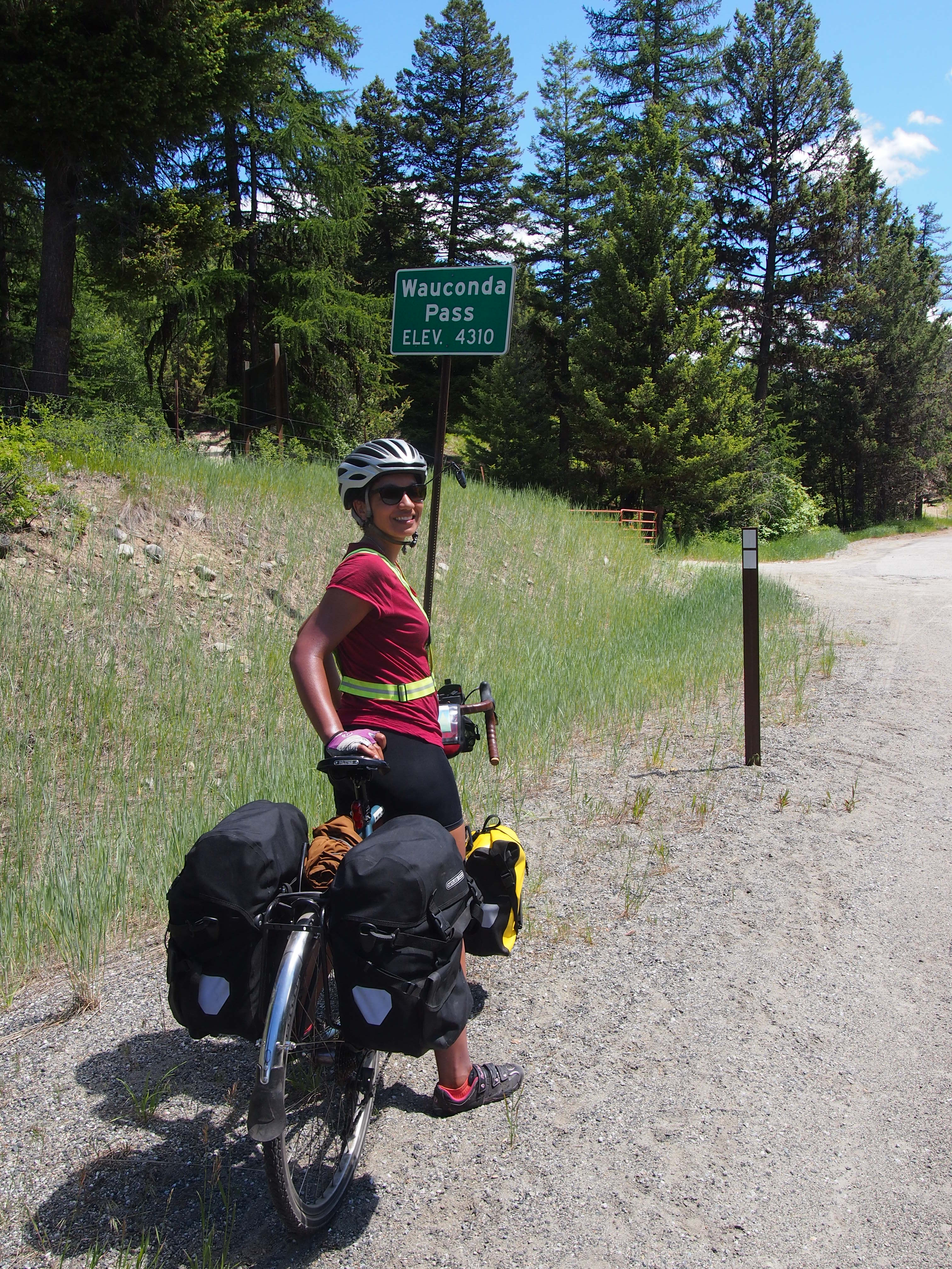
Wauconda Pass: Most Impolite Drivers
Sherman Pass: Most Demoralizing

Day 7: The day of extreme hospitality

Day 7, Tonasket to Republic: 40.5 miles, 4,363 ft. elevation gain, 9.6 mph average speed
Trip totals: 370.3 miles (52.9 daily average), 24,912 ft. elevation gain, 10.6 mph overall average speed

Map and stats here.

We woke up and packed up camp relatively quickly, eating a breakfast of mostly snack food in an effort to save time. We still got on the road at 7:48a (no matter how hard we try, we always leave in the 7:45a – 8a range) and immediately started a steep ascent out of town. We climbed through more dry, rolling pastureland. It was hot. Hot hot hot. We need to start leaving around 6a just to avoid the heat! The cars (mostly pickup trucks) on this two-lane highway were also giving us a narrow berth and there was very little shoulder, so we also need to leave early to avoid traffic. During one of our water breaks, three police cars, one ambulance, and two fire department vehicles (not fire trucks) sped up the road with their lights flashing, so we both had terrifying daymares of one of us getting hit by a truck.

OLYMPUS DIGITAL CAMERA

There was virtually no shade on the road, and although the climb to Wauconda pass was much gentler and more rolling than previous climbs, we both hated it. We stopped in the “town” of Wauconda (quote marks because there is a population of zero and the town consists of only a post office, a single gas pump, and a recently closed store/café) about 2-3 miles before the top of the pass. We found a shady spot outside of the post office to sit and cook ramen for lunch. We took out our camp chairs and really made an event out of it. The post office serves folks living in the rural area we biked through, and people came by periodically to collect their mail and had lots of questions for us. Some folks said things like, “ah, taking a break before you get to the hill, I see.” To which we replied, “what do you mean ‘the hill?’ We’ve been climbing for hours!”

OLYMPUS DIGITAL CAMERA

We sat there for over an hour before mustering up the energy (or guilt?) to climb the rest of the hill. As we were getting on our bikes, Clive, an Englishman who’s lived in Boston for a very long time, rolled up to Wauconda. Clive is a semi-retired physicist who is riding from Anacortes to Boston via a very similar route to ours. He’s carrying an absurdly small amount of luggage (a handlebar bag and a Carradice saddlebag) with full camping/cooking gear somehow clown-carred in his two small bags. As a result, he’s able to ride a Cervelo road bike and cruise. We sheepishly rolled away with our nearly 100-pound bikes knowing that he’d catch us on the pass, which he did. At the top of the pass we all decided to grab a beer and food after the 10-mile descent into town. We found an excellent brewery (Republic Brewing Co.) right next to an excellent BBQ shop (Freckles BBQ) and sat around for a couple hours chatting, eating (chili cheese fries, among other things!), and drinking.

As we were planning our trip, we heard about a website called warmshowers.org that allows people to sign up to host cyclists at their homes, either in a tent or in their homes. Ideally, the sleeping privileges also come with warm showers, but it’s mostly about having a free place to stay. We hosted someone in our tiny apartment in NYC and were excited to stay in our first warmshowers home in Republic. We stayed with the most wonderful people, Patty and Rob, pharmacists who run the local drugstore. They have three college-aged boys who were not home at the time, so we were able to sleep in one of their beds! We showered and Patty had prepared some lovely bruchetta as an appetizer for the most incredible meal we’ve had yet (and there’s been good competition): grilled salmon (caught by Rob), baked asparagus, oven-roasted potatoes, and a delicious fruit salad with local cherries that happen to be in season right now. This was followed by brownies a la mode. They hit both of our favorite foods (salmon for Dani, brownies and vanilla ice cream for Ted) and we could not have been more pleased. We sat and chatted with them on their porch overlooking the mountains for hours before heading to sleep in a comfy bed. It was the perfect end to a tough day.

We’re so grateful to have stayed with Patty and Rob and encourage any cyclists coming through to stay with them via warm showers!

Day 6: The day without climbing a pass

Day 6, Loup Loup Pass to Tonasket: 52.1 miles, 1,656 ft. elevation gain, 13.9mph average speed.
Trip Totals: 329.8 miles (54.9 daily average), 20,549 ft. elevation gain, 10.81 mph overall average.

Map and stats here.

I never did get comfortable with our sleeping arrangement last night, so I woke up this morning at 5:00a wanting to get on the road as soon as possible. Dani patiently explained to me that she didn’t think 5:00a was a reasonable start time, so I let her go back to sleep as I took down the bear bag and packed everything I could without taking down the tent with Dani still in it.

By this time it was 5:40a, which seemed reasonable enough for me to gently prod Dani awake yet again and express my desire to get on the road. She, as tolerant as ever, allowed me to hassle her out of the tent and onto her bike.

So we were on the road by 6:10 and we started the day by sailing down Loup Loup pass toward Okanogan. What a way to start the day. Aside from one short (and unfortunately steep) uphill, we covered the 18 miles to Okanogan with barely any effort. (Check out the elevation map in the above link. That’s a fun way to begin a ride!)

OLYMPUS DIGITAL CAMERA

Ever since coming down from Washington Pass, the landscape has changed dramatically. We passed through the dense, lush forests of the west side of the mountains, and we are now moving into the high desert climate of Central and Eastern Washington. We’ve been riding through ranchland and farmland, where bright green patches of irragated fields jump out from the surrounding brown terrain. We also passed by thousands of acres of apple orchards, sometimes with hundreds of acres entirely covered in mesh netting to keep the birds away. And it has become exceptionally hot. The temperature over the last couple of days has been over 90 degrees. I really enjoyed riding through old-growth forests, but seeing the variety the country has to offer is one of the perks of this trip.

OLYMPUS DIGITAL CAMERA

One thing that I don’t miss about Western Washington is the mosquitoes. I was expecting there to be mosquitoes on this trip, but maybe not until we were passing through Minnesota in mid-July. They have been vicious. This morning, Dani had 11 separate bites in a handspan area on her leg. I’m hoping they become less prevalent as we move into a drier clime.

At Okanogan, we stopped to grab a cup of coffee to reinvigorate ourselves and use the coffee house’s wifi to plan our next couple of days. Our ride continued through the towns of Omak and Riverside, before ending in Tonasket. Since we got started so early, we arrived at Tonasket before 2:00p. We’re climbing a couple more passes over the next two days, so we’re happy to have a little shorter, more relaxing day today. Also, Tonasket offers free camping for cyclists behind their visitor center, which is about as far from last night’s camping experience as one can get, and that’s ok with me!

OLYMPUS DIGITAL CAMERA

Before settling down for the evening in our private backyard, we tooled around town for a bit, picking up some groceries and grabbing dinner at the delicious local pizza joint, where I proved once and for all how hard-headed I am by standing up and shattering the low hanging light fixture with my head, much to the delight of all of the other patrons. The story has a tragic ending though. There were still three pieces of pizza left, and we had to throw them away because we didn’t want to accidentally eat shattered light fixture for dinner.

We climb our penultimate pass in the Cascades tomorrow.  We’re both ready for some flatter rides!


Day 5: Climbing a pass on a rest day.

Day 5, Bicycle Barn to Loup Loup Pass: 33.6 miles, 3,321 ft. elevation gain, 8.9 mph average speed
Trip Totals: 277.7 miles (55.54 daily average, 18,893 ft. elevation gain, 10.4 mph overall average speed

Map and stats here.

We slept in until 8a and packed up camp, eating just a couple handfuls of trail mix to get us through to our “we climbed a pass” treat: breakfast at a restaurant! We arrived in the cutesy faux-western town of Winthrop around 9:30a and chose to eat at Shari’s Sweet Shop (odd, I know), prioritizing ambiance/ability to sit near our bikes outdoors over food quality (according to Yelp). We enjoyed our egg, ham, and cheese sandwiches; walnut cinnamon roll; and delicious coffee while sitting on the patio planning our next few days and catching up on the news. After sitting for three hours (!) we went to the outdoor supply store to pick up camp fuel and met the proprietor, Brian. He and his partner took a seven-month bike tour from San Diego to Washington, D.C., then over to Europe where they cycled through France, Switzerland, the Czech Republic, and the Ukraine. I could have sat there listening to his tales all day, but we headed to Twisp to try to sort out a lodging situation (our second “we climbed a pass” treat: staying in a motel). He also reminded us that it’s legal to wild camp in any national forest land, a helpful tip because we are spending much of our budget on expensive, crowded campsites with amenities we don’t need or want.

OLYMPUS DIGITAL CAMERA

On to Twisp via mostly downhill rolling farmland. From what we observed, Twisp is a strange mix of rugged farmers and outdoorsy hippies, without much in between. We checked out a couple of motels, all of which were either overpriced and crappy or overpriced and super fancy, so we decided to forego the motel and push on toward the pass, planning to wild camp as soon as we made it to the national forest 10 miles outside of town. But not before doing a little laundry and eating in what a local told us is Twisp’s best restaurant, Rey Emmanuel Cuban and Mexican Restaurant. The owners, Rey (Cuban) and his wife (didn’t catch her name, assume one of her names is Emmanuel, but she is Mexican), somehow landed in Twisp around 20 years ago and decided to open a restaurant a couple years ago. This is a hard-working couple: they both have full-time jobs on top of operating the restaurant pretty much all on their own.

The food at this restaurant was incredible. I had the very best ropa vieja I’ve had in my life (and I recently tried the dish at what many have told me is NYC’s best Cuban restaurant, Cuba in Greenwich Village), and everything else was great, as well. If you find yourself in Twisp, eat here!

With very full bellies we began our ascent out of town. By the time we got to the national forest we decided that we may as well climb the next 7 miles over the pass. We had plenty of daylight left (it was around 7p and we’re very far north, so it’s light until 9:30p or so) and figured it would be nice to have an easier day tomorrow. We got to the official campsite at the top of the pass, but the camp was vacant and there was nowhere to hang a bear bag due to what appeared to be a recent forest fire. A bear recently destroyed a campsite at this camp, so we pushed a little further, looking for places to camp off of the road with better tree limbs. Plus, we didn’t want to pay $8 for a bathroom we didn’t need.

OLYMPUS DIGITAL CAMERA

We found a forest service road for a snow park (snowmobiling, snowshoeing, and cross-country skiing) at the absolute top of the pass, so we went along that road for a bit and were pleased to see that there were several people camping in a large flat area about a third of a mile from the road. My theory with bears is that there’s always going to be someone who’s less vigilant about bear procedures than I am, so as long as there are people around, we won’t be bothered.

As we got a little closer, it was clear that this was a settlement of some sort; people were set up to camp for days, at least, possibly longer. There were several tents with large tarps over them to provide sun and rain protection (I assume?) and an assortment of older pickup trucks and SUVs parked nearby. Some of these sites had whole outdoor pantries set up, as well as tables and chairs. When we rolled up, around 20 men were sitting around fires, drinking beers and eating dinner. Everyone sort of looked at us a little suspiciously, but we looked around to find a campsite anyway. The area was beautiful, overlooking the mountains we just climbed through today and yesterday.

We found a perfect site right on the edge of a cliff and far enough from the settlement that we figured we wouldn’t be bothering anyone, and proceeded to set up camp. People were staring at us the whole time so we waved and they tentatively waved back and continued staring, which made us a little nervous. We definitely didn’t want to camp here if we weren’t wanted, particularly because we were far enough off the road that if on the off chance something happened, we’d have little recourse.

OLYMPUS DIGITAL CAMERA

After hanging our bear bag and setting up camp, Ted headed over to one of the groups of men to say hi and make sure they were okay with us camping near them. Turns out they were out here to harvest wild mushrooms from the mountains and had been camping in this spot for almost 4 weeks! Ted said they were all tipsy and generally pleasant, but something about the interaction left him uneasy. Also, they said that a little bear comes almost every night and eats their stuff, so we had that to worry about.

A couple minutes after we got in our tent, a man walked over and stood about 20 feet behind our tent, talking to himself and breathing loudly. Ted stepped out of the tent to see what he was doing, and the guy was just staring at our stuff. Ted waved, but the guy didn’t wave back and continued to stare at our stuff, which was a little creepy and unnerving. We need all of our stuff and can’t afford to/don’t have access to stores to replace it, so if he decided to take anything, we’d be in trouble. The guy stayed there, talking to himself in bursts, until after we both uneasily fell asleep.

We nervously slept and heard close footsteps a couple times and a giant tree branch breaking (luckily, not a bear defeating our bear bag), and as soon as the sun rose, Ted awoke and decided it was time to go.

Moral of the story: maybe camping alone and hanging the bear bag really well is better/safer/smarter than crashing a settlement.

Day 3: The day of the unleashed guard dogs

Day 3, Sedro-Woolley to Colonial Creek Campground: 72.3 miles, 3,505 ft. elevation gain, 11.4 mph average speed.
Trip: 191.1 miles (63.7 daily average), 9,413 ft. elevation gain.

I’m writing this post looking at this view.

OLYMPUS DIGITAL CAMERA

In addition to the fact that Ted is doing real work as I type this post, which is always a pleasant view, our campsite is right next to a gorgeous lake and I think it was worth pushing through a steep 10-mile climb at the end of the day to get here. The end of today felt pretty steep, but tomorrow we will climb our first two passes. 30+ miles of climbing. Ugh.

We started off from Riverfront Campground (no river in sight, just a bunch of RV campers and a bathroom with white power/swastika graffiti) in Sedro Woolley at 7:52a. After a few miles of residential roads, we entered the Cascade Trail, a well-maintained crushed limestone trail that ran beside the official American Cycling Association (ACA) route for about 22 miles. It was beautiful, but a little slow-going and, at times, a little too rocky and sandy for our taste, so we decided to jump back on the road after about 5 miles.

OLYMPUS DIGITAL CAMERA

The road was not very busy this morning and the ACA route took us on pleasant back roads through quaint towns with populations of 100-400 people and only a post office and a rarely open tavern. The whole morning was gorgeous; lots of idyllic pastures and barns with mountains as a backdrop. I enjoyed all of this, but I spent a lot of the morning thinking about ice cream.

OLYMPUS DIGITAL CAMERA

OLYMPUS DIGITAL CAMERA

OLYMPUS DIGITAL CAMERA

We got to the slightly larger (pop. 705) town of Concrete around lunch and were pleased to finally find a post office that was open when we passed so we could ship home some things we’d been carrying since Hawaii. Concrete had just one grocery store that was inexplicably closed at noon on a Tuesday so my dreams of midday ice cream were dashed.

We found a nice spot near the Skagit River (a gorgeous blue-green river that much of our ride paralleled today) to eat lunch and then pushed on to Rockport, where our route veered away from SR 20 to a beautiful forested road with minimal traffic. We took a nice 30-minute break on the side of the road, complete with our comfy camp chairs, grapes, and pretzels, listening to chirping birds and a rushing stream.

OLYMPUS DIGITAL CAMERA

As we continued down the road after our break, we heard a few dogs barking and Ted said, “I’m glad we’re not riding the Southern Tier because those dogs would be chasing after us.” Five seconds later, two dogs came sprinting out of their yard angrily barking and chasing after us. Ted maintained perfect composure, as he does, but I sort of panicked, as I do. We were riding uphill at the time so I couldn’t sprint away. My reaction was to sort of yelp helplessly, say, “Ted…help” a couple times, and spew fear pheromones everywhere so that the dogs focused their ire on me rather than Ted. They stopped chasing us once we left their territory, but it sure was an adrenaline rush. Another dog chased after us with a little more persistence about 15 minutes later. Also scary. Back roads come with drawbacks, too, I guess.

We rejoined SR 20 after noon at Marblemount, and spent some time sitting outside the grocery store/hardware store/gas station drinking chocolate milk, eating Hostess cupcakes, and planning the rest of our day. As we left town, we were chased by three more dogs, this time on a major road! Luckily we were cruising downhill at the time so I sped away while Ted tried to talk the dogs down. I am not looking forward to the rural Midwestern areas where I fear this will be the norm.

For the last 25 miles of the day we approached and rode through part of North Cascades National Park. Man oh man. More of that blue-green water and gorgeous old growth forest. I feel like we’re overusing our superlatives trying to describe all of the beautiful scenery we’re passing through. Everything is beautiful, amazing, stunning, etc. I worry that by the time we get to Glacier these adjectives will feel stale and cliché, and then what will we do?

OLYMPUS DIGITAL CAMERA

But I suppose that’s one of the main reasons we’re doing this. We spent 10 hours today riding (and resting) in some of the best nature has to offer. We saw beautiful scene after beautiful scene, and it was our standard environment. This stuff is fun.

Food was sort of boring and vice-y today (blocks of cheese, Hostess cupcakes, potato chips), but we did make a nice black bean stew with brown rice, quinoa, carrots, tomatoes, and peppers for dinner.

OLYMPUS DIGITAL CAMERA

Day 2: A Day of Aches and Pains

I opened my eyes to a brilliant morning: sunlight filtering through the trees, birds singing joyfully, and Dani sleeping the deep sleep of the bike tourist.

My first thought was, “Holy moly! My bladder is full to bursting!” My second thought was, “Did my alarm (set for 6:00a) not go off? It’s so bright. We’ve gotta get started so we don’t miss our ferry!”

First things first: I stumbled out of the tent and sorted out that full bladder. Getting back in the tent, I debated whether to wake up Dani or let her sleep a while longer while I started breakfast. I checked the time on my phone to see if I could let her sleep more without risking missing the ferry.

It was 4:27a. Yep. Turns out we’re quite a bit further north than I’m used to and also coming up on the summer solstice. Lots and lots of daylight.

Anyway, since the ferry didn’t leave until 8:00a, I figured Dani could sleep a little longer.

Aside: A quick note about point of view.

We’re writing this blog together, and we’re still experimenting with the point of view we want to use. It’s strange to use first person when there are two people speaking, but it’s also strange to write about individual thoughts and feelings when writing in third person. We’ll figure it out; bear with us.

Dani looking sharp with her visibility vest and helmet mirror.

Dani looking sharp with her visibility vest and helmet mirror. Safety trumps fashion on a bike tour!

Day 2, Port Townsend to Sedro-Woolley: 67.0 miles, 2,754 ft. elevation gain, 11.9 mph average speed.
Trip: 118.8 miles (59.4 daily average), 5,908 ft. elevation gain, 11.15 overall average speed.

Map and stats here.

Today was a day of several small aches and pains. Feet, butts, knees, hands, and necks all started to complain, “Hey now. We did this long-distance riding thing yesterday. We don’t do this two days in a row.” Thankfully there are no serious hurts. Hopefully our bodies quickly get used to this new lifestyle.

We left the campground at Fort Worden State Park around 7:20a and made it to the ferry terminal in time for the 8:00a ferry. The 8:00a ferry that was canceled due to lower than normal tides. So we explored the Fort Townsend city center for a bit. It is an adorable town, but not much is going on at 7:45a on a Monday.

The next ferry left at 8:45a, and it was about a 30-minute trip to Coupeville. We met a man named Lou on this trip, a 55-year-old Air Force veteran who retired at the age of 50 and from what we gather, has spent his retirement taking amazing trips like hiking the PCT and now, riding our exact same route as us (including the Great Lakes alternate route), except he’s going all the way to Maine. He’s riding a recumbent bike (a bike that looks like a mesh lounge chair on wheels that can apparently reach 60 mph downhill, but struggles with uphill climbs) and when we saw him roll down State Road 20 after the ferry ride, our feet, butts, knees, hands, and necks all yelled at us for not making a smarter bike choice. He looked like he may as well have been sipping Piña Coladas and reading a book at the beach. Sigh.

Anyway, after disembarking the ferry we rode through a combination of farmland and coastal vacation properties for many miles. We stayed on side roads as much as possible, but spent a large chunk of the day on terrible State Road 20, which was heavily trafficked and often did not have a shoulder. This exacerbated our neck and shoulder problems because we tensed up every time a vehicle passed us going 60 mph about 2 feet from our bikes, which happened about 50 percent of the time today. Yesterday, we added tiny rearview mirrors to our helmets. These were great because we could see when the large trucks and rented RVs were about to pass us, but they were also awful, because we could see when the large trucks and rented RVs were about to pass us.

After passing through a couple of town-like areas that were cute, but not particularly notable, we came to the highlight of the day: Deception Pass. For a pass, the climb to the top wasn’t too bad. We didn’t even mind the roadwork on the way. What was a little frustrating was the giant roadwork signs that occupied the entire shoulder, forcing us into the highway traffic lane.

Anyways. Deception Pass. It is a two-span bridge connecting Whidbey and Fildalgo Islands. It has amazing views of mountains and turquoise water. We don’t know how to better describe it, so hopefully our pictures can do it justice.

OLYMPUS DIGITAL CAMERA OLYMPUS DIGITAL CAMERA

The other most notable aspect of our day was that we made the big right turn to start riding east. We are now officially on the Adventure Cycling Association Northern Tier Route and heading toward home!

Doing the laundry and writing a blog post at Riverfront Campground in Sedro-Woolley.

Doing the laundry and writing a blog post at Riverfront Campground in Sedro-Woolley.

Food Diary :

(note: Dani is posting pictures of some of our meals to the PanniersandGrannyGears Instagram account, which appears in the right sidebar)

Breakfast: Farm fresh cheesy scrambled eggs with onions. Yum! Those fresh eggs taste amazing!

Lunch: Peanut butter and (blackberry pomegranate) jelly sandwiches, apple, almond/cashew nut mix.

Dinner: Don’t judge us. Popeye’s Louisiana Chicken. As we rode through Burlington, WA, we were tired, sore, and hungry. We saw a Popeye’s on the side of the rode on our way to a bike shop, and it was inevitable. We both independently decided to go there for dinner, just like Leibniz and Newton inventing calculus.

Day 0-1: Seattle to Bainbridge Island to Port Townsend

Day 0: 14.5 miles, 932 ft. elevation gain, — average speed (whatever speed equates to meandering around a city, looking for various things)

We’re calling the first day on the bike “Day 0” because we spent more time dealing with logistics than actually riding. We arrived to Seattle on a red-eye from Kona, HI around 6:45a. Ted got about 2 hours of sleep and Dani estimates that she got between 3 and 4. Needless to say, we got off to a bit of a groggy, grumpy start. We navigated a confusing modified public transportation schedule (due to a marathon) and arrived around 9a to a colleague of Dani’s dad’s house to assemble our bikes, which the colleague graciously received and stored for us. Our bikes were relatively unscathed after the cross-country FedEx trip, and Ted expertly threw them back together using fancy bike-throwing-together techniques Dani doesn’t understand.

Starting off!

We then got on our bikes. Dani had never ridden a touring bike with back and front panniers before and immediately regretted not acting on her notion to load up the bike back home to get a hang of things in Prospect Park. Instead, she sort of wobbled through busy Seattle streets silently cursing her decision to spend her summer riding a heavy bike across a giant country. After running (wobbling?) several errands around Seattle (shopping for food and cooking fuel, etc.), we boarded the 3:45p Bainbridge Island ferry.

The ferry ride was beautiful, complete with a lovely view of Mt. Ranier. After getting off the ferry, we began our trip in earnest, intending to ride straight to the Fay Bainbridge Campground only 10 miles from the ferry dock. But Ted spotted a brewery not far off the path and we decided that our 10 total miles of riding so far today merited a visit to a microbrewery for some celebration. Turns out the brewery (Bainbridge Island Brewery) was having their own little celebration for their three year anniversary. We got delicious beers, of course, but they were also barbequing so we got delicious pulled pork sandwiches.

Every bike tour blog we’ve ever read and every bike tourist we’ve ever talked to has emphasized how meeting amazing people and receiving random acts of kindness is perhaps the best part of bike touring. And it is. And we were truly excited for that aspect of the trip. But we really didn’t expect it on the very first day, 10 miles into our 4,000+ mile ride. While we were sitting outside Bainbridge Island Brewery, enjoying our pulled pork and tasty beer, up walked Sue and Lloyd, who live nearby and invited us to camp in the yard behind their beautiful house, a few minutes away from the Puget Sound. (I think. It’s entirely possible it was a different body of water.) We rode back to their house; walked down to the beach; and chatted about bike touring, the beer scenes on the east and west coast, Peace Corps, and more. We were able to shower (yay!), make adjustments to our hastily assembled bikes, and reorganize all of our panniers (for what is certainly not the last time) before we called it a night, telling Sue and Lloyd that we were planning to hit the road between 7a and 8a the next morning.

Day 1: 49.5 miles, 3,153 ft. elevation gain, 10.3 mph average moving speed

We woke up at 7:35. Oops. We packed up all of our gear while sipping on the delicious coffee Sue made for us. Then we chatted for a while more before we actually got started. I think we were subconsciously delaying starting out. Getting started is always so hard! Sue and Lloyd gave us some tips on the best route to take and we started the day riding through winding side roads with rolling hills before reaching a busier highway. It seems like people name their driveways when they buy a plot of land up here, which is common in vacationy places, I suppose, but here they get official road signs made. We saw some fun names like See Forever Lane (Ted’s favorite, but Dani thinks “Sea Forever” would be a punnier name) and uncreative, descriptive names like Water View Road, Mainland View Road, and Harbor View Road. We ate breakfast at a lovely cemetery, then continued on to Port Gamble and were lured into a delicious barbeque lunch (with mind-blowing garlicy cheese fries). We then traversed a cool floating bridge with an incredible view of the water with the Olympic Mountains as a backdrop.

Cemetery breakfast spot

Cemetery breakfast spot

BBQ in Port Gamble

BBQ in Port Gamble

The app we used to plot out this ride (Ride with GPS; highly recommended) took us on a beautiful side road through Shine, WA where we rode on the water with those same gorgeous water/mountain views and no traffic whatsoever. We jumped back on the highway, then rode through a rock quarry to avoid more traffic. We stopped (again – lots of stops!) at Chimacum Corner Farm Stand because they had a sign for ice cream and fresh fruit. Dani tricked Ted into thinking she was mainly interested in the fruit, but ran straight to the ice cream stand, of course. This shop was capital A adorable and we would have spent all of our money here if we didn’t have limited pannier capacity. We bought some snacks and some veggies for dinner, then headed out for the last leg of our first day.

The view from Shine Road

The view from Shine Road

A few miles from Port Townsend, our final destination and the location from which we’re writing this post, we entered the Discovery Trail, a lovely bike trail that went along whatever body of water we’re close to. It’s hard to keep track of all of the names of water bodies up here!

Biking down the Olympic Discovery Trail.

Biking down the Olympic Discovery Trail.

Overall, it was a hilly, challenging day that made me (Dani) a little nervous about my lack of training for this trip (turns out inconsistently bike commuting through flat-as-a-pancake NYC is NOT sufficient preparation for riding 50+ hilly miles with a loaded bike), but we’re hoping that we sort of train as we go and things will be easier in a week or two. Wishful thinking? Perhaps. But our friends on Bainbridge Island taught us the mantra they learned on their bike tour through Portugal that applies here: sempre frente. When they asked for directions, this was a common response and it means “always forward.” That’s how it felt today and I’m sure that’s how it will continue to feel, but we’ll just keep pedaling until we hit the Atlantic Ocean!

Food Diary

We read several blogs to prepare for our trip and most said little about the food they ate. We think the most important part of traveling is food, so we’re planning to try our best to document our meals, whether eaten out or cooked at camp!

Day 0 Dinner: Pulled pork sandwiches with baked beans (with cilantro!) and mac and cheese (with Goldfish Crackers?!) at Bainbridge Island Brewery. Day 1 Breakfast: Granola bar, peanut butter and jelly sandwiches, coffee.

Day 1 Lunch: Pulled chicken sandwich (Dani), smoked sausage sandwich and a single BBQ rib (Ted), garlicky cheese fries at Mike’s Four Star BBQ in Port Gamble.

Day 1 Snack: Cardamom / bittersweet chocolate ice cream cone (Dani), fancy chocolate milk (Ted) at Chimacum Corner Farm Stand.

Day 1 Dinner: Spaghetti with a spicy broccoli, mushroom, and tuna marinara (to be cooked once we reach our campsite).

Tips and Tricks: Packing your bike for shipping

Let me start by saying that I don’t intend for this post to provide comprehensive instructions for how to pack a bicycle for shipping. The internet abounds with videos that serve that purpose and that were created by people more competent than I. Instead, this post is meant to show a few pictures of what ended up consuming most of a Sunday and to share a few tips that I didn’t find elsewhere (although I’m certain I’m not the first to think of them).

DSC_0463

Tip #1: Do it yourself. There’s a lot to be said for the convenience of putting someone else in charge of disassembling, packing, and shipping your bikes before your tour. But that convenience comes at a cost.  I’ve talked to bike shops that charge anywhere from $40 to $100 to pack a bike, and that excludes shipping. That’s a lot of money that could otherwise be spent splurging on a nice meal or a motel on a rainy night on our tour. Toss in the sense of accomplishment and self-sufficiency and some other lovely intangibles, and doing it yourself is definitely worth it.

Tip #2: Get a box from a bike shop.  You can buy brand new cardboard bike boxes from shipping stores and bike shops from $10 to $25. Or you could walk into a bike shop and say, “Hey! I’m going on a bike tour and I need to ship my bike. Do you have any empty bike boxes that I could have?” Generally they do and generally they’re excited for your trip and happy to help. (Aside: if your bike shop tries to charge you for something that they’re going to throw away, not only should you not pay for the box, you should also find a new bike shop.)

Tip #3: Use www.shipbikes.com. I don’t know how they do it.  It doesn’t make sense. If I go to the FedEx website and enter my bike package details, I am quoted a price of roughly $155 (UPS and USPS give similar quotes).  When I go to ShipBikes (which uses FedEx) and enter the same information, the quoted price is roughly $60. It’s not a scam; you print out a FedEx label and drop your bike off at a FedEx location. But I have no idea how they’re making it work.

(Tangential) Tip #4: Bike stands are amazing. This isn’t strictly related to packing your bike for a tour, but it merits mentioning. I received a bike stand as a gift a year and a half ago, and it’s one of my favorite possessions. Suddenly, basic maintenance became a breeze and slightly more complicated maintenance (that includes the use of both hands, pedaling, or anything that is inconvenient on an upside-down bike) became much more feasible. I’ve learned tons about bike maintenance since I received the stand, which has saved me lots of money and also increased my confidence in my ability to perform on-the-road repairs on the tour. The stand folds up and lives in a small corner of our closet, so it’s worth the storage space (even in our 319 sq ft. apartment).

DSC_0468

Tip #5: Protect that pesky rear derailleur. If someone came up to me and said, “Ted, I’m going to give you a ton of money on the condition that you only use it for bike-related purchases,” I would a) do everything in my power to build an ongoing relationship with that person, and b) buy a Rolhoff Speedhub. The rear derailleur is one of the most critical aspects of a well-functioning bike, and it is also the most vulnerable to damage.  When we went on our honeymoon tour down the Oregon coast, the derailleur on my LHT was bent slightly inward during shipping. It wasn’t impossible or even difficult to ride, but the shifting was off just enough to make it incredibly frustrating.

I don’t want to deal with that again. When I packed up my bike, I removed the chain from the rear derailleur by taking out the bottom jockey wheel. Then I removed the derailleur from the frame (leaving the cable attached) and wrapped it in bubble wrap.  Then, in order to make it as safe as possible, I rested the wrapped derailleur on the drive-side chainstay before I zip tied the front wheel to the frame, which held it nicely in place between the two wheels (you can see the result in the image above).  Hopefully this minimizes the risk of damage during shipping.

Tip #6: Shortcuts can veer long. This goes in the “obvious observations” file. Bike boxes are designed to fit the bike in the smallest possible box to keep shipping costs down. Thus, it’s tough to fit your bike in the bike box with all of its cumbersome accessories attached to the frame. I know this. I knew this.  But I still tried to pack my bike without taking off my rear rack and rear fender. That was a bad decision that led to unnecessary stress and annoyance. Take all of your accessories off and pack them in after the bike is already in its box.

DSC_0469

I got so good at maneuvering the boxed bikes on top of a longboard that I almost regret not having more bikes to pack. Almost.

Tip #7: Do what you can, but it all comes down to hope. Once the bike was in its box, I stuffed the empty space with newspapers to pad the bike and minimize the amount the bike could move around inside the box. I also wrapped accessories (e.g., water bottle cages) and put them in the box with the bike. Then I taped signs to the both sides of the box imploring the FedEx people to please treat my bike nicely.  And it will probably be fine.  But there’s always the chance that my bike will end up on the bottom of a big heavy pile or that it will cross paths with a FedEx employee who is having a bad day.  I could have certainly packed my bike more carefully and I hope I don’t regret not taking every precaution. For now, I’m just hanging on to hope!

We’ll let you know whether these tactics worked when we pick up our bikes in a couple weeks!

(Organized?) Chaos

OLYMPUS DIGITAL CAMERA

Welcome to our living room. This pile of gear is a mess, but at least it exists! Small steps. Check out our packing list (and much more organized pictures of gear) here.

We’re also very close to having figured out all of our trip logistics. Dani just graduated and is finishing her two internships this week. Ted is wrapping things up at work and rushing to complete all of his paperwork to begin law school (three days after we expect to return :-/). We’ve just found a place for our car and dog, and recently secured a house sitter. Our list of little things to do before we leave is still quite long, but we’re happy to have gotten most of the large things sorted.We waver between feeling terrified and excited about this trip, but we’re definitely ready to stop worrying about it and get on the road!