Day 13: The day of 6,000 feet of elevation gain in 6,000 degree heat

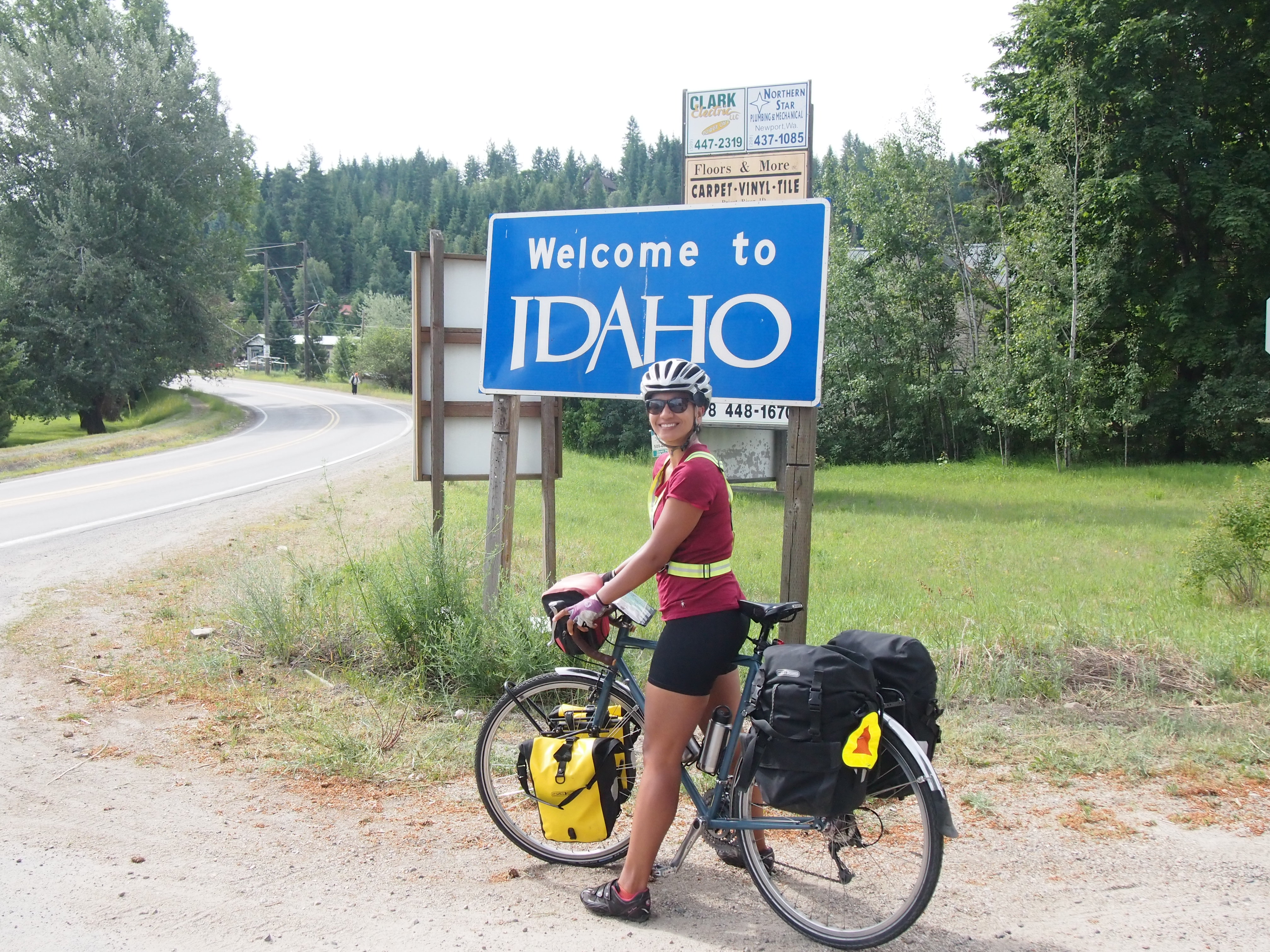
Day 13, Libby, MT to Eureka, MT: 74.6 miles, 5,954 ft. elevation gain, 10.6 mph average speed
Trip totals: 728.9 miles (60.7 daily average), 44,832 ft. elevation gain, 11.0 mph overall average speed
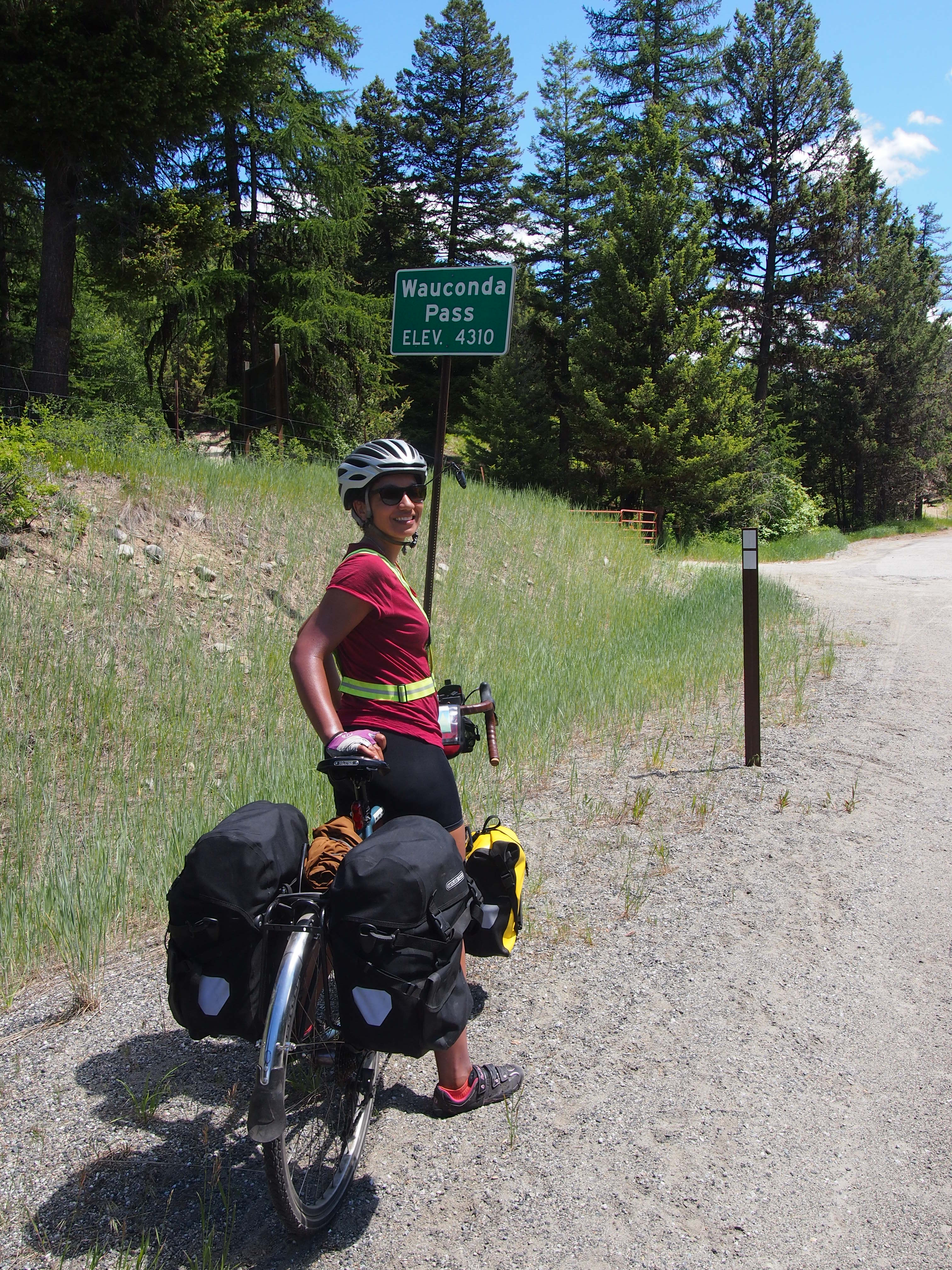
Map and stats here.

IMG_4444

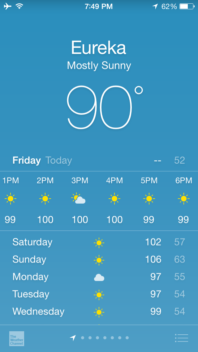
Oh boy. Heat warnings all over Montana. You know what 100+ degrees feels like, right? Pretty terrible. Now add riding a bike with no shade at all for 6 hours. No shade, but with cliffs on one side of the path that absorbed the heat and baked us from the side. Let’s just say I was not the happiest camper at the end of the day. Some kids on ATVs were complaining about how hot it was on their ATVs. I wanted to ask them to trade vehicles or stop complaining so close to me.

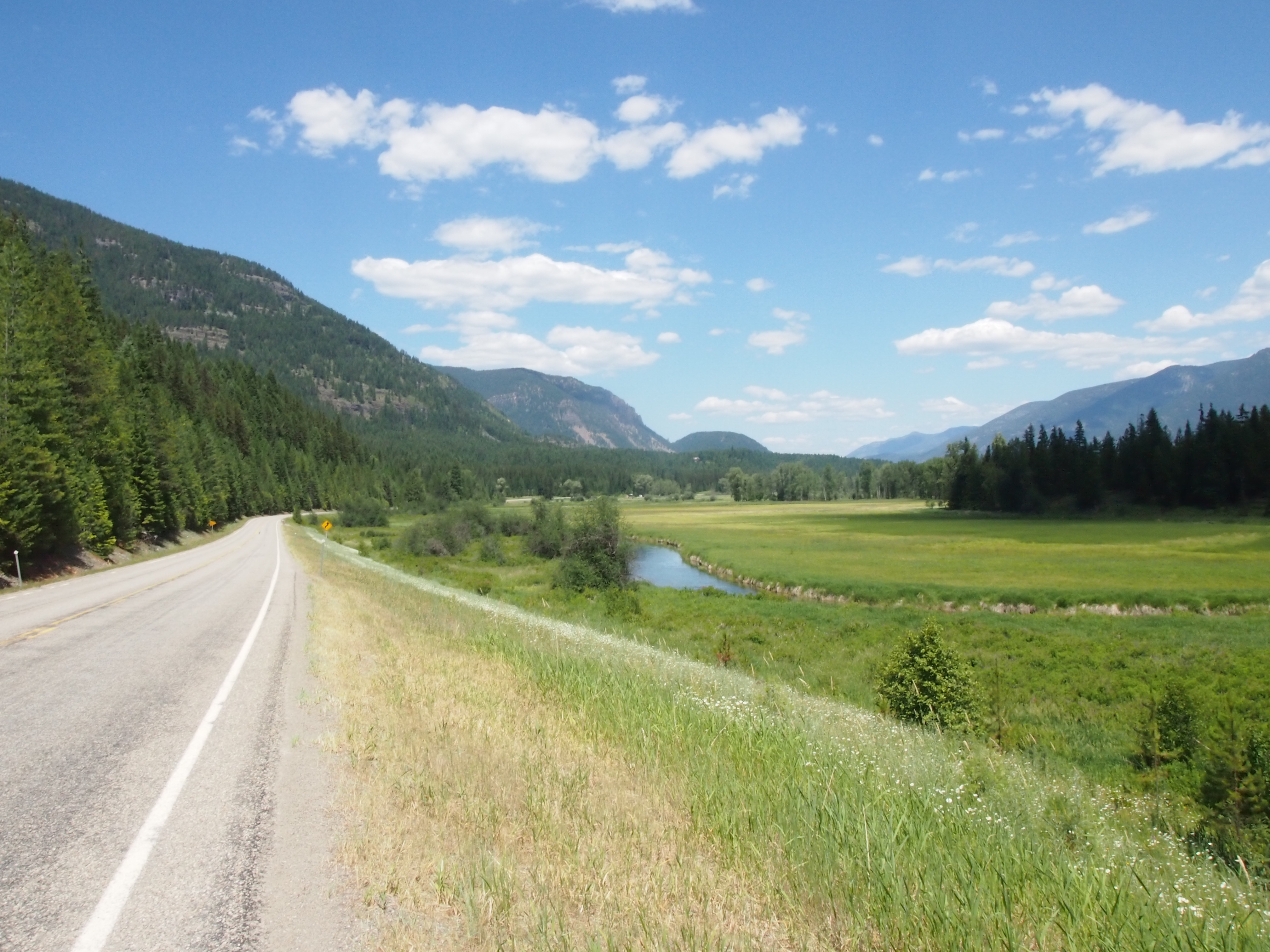
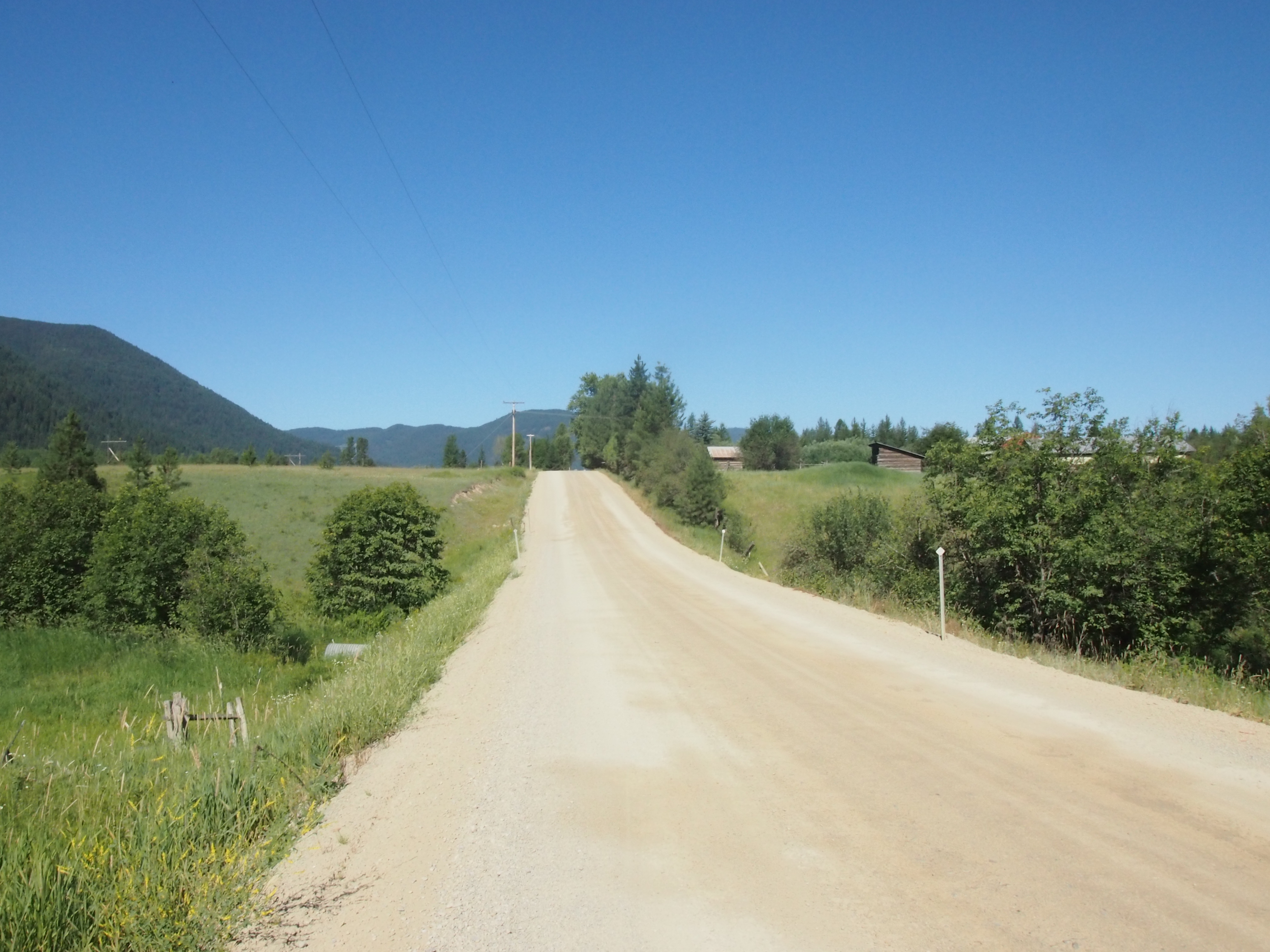
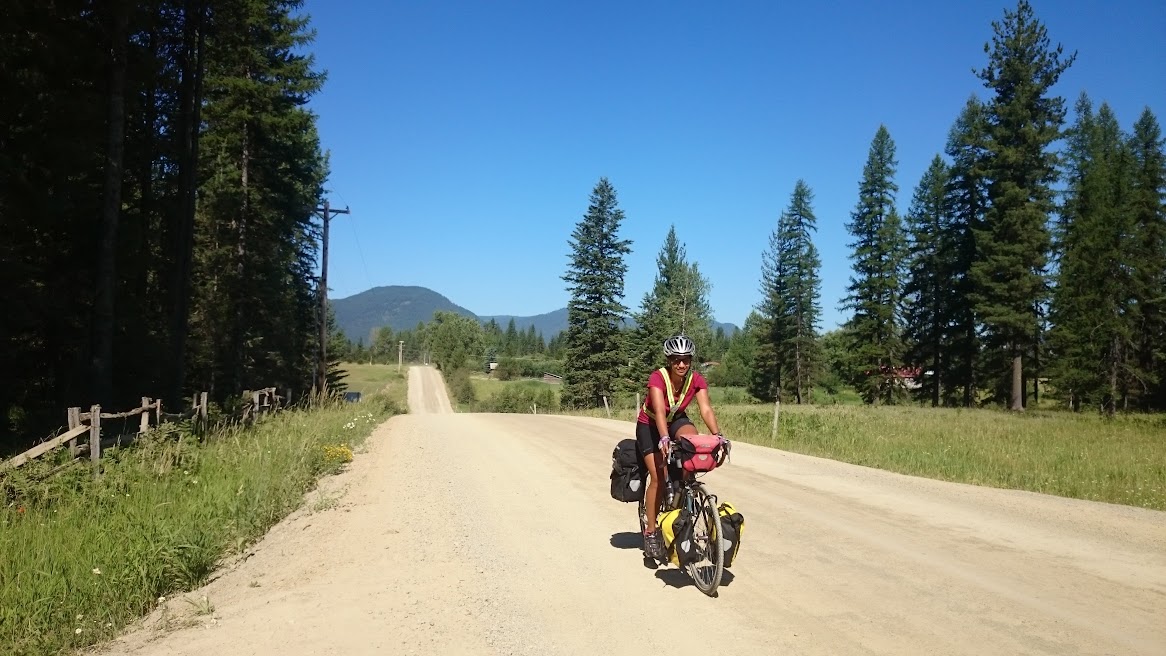
We started out of Libby a bit earlier than usual (7:35a), and it was actually quite cool in the morning. We had a lovely ride on a country road with rolling hills for 15 miles. Ted said he wanted to capture some of the chilliness he was feeling and put it in his pocket for later. I couldn’t agree more. We decided to enjoy the cool, calm road while we had it.

OLYMPUS DIGITAL CAMERA

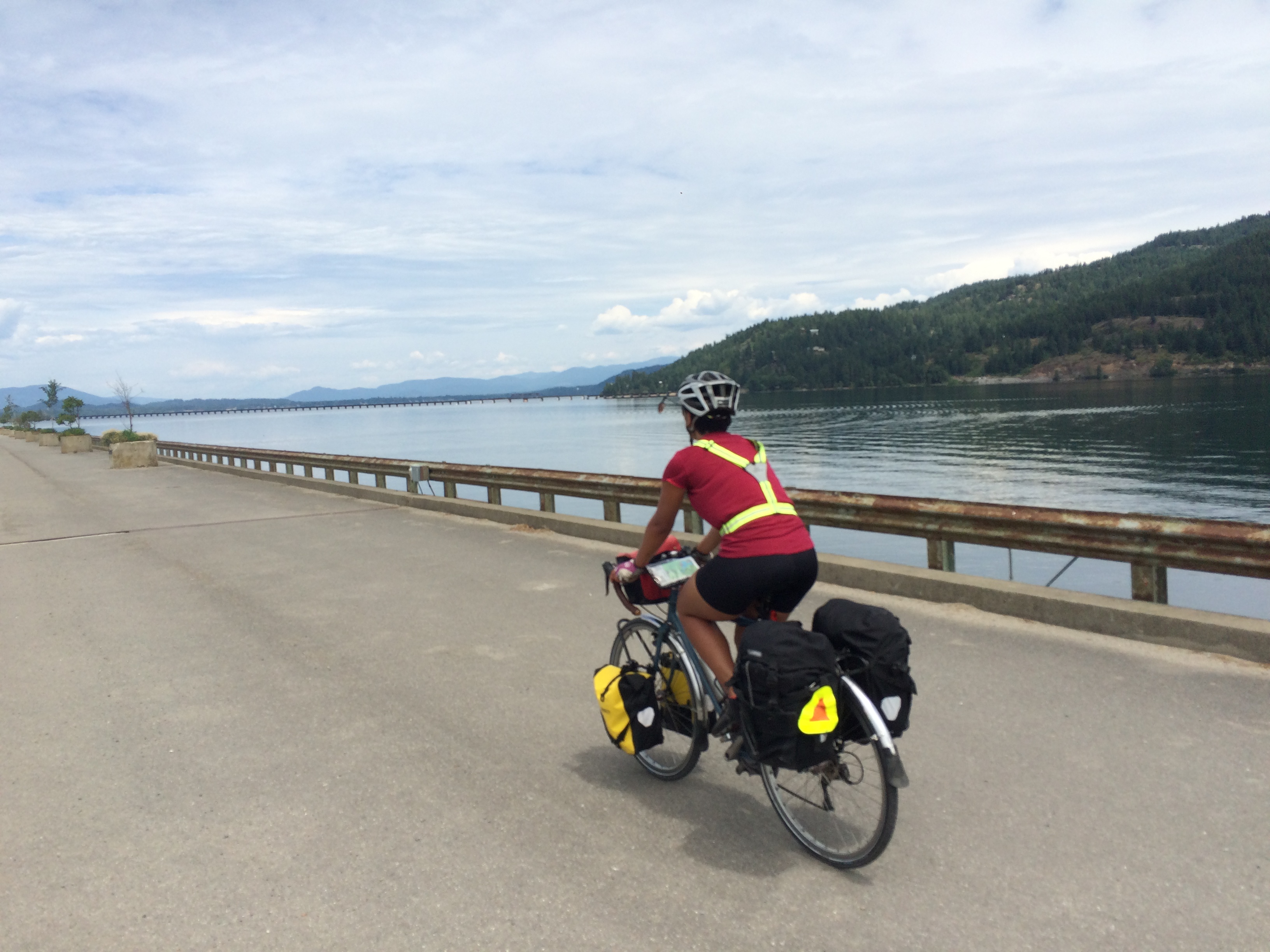
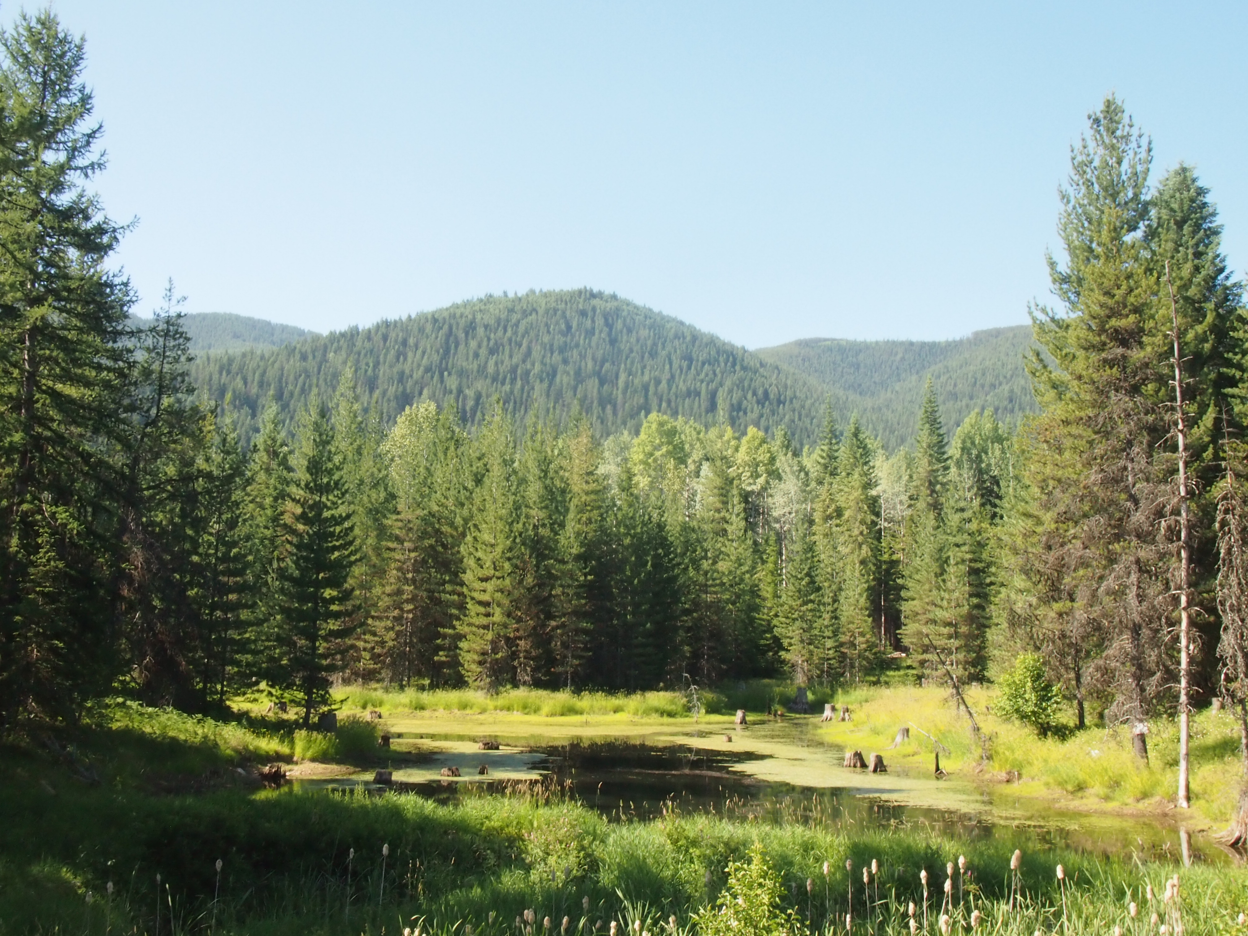
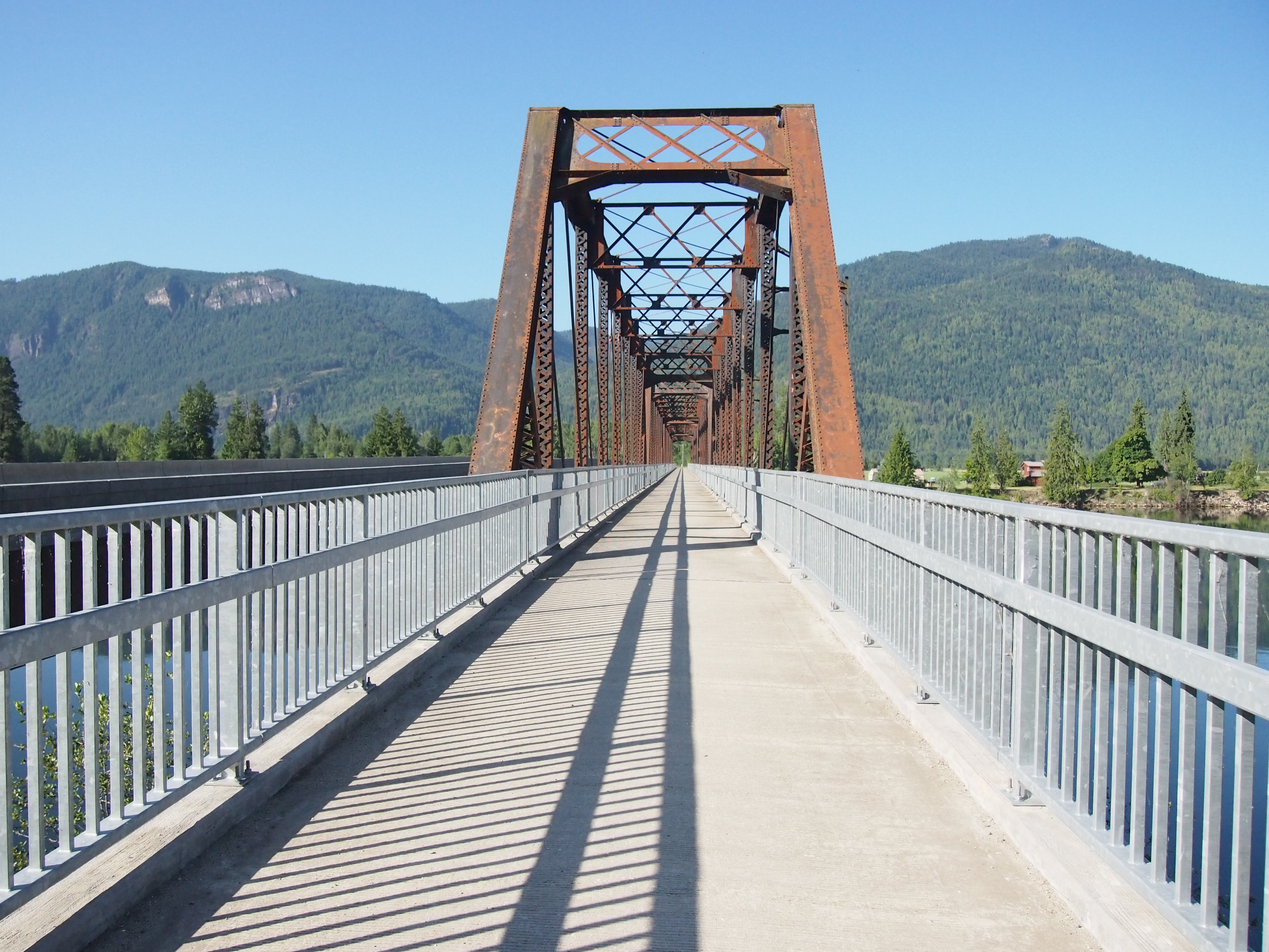
We turned onto the main route to Eureka and started climbing toward Libby Dam. We ran into our trail friends, Gina and Dan, who were exiting the dam. I don’t think we mentioned them before. We met them at the Bicycle Barn after climbing Washington Pass. Gina and Dan are moving from Sacramento to Minneapolis and decided to ride the Northern Tier during their transition. Fun fact: Gina is from Apple Valley, MN, where I lived from 1996-99, and was a year behind me at Falcon Ridge Middle School! This is the second random person I’ve met from middle school later in life (Katie, our friend from Peace Corps, also grew up in Apple Valley and went to Falcon Ridge). Anyway, we ran into them at the entrance of Libby Dam and they warned us that the climb up from the dam was steep, so we stashed our bags behind a road barrier and rode down–free!–on unloaded bikes. What a feeling! After the steep descent, we saw seven bald eagles perched on the dam and two ospreys flying from tree to tree. Ted’s family would have been in heaven!

OLYMPUS DIGITAL CAMERA

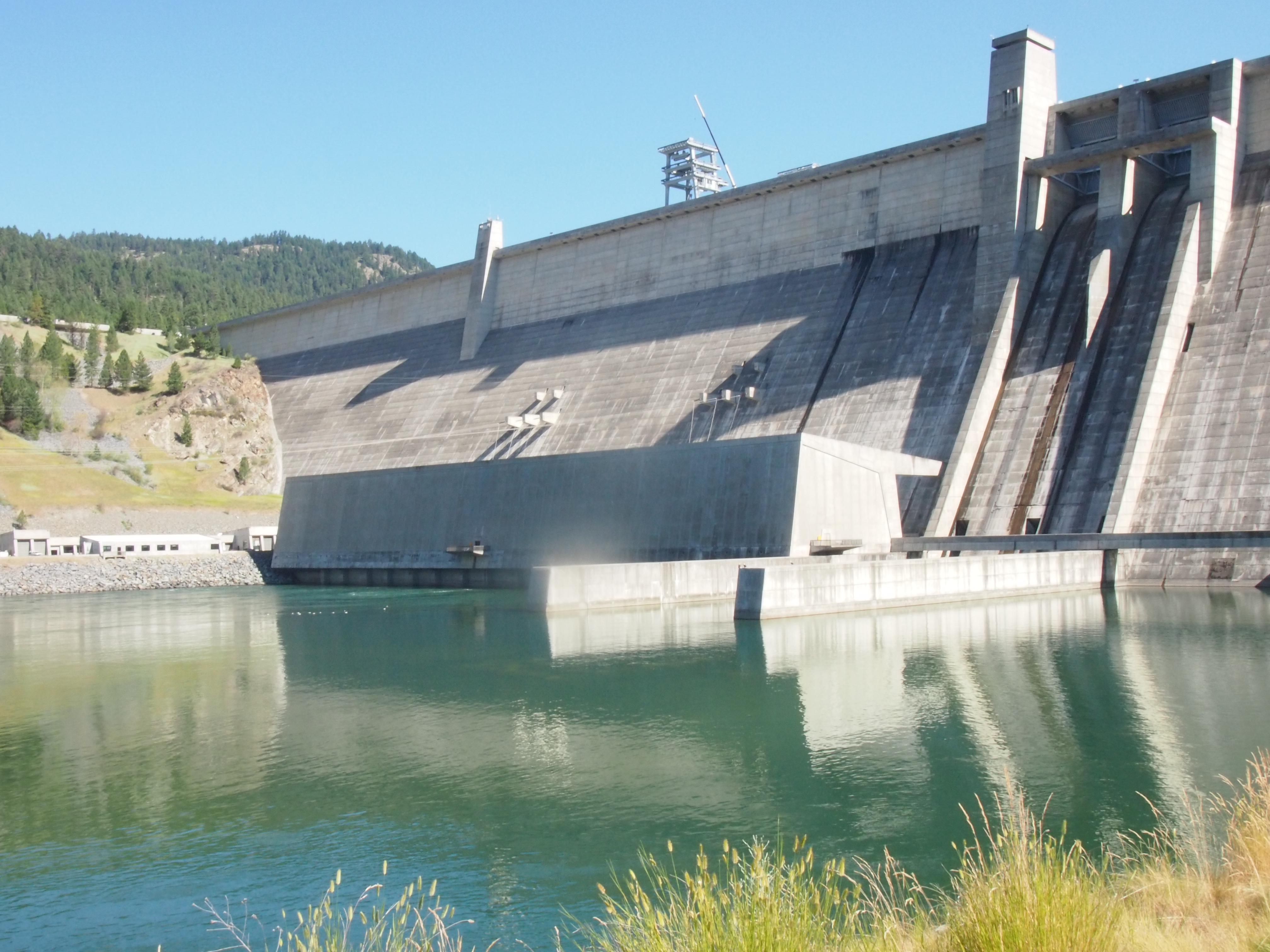
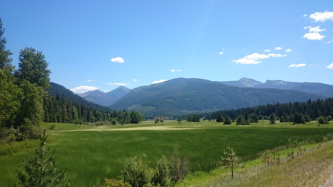
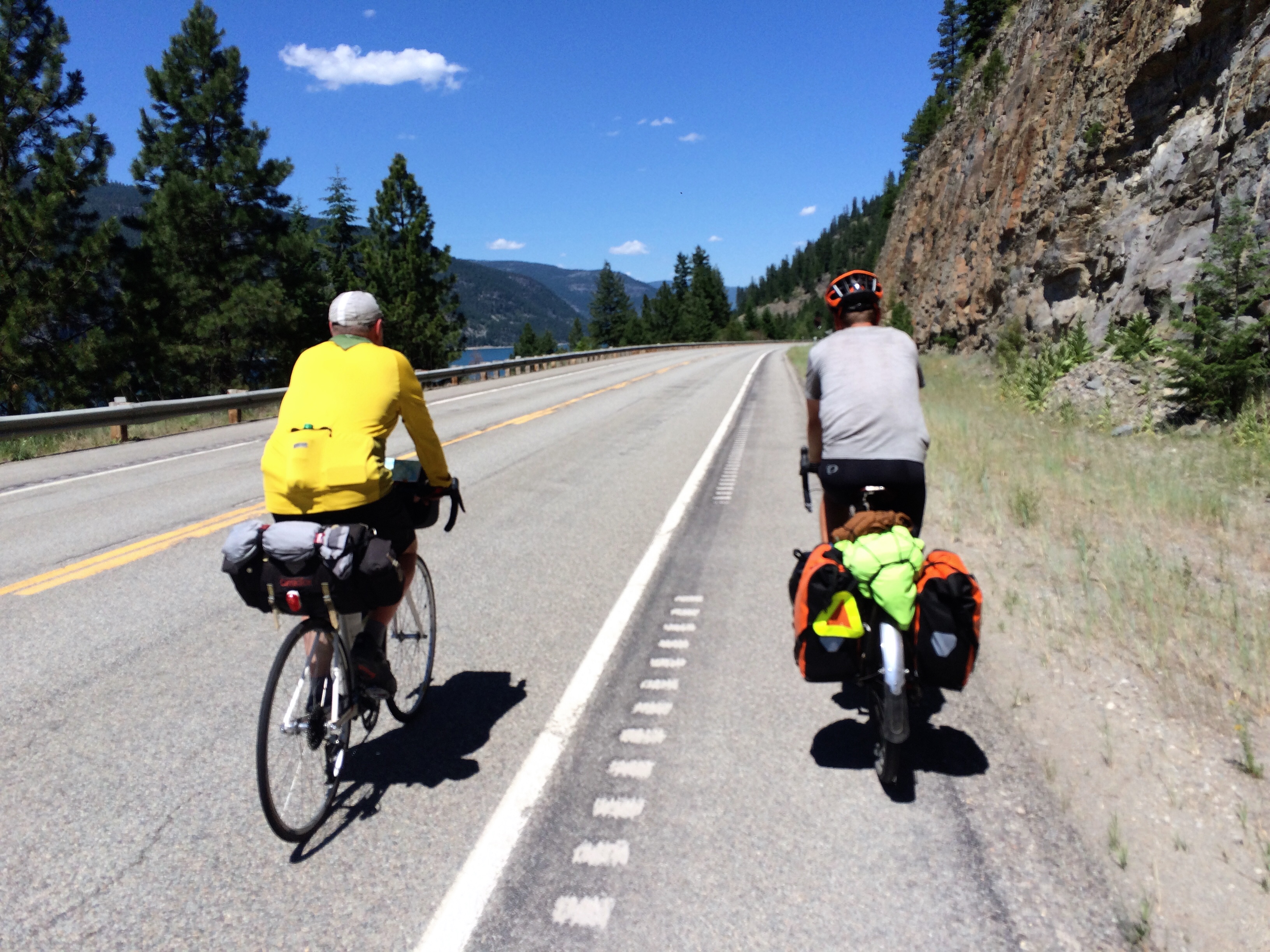
We climbed the steep mile-long hill back to the road, sat down to eat a snack, and up rolled another trail friend, Clive (the one who is carrying very little luggage on a road bike). Clive decided to slow his pace for the day and ride along with us. We stopped at the upper dam lookout about a mile further up the road (and sort of wished we hadn’t added a couple miles onto our ride to look at the dam from the lower perspective), then proceeded on our ride. The ride was extremely hilly and we actually exceeded our largest total elevation gain of the trip, but never exceeded 2900 feet of elevation. It was just up and down all day and so incredibly hot.

IMG_4445

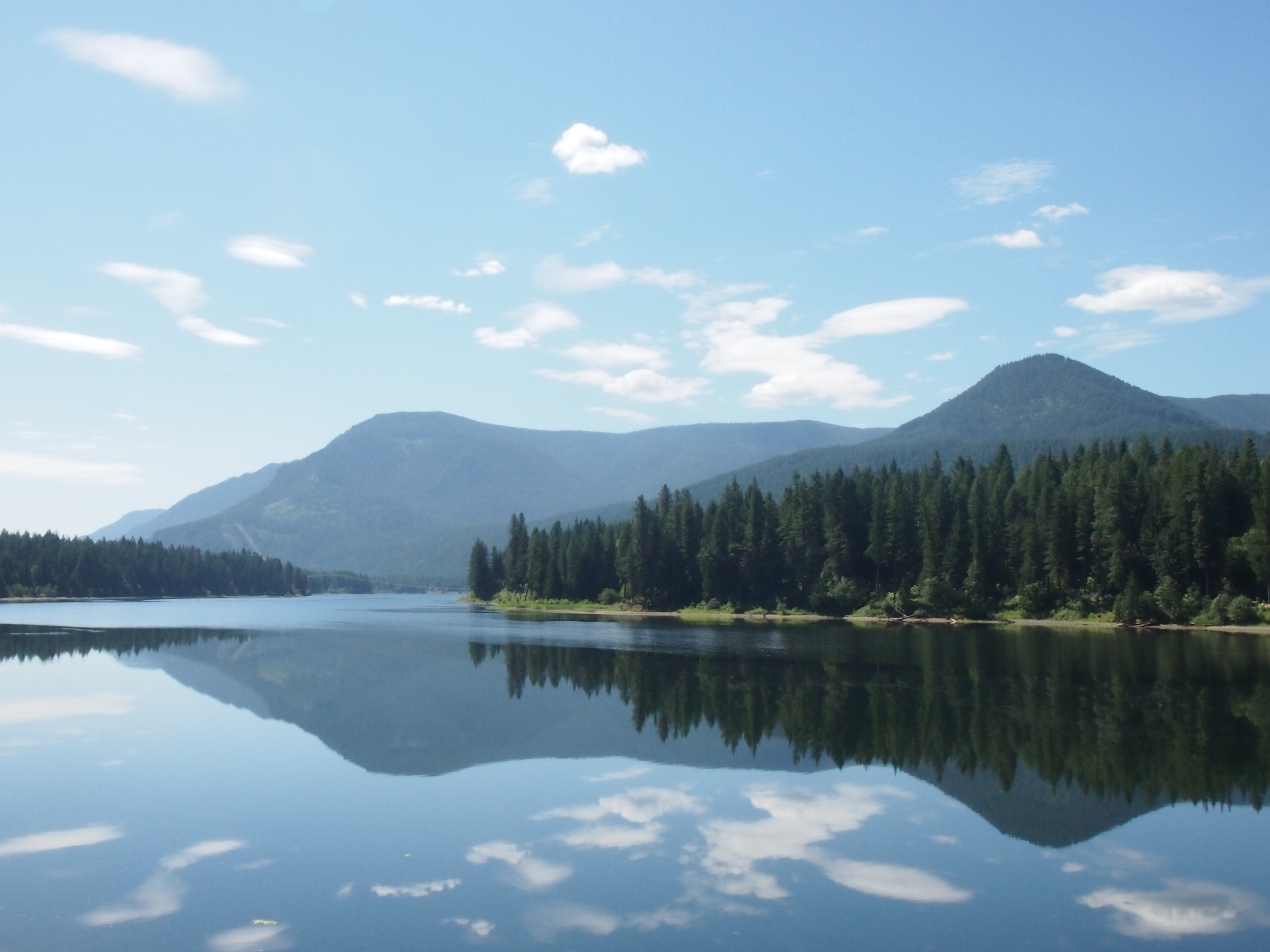
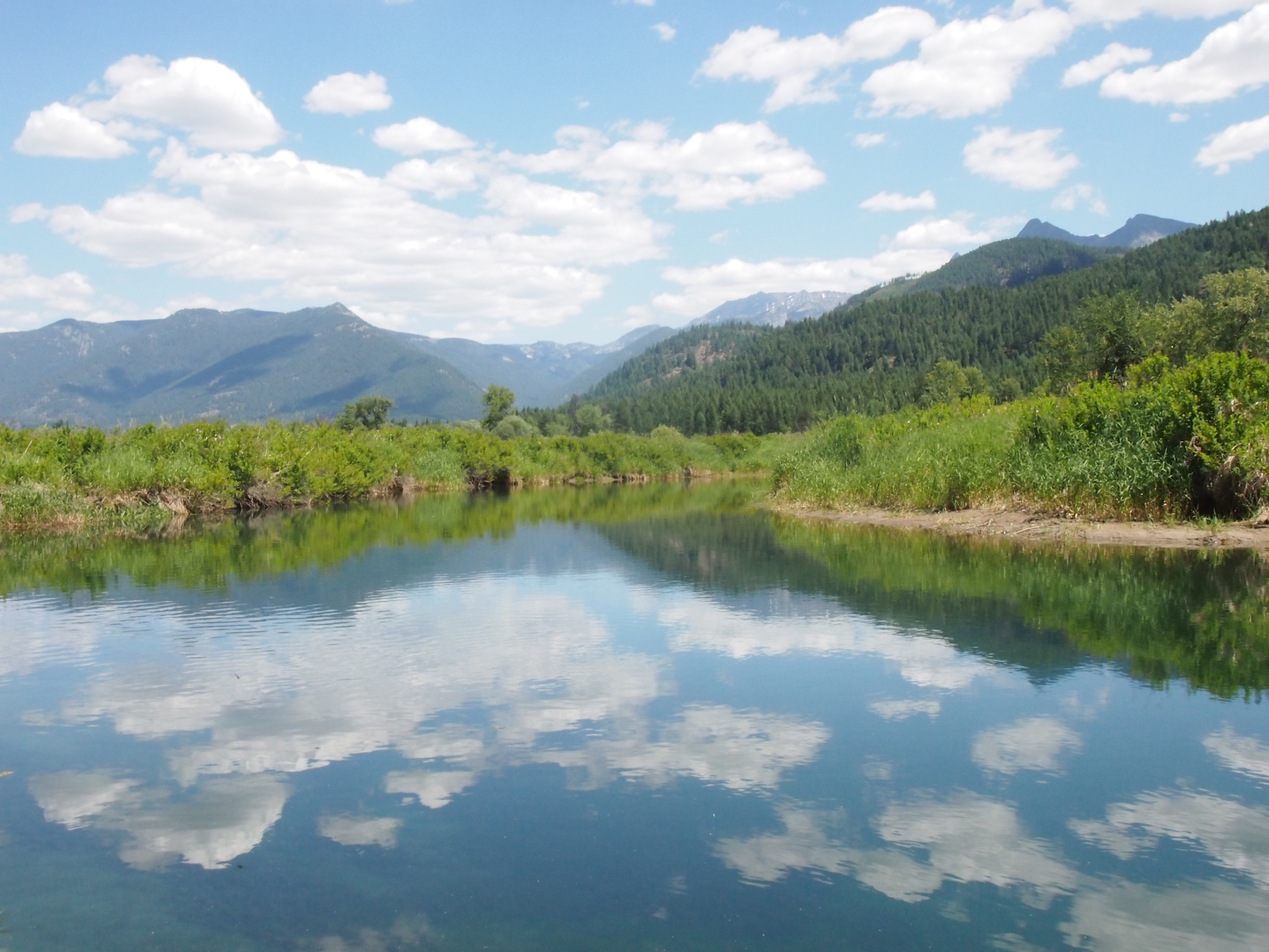
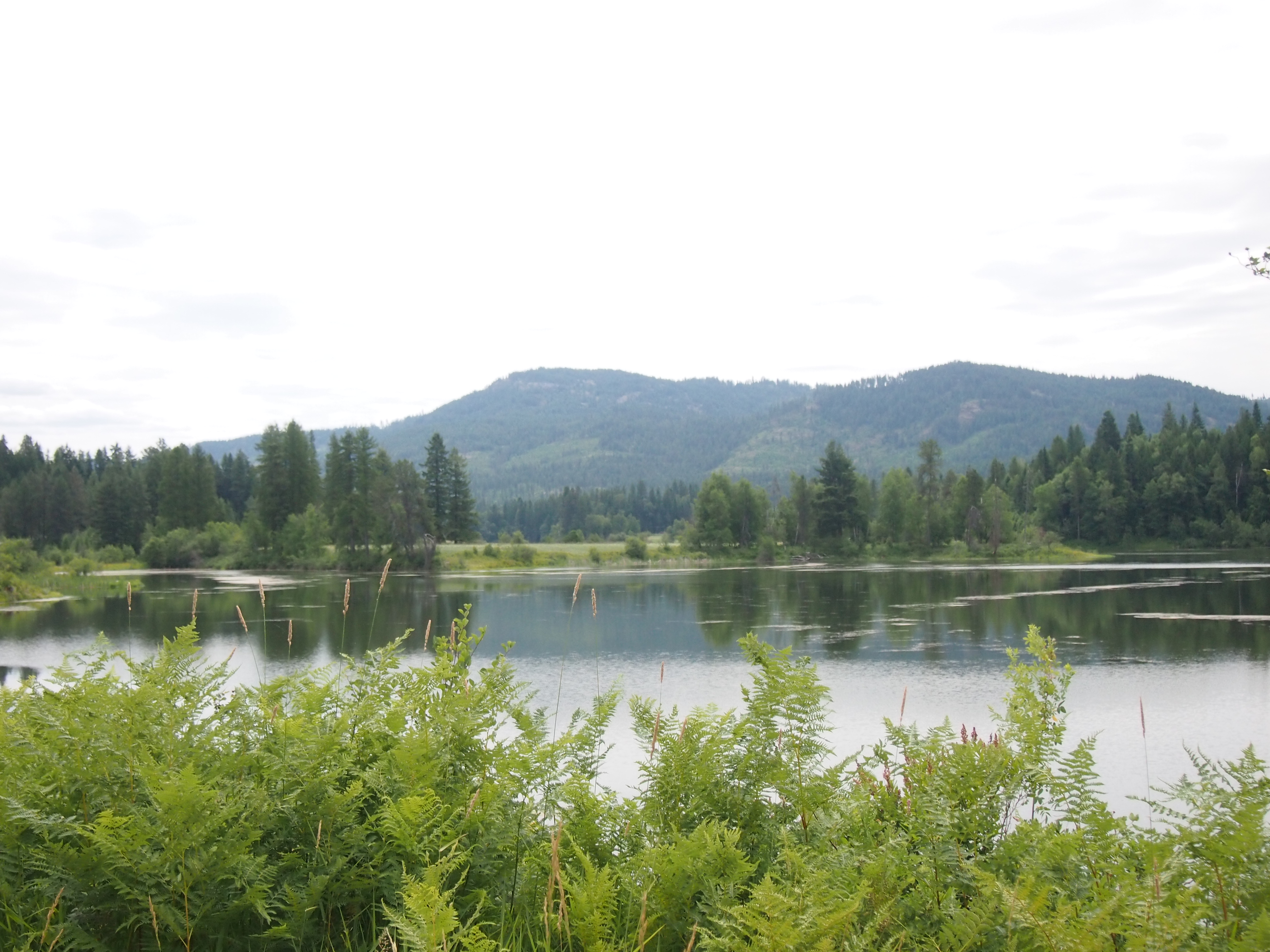
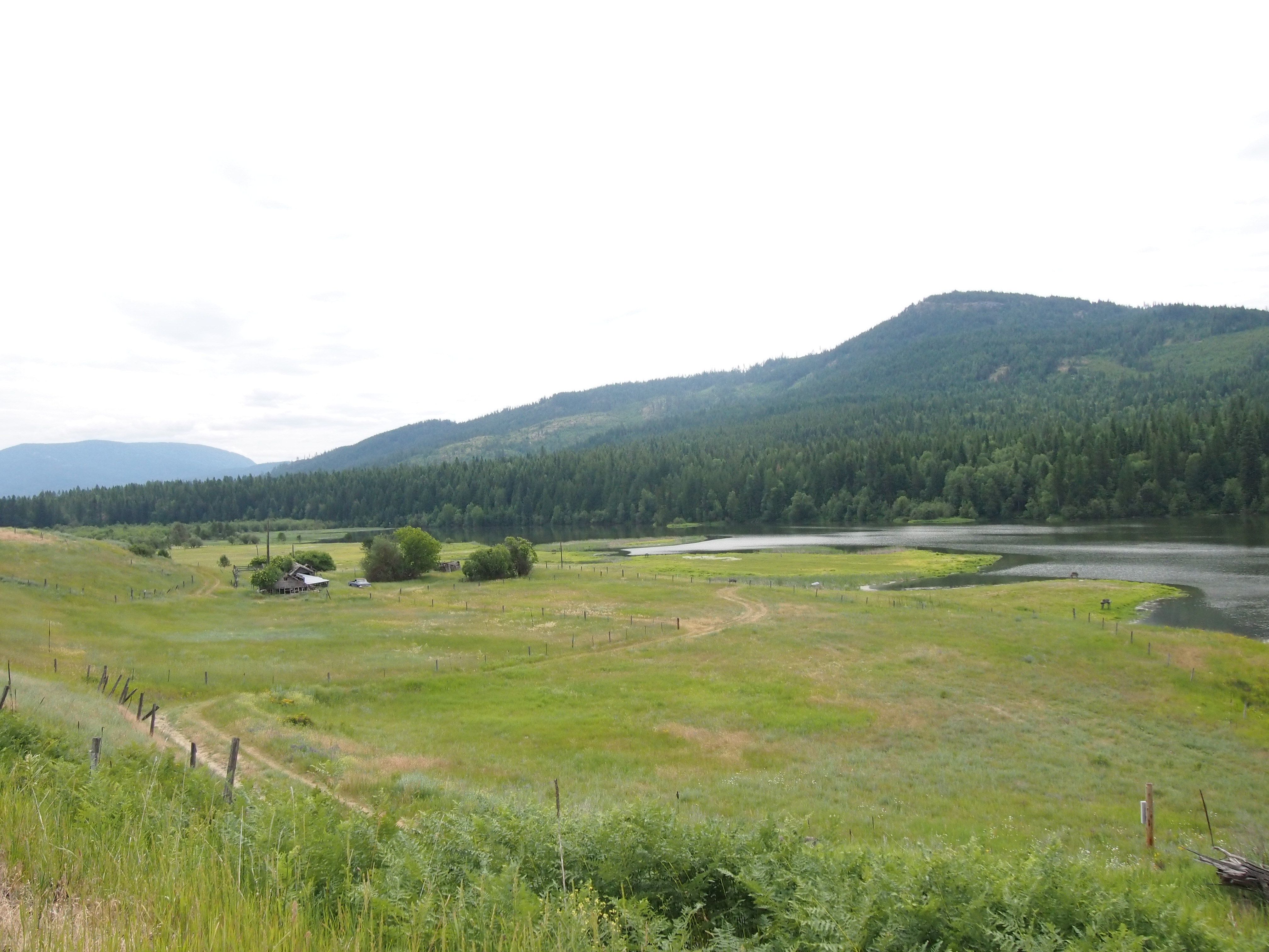
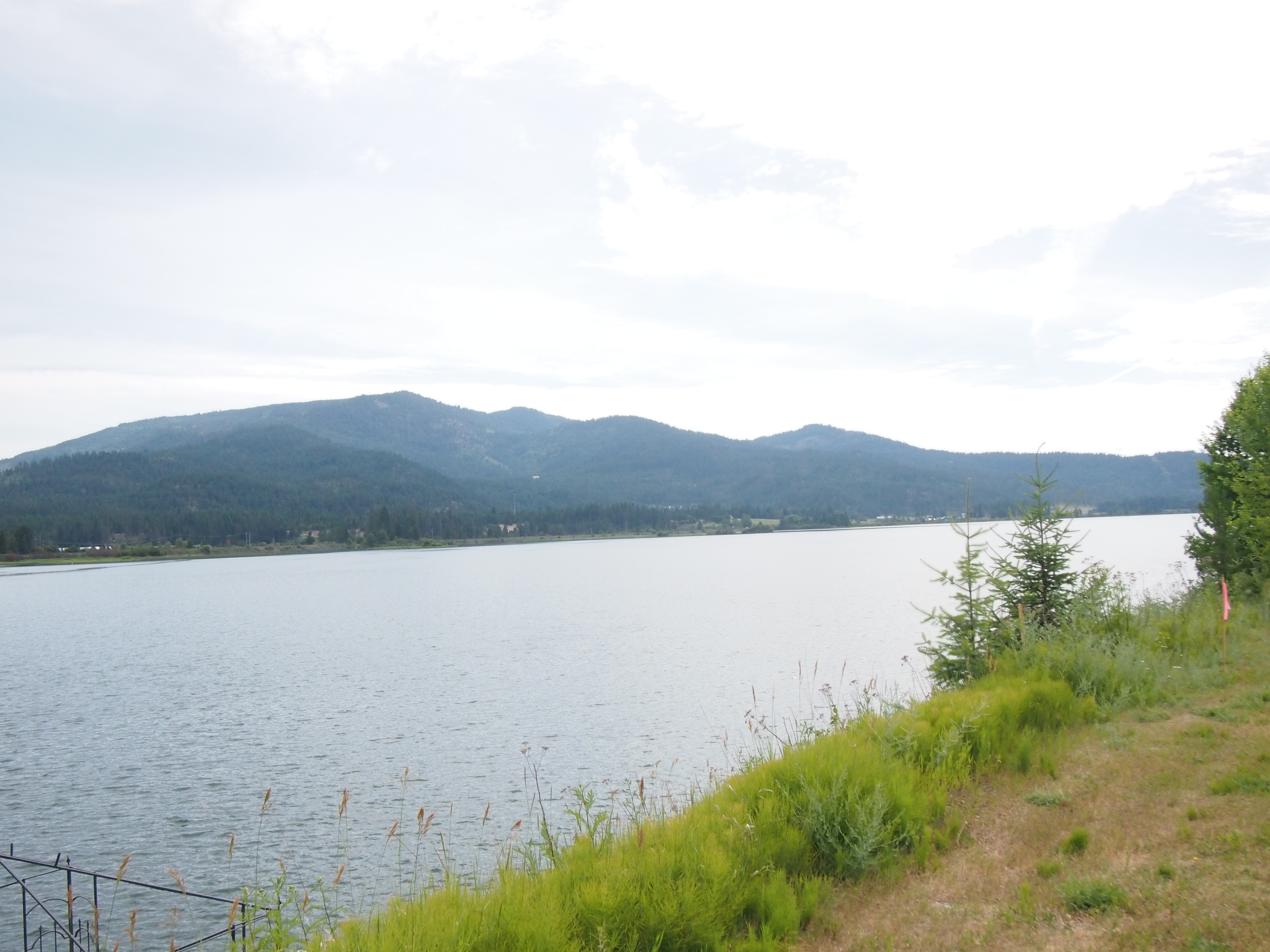
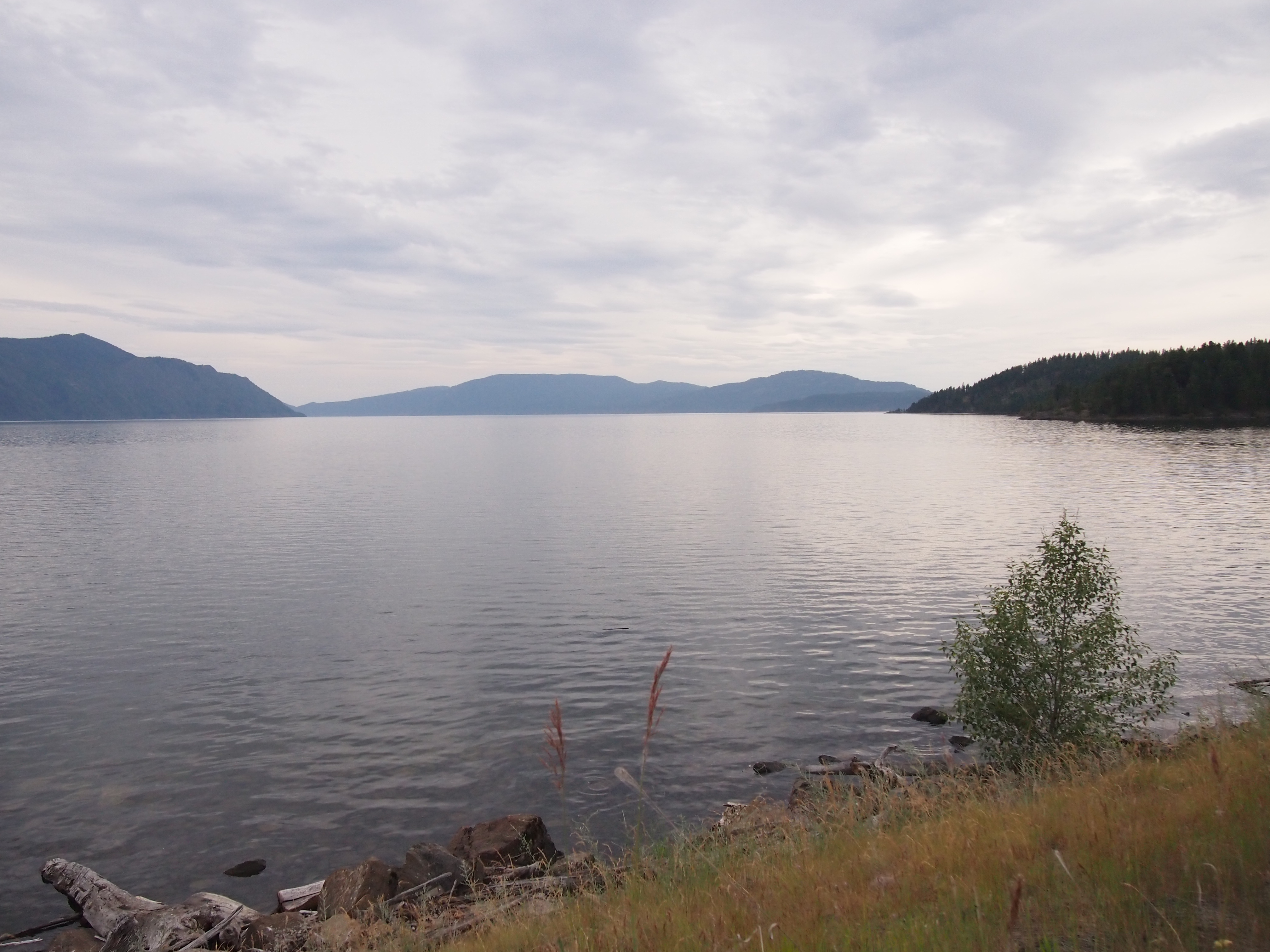
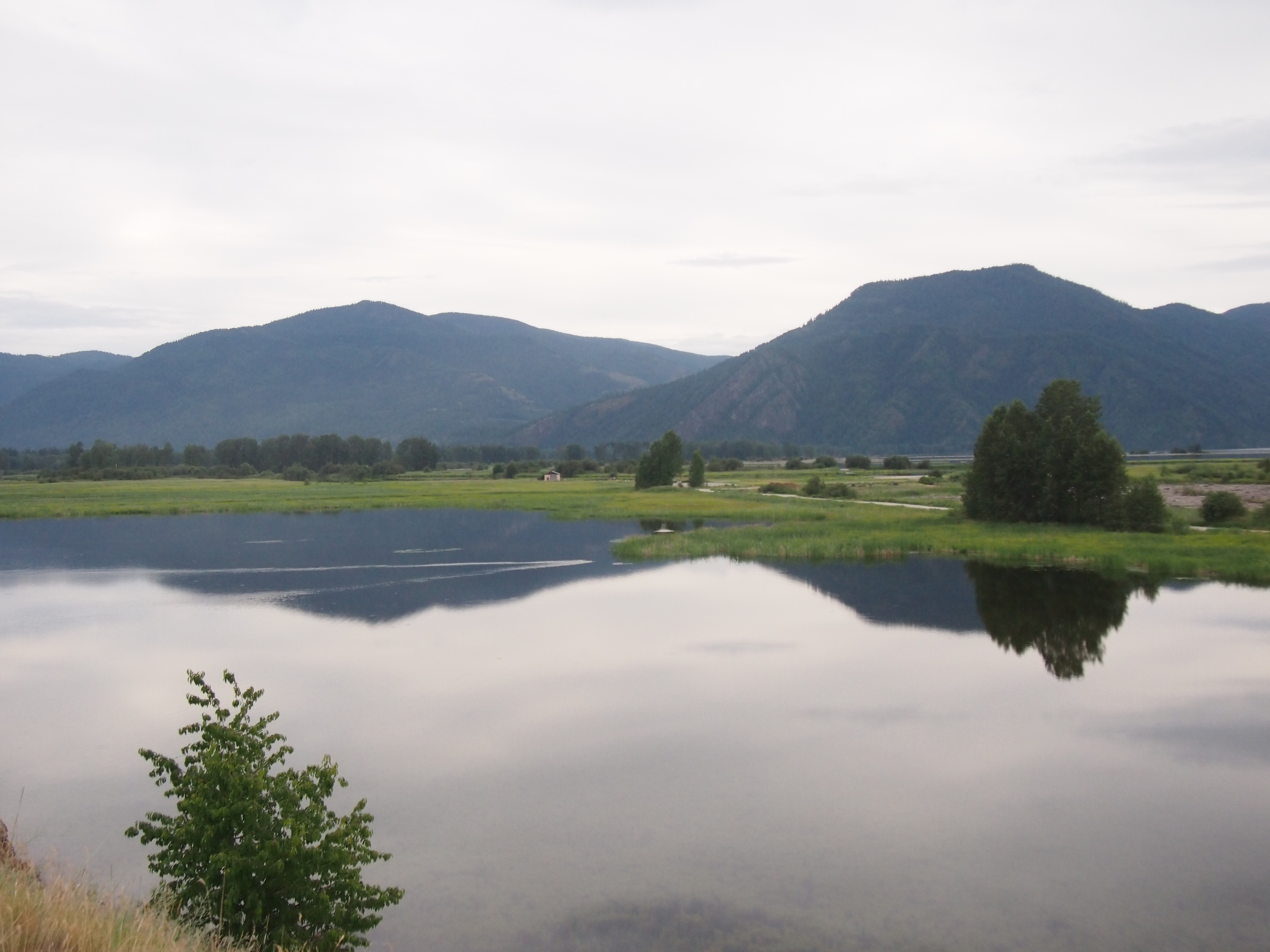
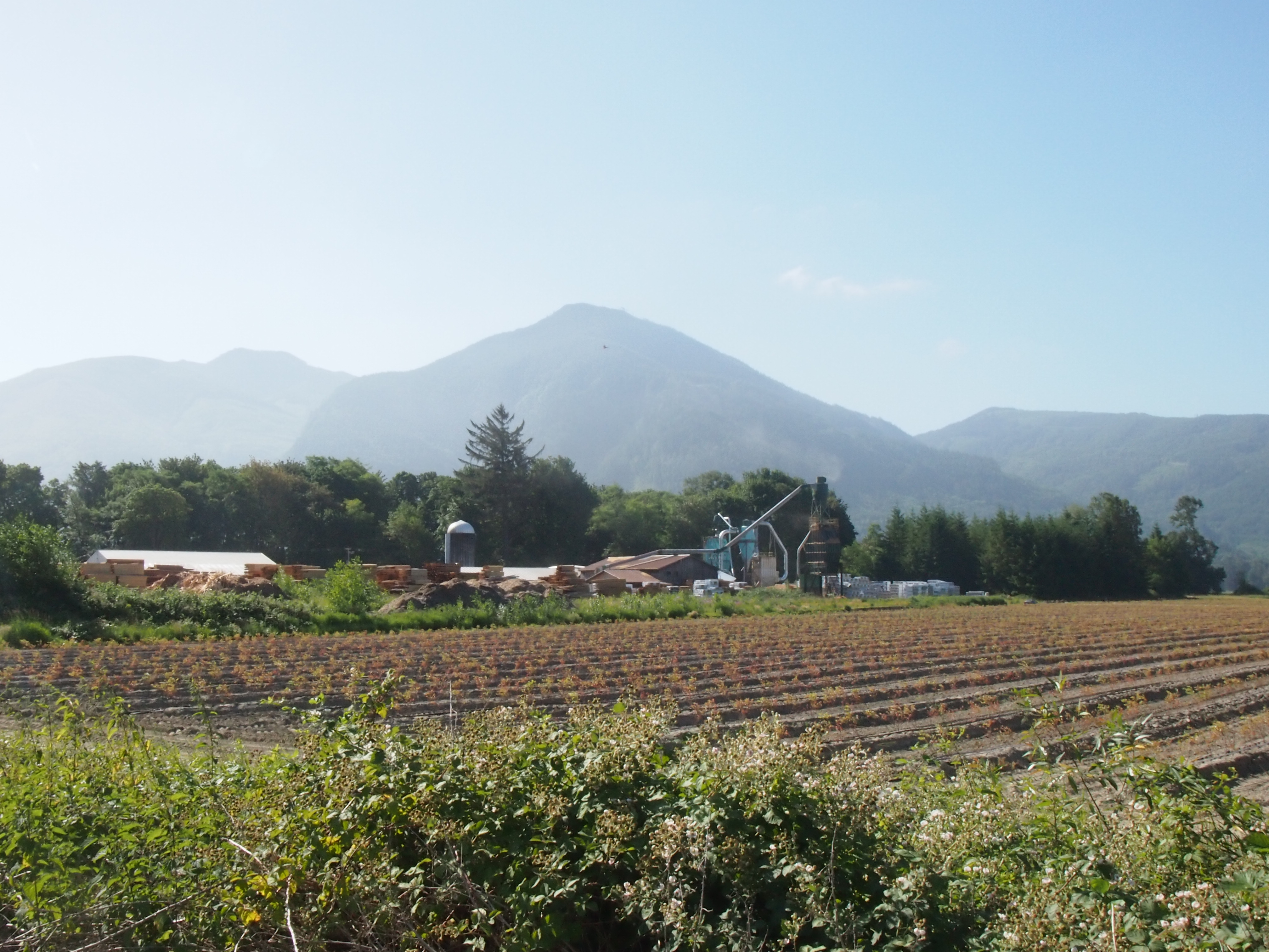
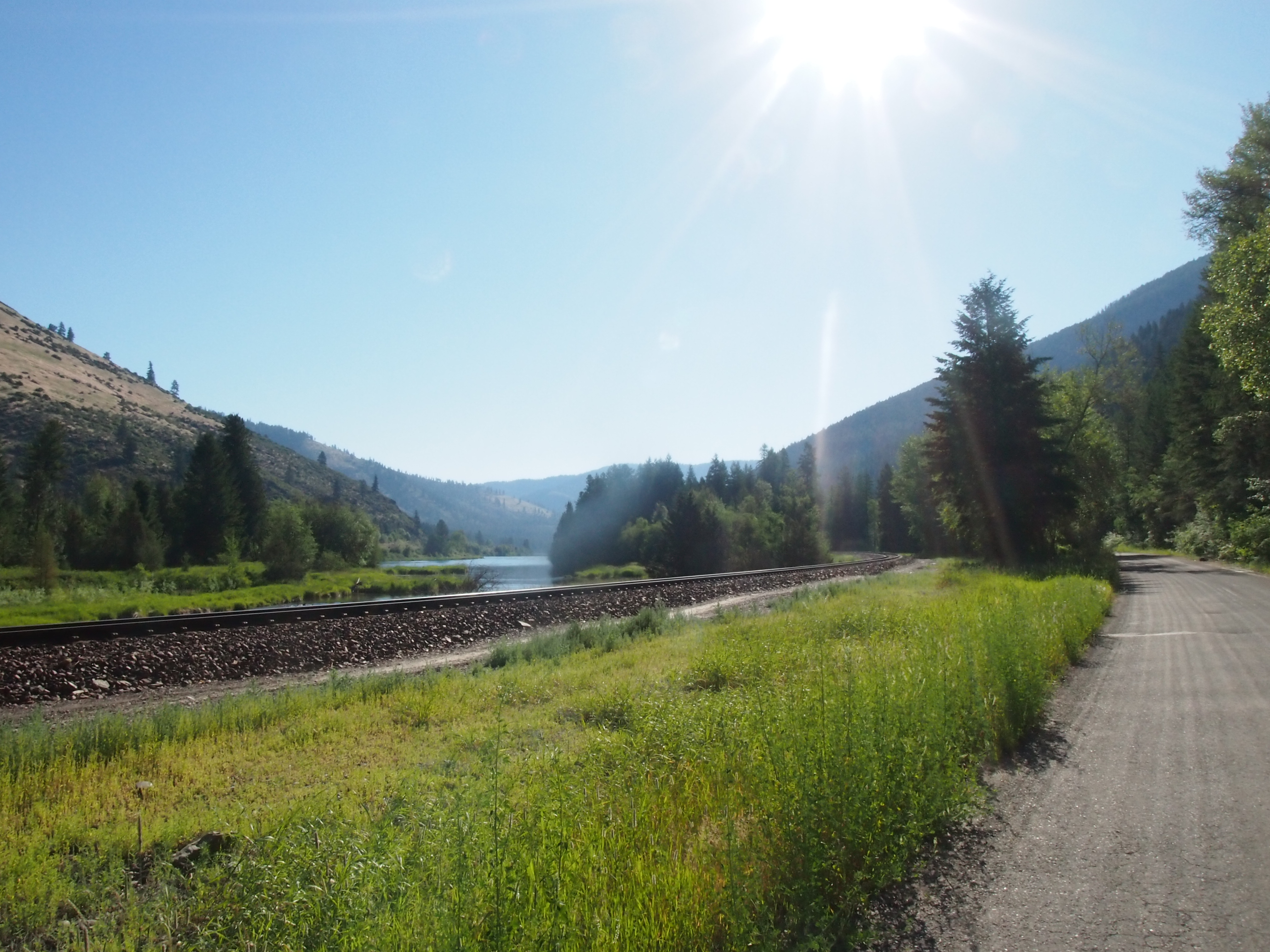
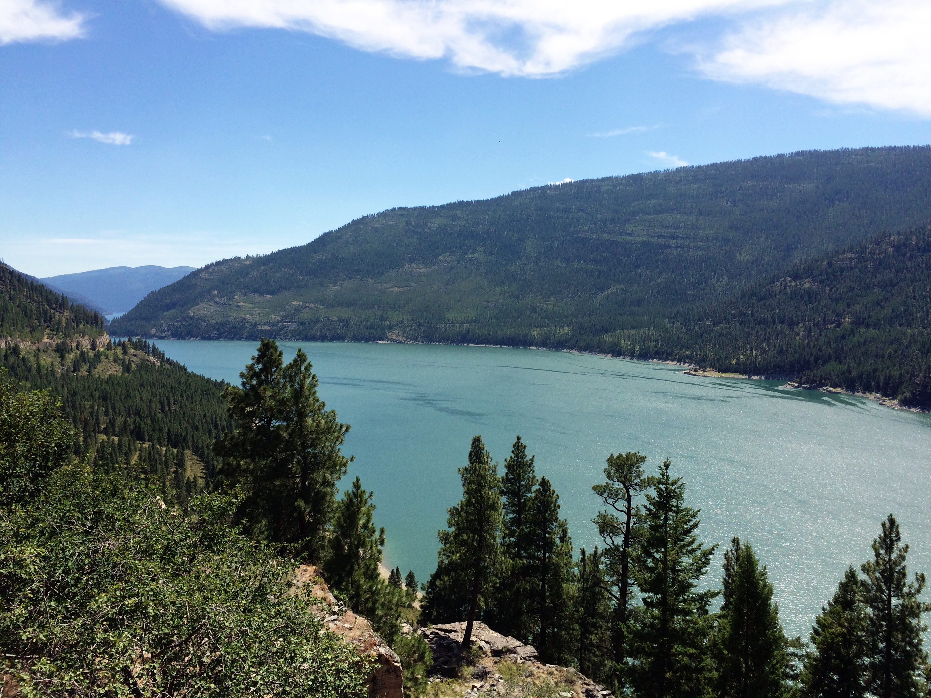
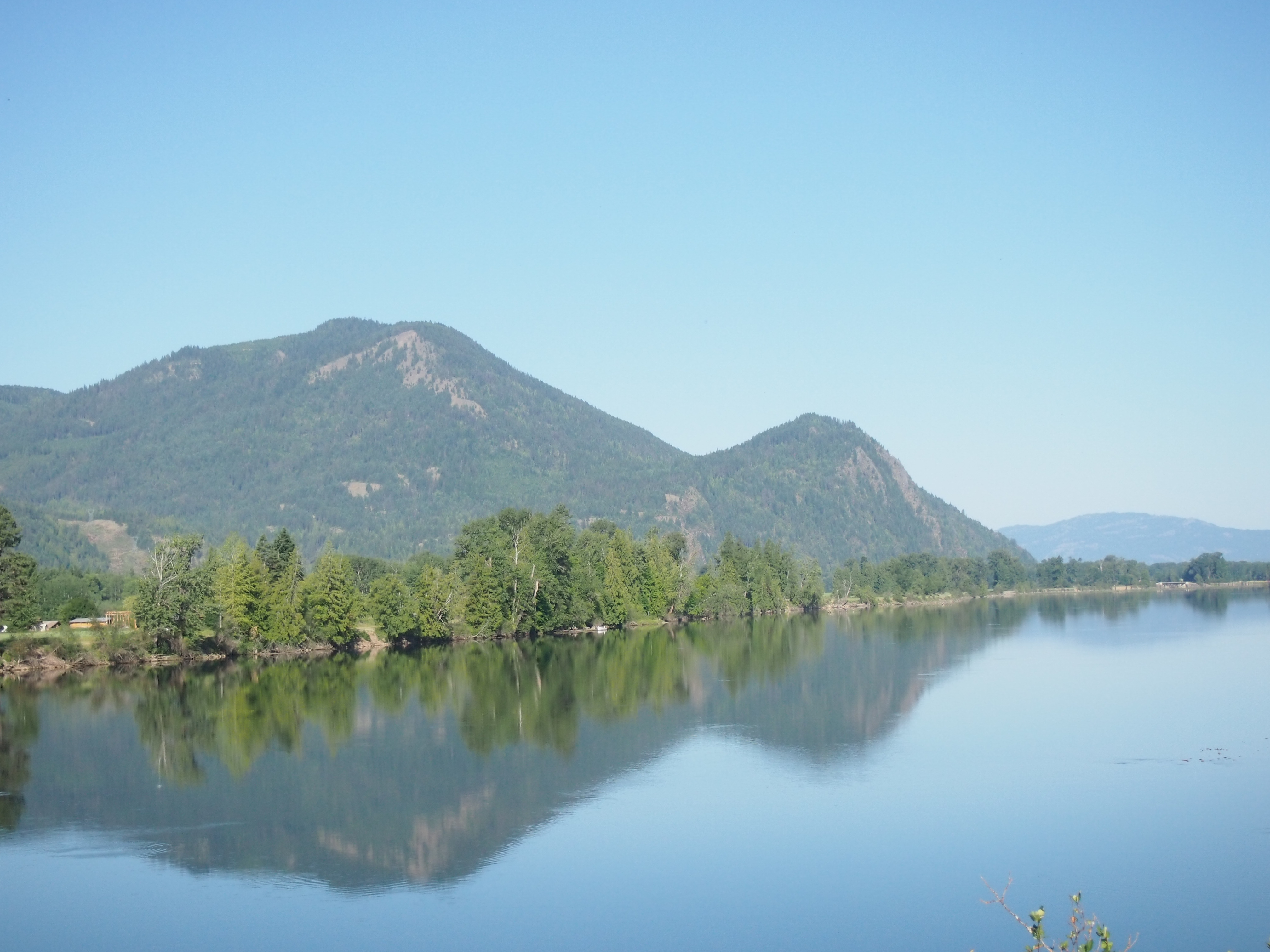
We rode along Lake Koocanusa for around 50 miles. The lake is 90 miles long, is beautiful, and was formed by Libby Dam. A professional cyclist later told us that professional cyclists ride along Lake Koocanusa early in the cycling season because it’s a banana belt and good for hill training. So add five to ten degrees onto the 100 degree high for the day and that’s what we were riding in. On hills that were good for training.

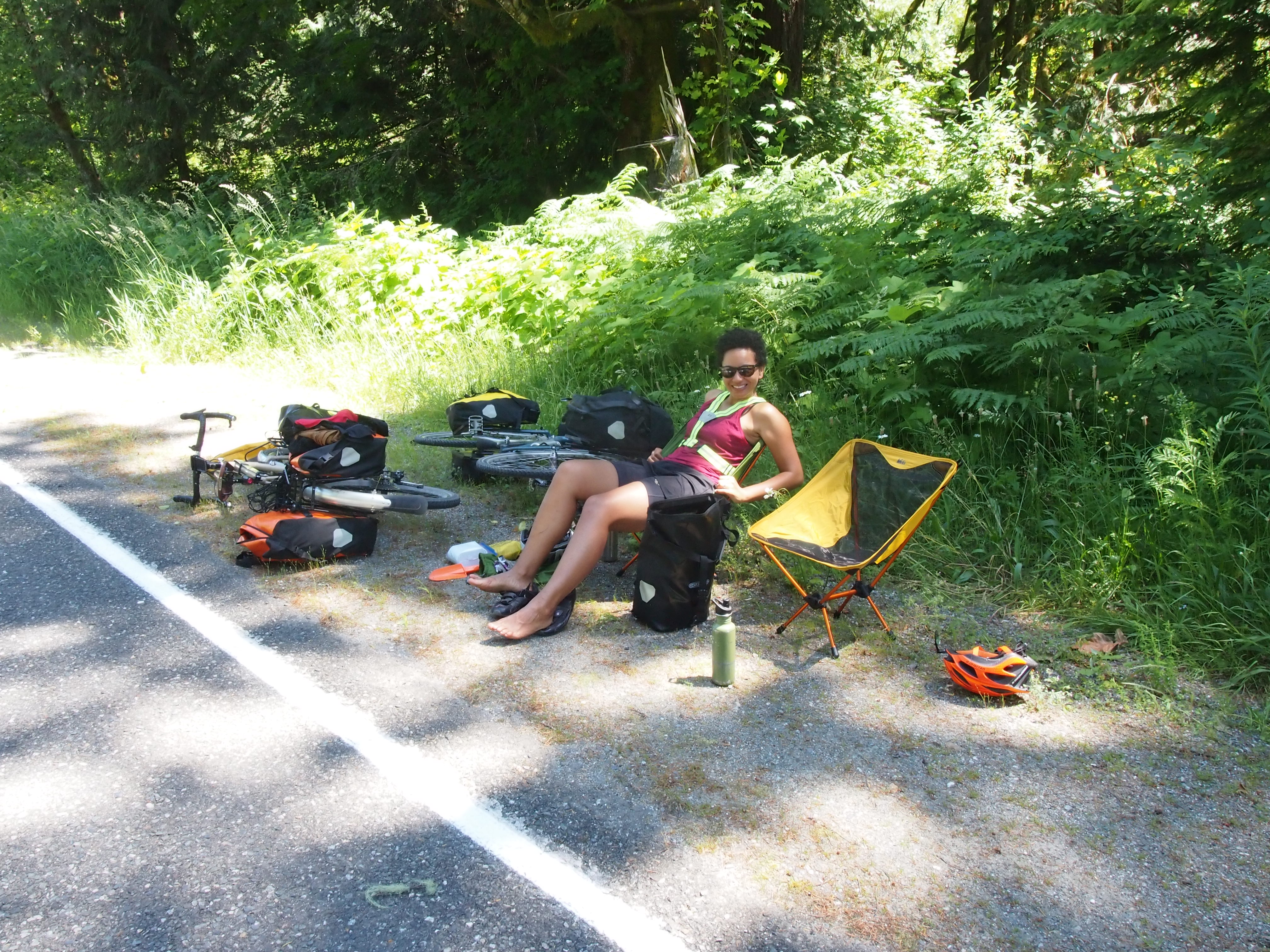
There’s very little real estate along the lake, so it was pristine and very few boats were out. Clive kept our breaks infrequent and short, so we made better time than usual. I tried to tone down my complaining since we had company, but it was hard to cut it out completely. Can we talk about saddle sores here? I won’t go into detail, but let’s just say I have them and they are painful.

IMG_4446

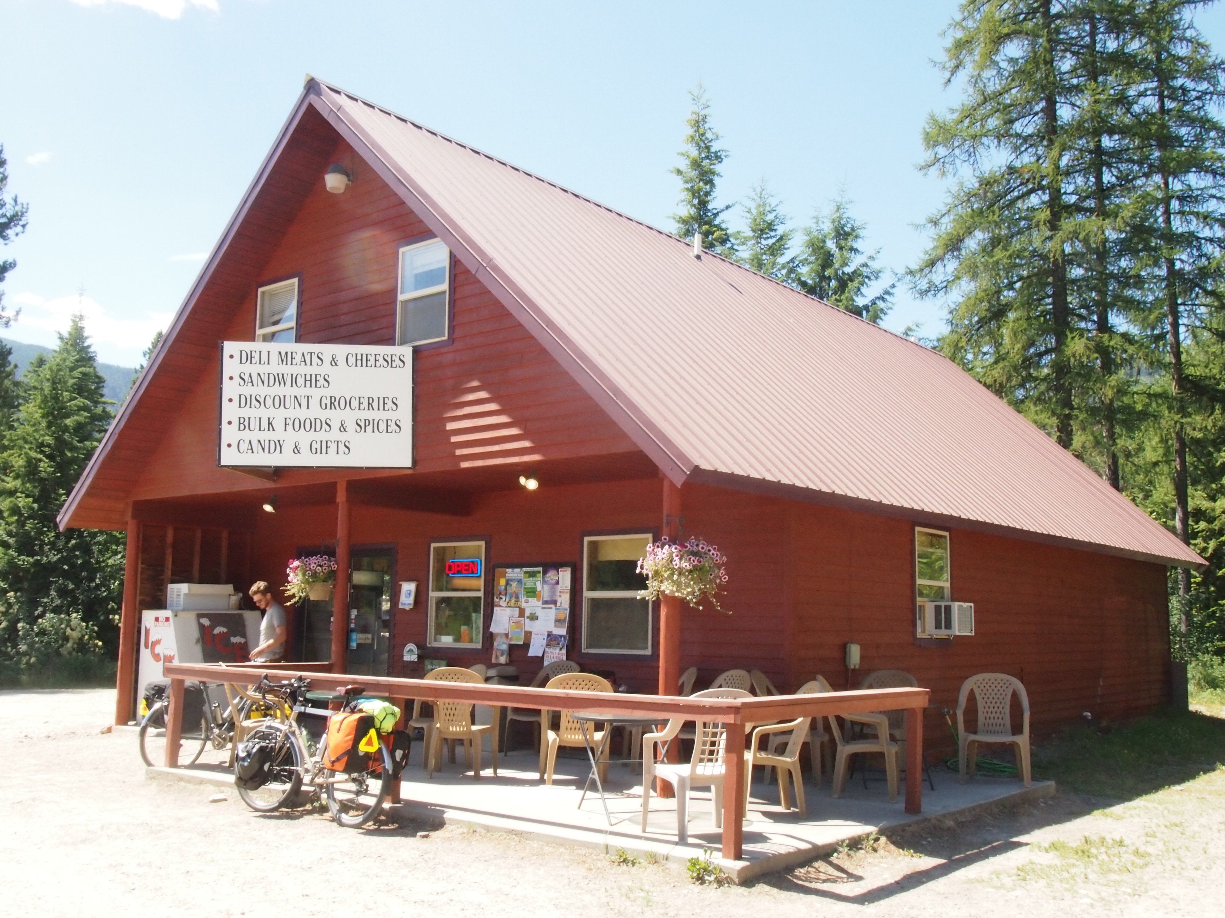
Just when we thought we were in the day’s downhill/flat approach to Eureka, we climbed three unexpectedly steep hills around mile 72 and ended up at a gas station at the edge of town (which, in my opinion, came straight from heaven). Upon arrival, I haphazardly threw my bike against the wall, ran inside, and bought a liter of seltzer water and a liter of chocolate whole milk. I then went to the attached Subway to chug seltzer water while Ted moved my bike to a more reasonable position, and when he returned, we quickly downed both liters of liquid. Turns out when it’s 100 degrees outside and you have stainless steel water bottles, you will be drinking 100-degree water all day. Dreaming of seltzer is what got me through the day.

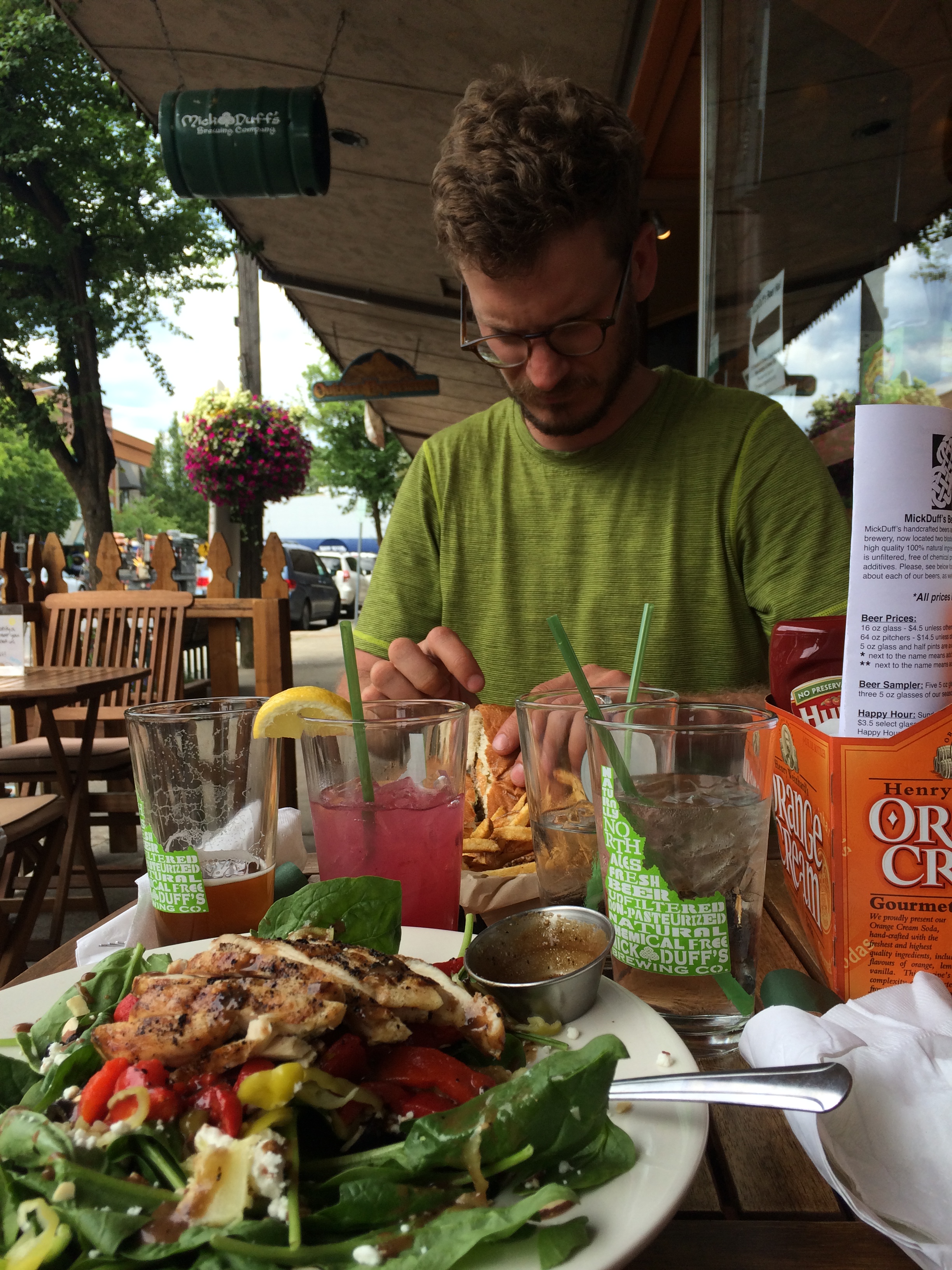
After I regained a bit of composure (emphasis on a bit), we pedaled the remaining 1.7 miles into town and arrived at our warm showers host’s house, where we found Lou, the guy on the recumbent bike, and met Steph and Tom, a retired couple from the bay area riding from Oregon to Maine on a recumbent bike. They retired in their 50s and are living it up! I’ve got to start maxing out my 401k!

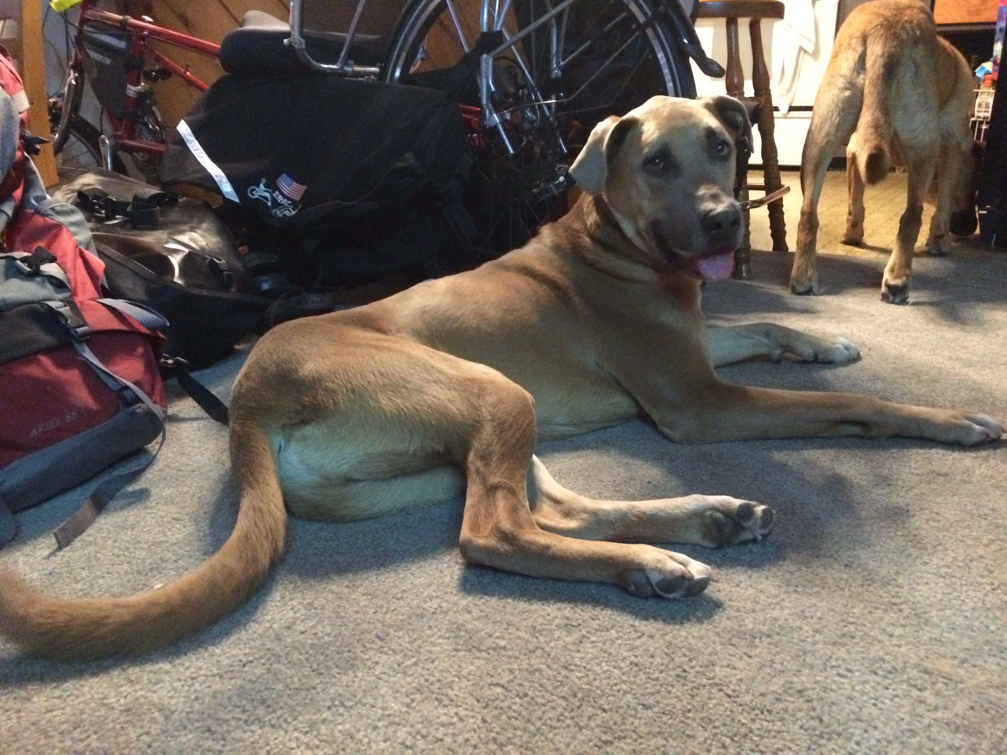
Our host, Nikki, was fabulous and incredibly generous. We’re having the best luck with warm showers so far and are so grateful to all of the kind souls who are so hospitable to total strangers. It really helps restore my faith in humanity. Nikki has two dogs, one of which has a happier and more proportional version of Ellie’s face, so Ted and I gushed over him all night and morning and got very homesick for Ellie.

IMG_4449

Getting up early tomorrow to beat the heat (learned our lesson today!).

Day 12: The day of daydreams

Day 12, Clark Fork, ID to Libby, MT: 74.7 miles, 3,350 ft. elevation gain, 11.5 mph average speed
Trip totals: 654.3 miles (58 mile daily average), 38,878 ft. elevation gain, 11 mph overall average speed

Map and stats here.

Dani and I first started seriously considering the prospect of a long-distance bike tour in the middle of January. So that means that I’ve had a little over 5 months to daydream about what bike touring would be like. Although each daydream had its own variations, they all generally involved us riding along a nice paved road along the bottom of a beautiful valley, alongside a creek, and with mountains in the background.

Or to put it more succinctly, I was daydreaming of today.

We started out from Annie’s Orchard at what we assumed was 7:45a, but we forgot that the time zone changed at the Idaho/Montana border, so we almost immediately lost an hour.  At the beginning of the day, we had to make a choice between taking the main Adventure Cycling route or talking a slightly different route, the “Heron Alternate.”  The Heron Alternate was three miles longer with considerably less traffic, but poorer road conditions.

OLYMPUS DIGITAL CAMERA

OLYMPUS DIGITAL CAMERA

After a little debate, we decided that we valued less traffic over better road conditions. However, if we knew that “poor road conditions” meant a washboarded dirt road with no smooth path, we might have made a different decision. That being said, the scenery was incredible. Farmland. Mountains. Trees. Beauty.

No official welcome from Montana, but at least the Inn was happy we arrived!

No official welcome from Montana, but at least the Inn was happy we arrived!

Montana's unofficial welcome: an end to the paved road.

Montana’s unofficial welcome: an end to the paved road.

OLYMPUS DIGITAL CAMERA

]

OLYMPUS DIGITAL CAMERA

After we rejoined the main route, we rode for about seven more miles before we stopped at a market near the junction of Rt. 200 and Rt. 56. This might be the best store ever. We bought banana nut bread, fudge, two types of cookie bars, chocolate milk, and a fresh-as-you-can-get-just-out-of-the-oven chocolate chip cookie. Everything was divine, and inexpensive, to boot! We met a friendly retired man who grew up in the area and had done a fair amount of biking on the roads we were taking today.

OLYMPUS DIGITAL CAMERA

After getting back on our bikes, we made the turn onto Rt. 56, where we spent the next 35 miles. At first we were a little nervous about spending so much time on a road with a variable shoulder width and a 70 mph speed limit, but traffic was light, most of the drivers were very polite, and those that weren’t didn’t end up hitting us, so all’s well that ends well.

But this road was the stuff of my daydreams. Exactly what I thought touring should be. Just wonderful vistas everywhere we looked.

OLYMPUS DIGITAL CAMERA

Halfway through our time on this road, a man in a camper who was going the opposite direction pulled over to chat with us and ended up leaving us with an ice-cold bottle of water and can of Dr. Pepper. We haven’t really mentioned how hot it has been. Record heat wave in Montana and all that. Suffice to say, the cold drinks were MUCH appreciated!

A little bit further down the road, we came upon Bull Lake.  It was clear and beautiful and we were hot and sweaty.  So we jumped in!! A midday swim is just what we needed! We also definitely needed the giant pile of cheese and bacon covered fries we ordered at a restaurant called the Halfway House a mile or so up the road. To be honest, we might have ordered food just to give us more time to enjoy our delicious huckleberry lemonade.

OLYMPUS DIGITAL CAMERA

OLYMPUS DIGITAL CAMERA

After we finished Rt. 56, we turned onto Rt. 2.  A few miles down the road, we stopped off to hike down to Kootenai Falls, which were lovely.  So much of the water around is a lovely blue-green, and we never get tired of looking at it.

OLYMPUS DIGITAL CAMERA

After visiting the falls, we pushed through the last 10 miles to Libby, MT. Libby is a much larger town than we expected and we got turned around a little bit, but we eventually we found our way to the campground, which was conveniently located right next to a grocery store, which conveniently had free seltzer water on tap and free wifi that reached to our campground, so it was all gravy.  The only downside is that there was no shower and it was still quite warm, so it was a hot and sticky night.


Day 11: The day we spent in Idaho

Day 11, Newport, WA to Clark Fork, ID: 61.8 miles, 1,708 ft. elevation gain, 11.9 mph average speed
Trip totals: 579.6 miles (58 mile daily average), 35,528 ft. elevation gain, 10.9 mph overall average speed

Map and stats here and here.

Is it possible that the country could keep getting more and more beautiful?

OLYMPUS DIGITAL CAMERA

As Ted mentioned, we stayed in a motel last night and I, always needing to get my money’s worth, required that we sleep in and take our time this morning. This meant we rolled out of the motel at 9:00a on the dot. That extra hour makes a difference, both in terms of how rested I feel and how hot it is. Win lose.

I did not expect Idaho to be such a spectacular place, but it was an impressive day. We pulled out of the cute town of Newport, WA and immediately entered Idaho. We started the day with some steady climbing, and proceeded onto rolling country roads with minimal traffic and terrific views. It wasn’t all smiles, though; we were both pretty grumpy this morning. Perhaps we were mentally unprepared for the fact that hills that aren’t passes are still hills and still hard, but this morning was hard. I found myself briefly wishing for passes because at least I wouldn’t have to change my gears so much, then I remembered how unhappy I was on the passes and took it back.

OLYMPUS DIGITAL CAMERA

OLYMPUS DIGITAL CAMERA

OLYMPUS DIGITAL CAMERA

One thing we haven’t talked about much is the weather. Because the weather’s been great and you don’t really talk about the weather until it’s bad. Sure, it’s been a little too hot at times, but (knock on wood) we haven’t gotten any rain yet.  I mention this because it sort of looked like it might rain much of today and we were incredibly grateful for every second it wasn’t raining. We know it will rain at some point, but we’re hoping it happens on a day that we’re on a road without much traffic and not climbing or descending a pass.

IMG_4335

We arrived in Sandpoint, ID around lunch and even though I had my heart set on Jack-in-the-Box (because I saw a Jack-in-the-Box hamburger box on the side of the road so I figured there must be one in Sandpoint, the only large town around, and I need some sort of food item to fixate on to get me through to lunch), when we saw how adorable Sandpoint was, it seemed sinful to visit a chain. So with our first (single bar of) T-Mobile service since Sedro-Woolley, we Yelped and found Mick Duff’s Brewing Company. We shared a burger and fries and a grilled chicken spinach salad, Ted ordered their IPA, and I ordered huckleberry lemonade because all I ever want these days is fresh-squeezed lemonade. Everything was delicious.

IMG_4353

As an aside, my strongest cravings of this trip so far have been chocolate milk (whole milk, specifically; the low fat versions don’t do the trick), lemonade, seltzer water, Snickers bars, pineapple, and potato chips. I will consume all of these things in unfathomable quantities at any time of the day and I am always thinking about at least one of them when on my bike. I’m not sure if Ted is having the same problem, but these cravings are with me as often as my aching bum.

Back to business. After leaving Sandpoint, we rode on a road with virtually no shoulder and heavy traffic for several miles. The shoulder and traffic improved as we got further from Sandpoint. We quickly came back to and rode along Lake Pend Oreille for the rest of our day. The moody clouds and calm waters made for some of the most spectacular scenery of the trip.

OLYMPUS DIGITAL CAMERA

OLYMPUS DIGITAL CAMERA

After a relatively uneventful and fast 28 miles we arrived at Annie’s Orchard, a family-run apple orchard, trading post, espresso shop, and garden center in Clark’s Fork, ID that allows cyclists to camp in their orchard and use their restroom and wifi. A godsend! This place and its proprietor, Terry, are wonderful and we feel so grateful to experience a little more friendliness on the road. Terry, who lives across the street, even sent his daughter over with a large pile of freshly picked raspberries!

When we rolled up, we found Clive, our Boston-based British buddy, waiting for us. We’ve been on the same schedule as him since Republic.  Normally I’d say we were leapfrogging each other, but that hasn’t been true. He’s going much faster than us, and we’ve just been catching up to him at the end of each day.

IMG_4363

IMG_4369

IMG_4367

We’ll leave Idaho early tomorrow morning and start our 900+ mile journey through Montana!

Day 7: The day of extreme hospitality

Day 7, Tonasket to Republic: 40.5 miles, 4,363 ft. elevation gain, 9.6 mph average speed
Trip totals: 370.3 miles (52.9 daily average), 24,912 ft. elevation gain, 10.6 mph overall average speed

Map and stats here.

We woke up and packed up camp relatively quickly, eating a breakfast of mostly snack food in an effort to save time. We still got on the road at 7:48a (no matter how hard we try, we always leave in the 7:45a – 8a range) and immediately started a steep ascent out of town. We climbed through more dry, rolling pastureland. It was hot. Hot hot hot. We need to start leaving around 6a just to avoid the heat! The cars (mostly pickup trucks) on this two-lane highway were also giving us a narrow berth and there was very little shoulder, so we also need to leave early to avoid traffic. During one of our water breaks, three police cars, one ambulance, and two fire department vehicles (not fire trucks) sped up the road with their lights flashing, so we both had terrifying daymares of one of us getting hit by a truck.

OLYMPUS DIGITAL CAMERA

There was virtually no shade on the road, and although the climb to Wauconda pass was much gentler and more rolling than previous climbs, we both hated it. We stopped in the “town” of Wauconda (quote marks because there is a population of zero and the town consists of only a post office, a single gas pump, and a recently closed store/café) about 2-3 miles before the top of the pass. We found a shady spot outside of the post office to sit and cook ramen for lunch. We took out our camp chairs and really made an event out of it. The post office serves folks living in the rural area we biked through, and people came by periodically to collect their mail and had lots of questions for us. Some folks said things like, “ah, taking a break before you get to the hill, I see.” To which we replied, “what do you mean ‘the hill?’ We’ve been climbing for hours!”

OLYMPUS DIGITAL CAMERA

We sat there for over an hour before mustering up the energy (or guilt?) to climb the rest of the hill. As we were getting on our bikes, Clive, an Englishman who’s lived in Boston for a very long time, rolled up to Wauconda. Clive is a semi-retired physicist who is riding from Anacortes to Boston via a very similar route to ours. He’s carrying an absurdly small amount of luggage (a handlebar bag and a Carradice saddlebag) with full camping/cooking gear somehow clown-carred in his two small bags. As a result, he’s able to ride a Cervelo road bike and cruise. We sheepishly rolled away with our nearly 100-pound bikes knowing that he’d catch us on the pass, which he did. At the top of the pass we all decided to grab a beer and food after the 10-mile descent into town. We found an excellent brewery (Republic Brewing Co.) right next to an excellent BBQ shop (Freckles BBQ) and sat around for a couple hours chatting, eating (chili cheese fries, among other things!), and drinking.

As we were planning our trip, we heard about a website called warmshowers.org that allows people to sign up to host cyclists at their homes, either in a tent or in their homes. Ideally, the sleeping privileges also come with warm showers, but it’s mostly about having a free place to stay. We hosted someone in our tiny apartment in NYC and were excited to stay in our first warmshowers home in Republic. We stayed with the most wonderful people, Patty and Rob, pharmacists who run the local drugstore. They have three college-aged boys who were not home at the time, so we were able to sleep in one of their beds! We showered and Patty had prepared some lovely bruchetta as an appetizer for the most incredible meal we’ve had yet (and there’s been good competition): grilled salmon (caught by Rob), baked asparagus, oven-roasted potatoes, and a delicious fruit salad with local cherries that happen to be in season right now. This was followed by brownies a la mode. They hit both of our favorite foods (salmon for Dani, brownies and vanilla ice cream for Ted) and we could not have been more pleased. We sat and chatted with them on their porch overlooking the mountains for hours before heading to sleep in a comfy bed. It was the perfect end to a tough day.

We’re so grateful to have stayed with Patty and Rob and encourage any cyclists coming through to stay with them via warm showers!

Day 5: Climbing a pass on a rest day.

Day 5, Bicycle Barn to Loup Loup Pass: 33.6 miles, 3,321 ft. elevation gain, 8.9 mph average speed
Trip Totals: 277.7 miles (55.54 daily average, 18,893 ft. elevation gain, 10.4 mph overall average speed

Map and stats here.

We slept in until 8a and packed up camp, eating just a couple handfuls of trail mix to get us through to our “we climbed a pass” treat: breakfast at a restaurant! We arrived in the cutesy faux-western town of Winthrop around 9:30a and chose to eat at Shari’s Sweet Shop (odd, I know), prioritizing ambiance/ability to sit near our bikes outdoors over food quality (according to Yelp). We enjoyed our egg, ham, and cheese sandwiches; walnut cinnamon roll; and delicious coffee while sitting on the patio planning our next few days and catching up on the news. After sitting for three hours (!) we went to the outdoor supply store to pick up camp fuel and met the proprietor, Brian. He and his partner took a seven-month bike tour from San Diego to Washington, D.C., then over to Europe where they cycled through France, Switzerland, the Czech Republic, and the Ukraine. I could have sat there listening to his tales all day, but we headed to Twisp to try to sort out a lodging situation (our second “we climbed a pass” treat: staying in a motel). He also reminded us that it’s legal to wild camp in any national forest land, a helpful tip because we are spending much of our budget on expensive, crowded campsites with amenities we don’t need or want.

OLYMPUS DIGITAL CAMERA

On to Twisp via mostly downhill rolling farmland. From what we observed, Twisp is a strange mix of rugged farmers and outdoorsy hippies, without much in between. We checked out a couple of motels, all of which were either overpriced and crappy or overpriced and super fancy, so we decided to forego the motel and push on toward the pass, planning to wild camp as soon as we made it to the national forest 10 miles outside of town. But not before doing a little laundry and eating in what a local told us is Twisp’s best restaurant, Rey Emmanuel Cuban and Mexican Restaurant. The owners, Rey (Cuban) and his wife (didn’t catch her name, assume one of her names is Emmanuel, but she is Mexican), somehow landed in Twisp around 20 years ago and decided to open a restaurant a couple years ago. This is a hard-working couple: they both have full-time jobs on top of operating the restaurant pretty much all on their own.

The food at this restaurant was incredible. I had the very best ropa vieja I’ve had in my life (and I recently tried the dish at what many have told me is NYC’s best Cuban restaurant, Cuba in Greenwich Village), and everything else was great, as well. If you find yourself in Twisp, eat here!

With very full bellies we began our ascent out of town. By the time we got to the national forest we decided that we may as well climb the next 7 miles over the pass. We had plenty of daylight left (it was around 7p and we’re very far north, so it’s light until 9:30p or so) and figured it would be nice to have an easier day tomorrow. We got to the official campsite at the top of the pass, but the camp was vacant and there was nowhere to hang a bear bag due to what appeared to be a recent forest fire. A bear recently destroyed a campsite at this camp, so we pushed a little further, looking for places to camp off of the road with better tree limbs. Plus, we didn’t want to pay $8 for a bathroom we didn’t need.

OLYMPUS DIGITAL CAMERA

We found a forest service road for a snow park (snowmobiling, snowshoeing, and cross-country skiing) at the absolute top of the pass, so we went along that road for a bit and were pleased to see that there were several people camping in a large flat area about a third of a mile from the road. My theory with bears is that there’s always going to be someone who’s less vigilant about bear procedures than I am, so as long as there are people around, we won’t be bothered.

As we got a little closer, it was clear that this was a settlement of some sort; people were set up to camp for days, at least, possibly longer. There were several tents with large tarps over them to provide sun and rain protection (I assume?) and an assortment of older pickup trucks and SUVs parked nearby. Some of these sites had whole outdoor pantries set up, as well as tables and chairs. When we rolled up, around 20 men were sitting around fires, drinking beers and eating dinner. Everyone sort of looked at us a little suspiciously, but we looked around to find a campsite anyway. The area was beautiful, overlooking the mountains we just climbed through today and yesterday.

We found a perfect site right on the edge of a cliff and far enough from the settlement that we figured we wouldn’t be bothering anyone, and proceeded to set up camp. People were staring at us the whole time so we waved and they tentatively waved back and continued staring, which made us a little nervous. We definitely didn’t want to camp here if we weren’t wanted, particularly because we were far enough off the road that if on the off chance something happened, we’d have little recourse.

OLYMPUS DIGITAL CAMERA

After hanging our bear bag and setting up camp, Ted headed over to one of the groups of men to say hi and make sure they were okay with us camping near them. Turns out they were out here to harvest wild mushrooms from the mountains and had been camping in this spot for almost 4 weeks! Ted said they were all tipsy and generally pleasant, but something about the interaction left him uneasy. Also, they said that a little bear comes almost every night and eats their stuff, so we had that to worry about.

A couple minutes after we got in our tent, a man walked over and stood about 20 feet behind our tent, talking to himself and breathing loudly. Ted stepped out of the tent to see what he was doing, and the guy was just staring at our stuff. Ted waved, but the guy didn’t wave back and continued to stare at our stuff, which was a little creepy and unnerving. We need all of our stuff and can’t afford to/don’t have access to stores to replace it, so if he decided to take anything, we’d be in trouble. The guy stayed there, talking to himself in bursts, until after we both uneasily fell asleep.

We nervously slept and heard close footsteps a couple times and a giant tree branch breaking (luckily, not a bear defeating our bear bag), and as soon as the sun rose, Ted awoke and decided it was time to go.

Moral of the story: maybe camping alone and hanging the bear bag really well is better/safer/smarter than crashing a settlement.

Day 3: The day of the unleashed guard dogs

Day 3, Sedro-Woolley to Colonial Creek Campground: 72.3 miles, 3,505 ft. elevation gain, 11.4 mph average speed.
Trip: 191.1 miles (63.7 daily average), 9,413 ft. elevation gain.

I’m writing this post looking at this view.

OLYMPUS DIGITAL CAMERA

In addition to the fact that Ted is doing real work as I type this post, which is always a pleasant view, our campsite is right next to a gorgeous lake and I think it was worth pushing through a steep 10-mile climb at the end of the day to get here. The end of today felt pretty steep, but tomorrow we will climb our first two passes. 30+ miles of climbing. Ugh.

We started off from Riverfront Campground (no river in sight, just a bunch of RV campers and a bathroom with white power/swastika graffiti) in Sedro Woolley at 7:52a. After a few miles of residential roads, we entered the Cascade Trail, a well-maintained crushed limestone trail that ran beside the official American Cycling Association (ACA) route for about 22 miles. It was beautiful, but a little slow-going and, at times, a little too rocky and sandy for our taste, so we decided to jump back on the road after about 5 miles.

OLYMPUS DIGITAL CAMERA

The road was not very busy this morning and the ACA route took us on pleasant back roads through quaint towns with populations of 100-400 people and only a post office and a rarely open tavern. The whole morning was gorgeous; lots of idyllic pastures and barns with mountains as a backdrop. I enjoyed all of this, but I spent a lot of the morning thinking about ice cream.

OLYMPUS DIGITAL CAMERA

OLYMPUS DIGITAL CAMERA

OLYMPUS DIGITAL CAMERA

We got to the slightly larger (pop. 705) town of Concrete around lunch and were pleased to finally find a post office that was open when we passed so we could ship home some things we’d been carrying since Hawaii. Concrete had just one grocery store that was inexplicably closed at noon on a Tuesday so my dreams of midday ice cream were dashed.

We found a nice spot near the Skagit River (a gorgeous blue-green river that much of our ride paralleled today) to eat lunch and then pushed on to Rockport, where our route veered away from SR 20 to a beautiful forested road with minimal traffic. We took a nice 30-minute break on the side of the road, complete with our comfy camp chairs, grapes, and pretzels, listening to chirping birds and a rushing stream.

OLYMPUS DIGITAL CAMERA

As we continued down the road after our break, we heard a few dogs barking and Ted said, “I’m glad we’re not riding the Southern Tier because those dogs would be chasing after us.” Five seconds later, two dogs came sprinting out of their yard angrily barking and chasing after us. Ted maintained perfect composure, as he does, but I sort of panicked, as I do. We were riding uphill at the time so I couldn’t sprint away. My reaction was to sort of yelp helplessly, say, “Ted…help” a couple times, and spew fear pheromones everywhere so that the dogs focused their ire on me rather than Ted. They stopped chasing us once we left their territory, but it sure was an adrenaline rush. Another dog chased after us with a little more persistence about 15 minutes later. Also scary. Back roads come with drawbacks, too, I guess.

We rejoined SR 20 after noon at Marblemount, and spent some time sitting outside the grocery store/hardware store/gas station drinking chocolate milk, eating Hostess cupcakes, and planning the rest of our day. As we left town, we were chased by three more dogs, this time on a major road! Luckily we were cruising downhill at the time so I sped away while Ted tried to talk the dogs down. I am not looking forward to the rural Midwestern areas where I fear this will be the norm.

For the last 25 miles of the day we approached and rode through part of North Cascades National Park. Man oh man. More of that blue-green water and gorgeous old growth forest. I feel like we’re overusing our superlatives trying to describe all of the beautiful scenery we’re passing through. Everything is beautiful, amazing, stunning, etc. I worry that by the time we get to Glacier these adjectives will feel stale and cliché, and then what will we do?

OLYMPUS DIGITAL CAMERA

But I suppose that’s one of the main reasons we’re doing this. We spent 10 hours today riding (and resting) in some of the best nature has to offer. We saw beautiful scene after beautiful scene, and it was our standard environment. This stuff is fun.

Food was sort of boring and vice-y today (blocks of cheese, Hostess cupcakes, potato chips), but we did make a nice black bean stew with brown rice, quinoa, carrots, tomatoes, and peppers for dinner.

OLYMPUS DIGITAL CAMERA

Day 0-1: Seattle to Bainbridge Island to Port Townsend

Day 0: 14.5 miles, 932 ft. elevation gain, — average speed (whatever speed equates to meandering around a city, looking for various things)

We’re calling the first day on the bike “Day 0” because we spent more time dealing with logistics than actually riding. We arrived to Seattle on a red-eye from Kona, HI around 6:45a. Ted got about 2 hours of sleep and Dani estimates that she got between 3 and 4. Needless to say, we got off to a bit of a groggy, grumpy start. We navigated a confusing modified public transportation schedule (due to a marathon) and arrived around 9a to a colleague of Dani’s dad’s house to assemble our bikes, which the colleague graciously received and stored for us. Our bikes were relatively unscathed after the cross-country FedEx trip, and Ted expertly threw them back together using fancy bike-throwing-together techniques Dani doesn’t understand.

Starting off!

We then got on our bikes. Dani had never ridden a touring bike with back and front panniers before and immediately regretted not acting on her notion to load up the bike back home to get a hang of things in Prospect Park. Instead, she sort of wobbled through busy Seattle streets silently cursing her decision to spend her summer riding a heavy bike across a giant country. After running (wobbling?) several errands around Seattle (shopping for food and cooking fuel, etc.), we boarded the 3:45p Bainbridge Island ferry.

The ferry ride was beautiful, complete with a lovely view of Mt. Ranier. After getting off the ferry, we began our trip in earnest, intending to ride straight to the Fay Bainbridge Campground only 10 miles from the ferry dock. But Ted spotted a brewery not far off the path and we decided that our 10 total miles of riding so far today merited a visit to a microbrewery for some celebration. Turns out the brewery (Bainbridge Island Brewery) was having their own little celebration for their three year anniversary. We got delicious beers, of course, but they were also barbequing so we got delicious pulled pork sandwiches.

Every bike tour blog we’ve ever read and every bike tourist we’ve ever talked to has emphasized how meeting amazing people and receiving random acts of kindness is perhaps the best part of bike touring. And it is. And we were truly excited for that aspect of the trip. But we really didn’t expect it on the very first day, 10 miles into our 4,000+ mile ride. While we were sitting outside Bainbridge Island Brewery, enjoying our pulled pork and tasty beer, up walked Sue and Lloyd, who live nearby and invited us to camp in the yard behind their beautiful house, a few minutes away from the Puget Sound. (I think. It’s entirely possible it was a different body of water.) We rode back to their house; walked down to the beach; and chatted about bike touring, the beer scenes on the east and west coast, Peace Corps, and more. We were able to shower (yay!), make adjustments to our hastily assembled bikes, and reorganize all of our panniers (for what is certainly not the last time) before we called it a night, telling Sue and Lloyd that we were planning to hit the road between 7a and 8a the next morning.

Day 1: 49.5 miles, 3,153 ft. elevation gain, 10.3 mph average moving speed

We woke up at 7:35. Oops. We packed up all of our gear while sipping on the delicious coffee Sue made for us. Then we chatted for a while more before we actually got started. I think we were subconsciously delaying starting out. Getting started is always so hard! Sue and Lloyd gave us some tips on the best route to take and we started the day riding through winding side roads with rolling hills before reaching a busier highway. It seems like people name their driveways when they buy a plot of land up here, which is common in vacationy places, I suppose, but here they get official road signs made. We saw some fun names like See Forever Lane (Ted’s favorite, but Dani thinks “Sea Forever” would be a punnier name) and uncreative, descriptive names like Water View Road, Mainland View Road, and Harbor View Road. We ate breakfast at a lovely cemetery, then continued on to Port Gamble and were lured into a delicious barbeque lunch (with mind-blowing garlicy cheese fries). We then traversed a cool floating bridge with an incredible view of the water with the Olympic Mountains as a backdrop.

Cemetery breakfast spot

Cemetery breakfast spot

BBQ in Port Gamble

BBQ in Port Gamble

The app we used to plot out this ride (Ride with GPS; highly recommended) took us on a beautiful side road through Shine, WA where we rode on the water with those same gorgeous water/mountain views and no traffic whatsoever. We jumped back on the highway, then rode through a rock quarry to avoid more traffic. We stopped (again – lots of stops!) at Chimacum Corner Farm Stand because they had a sign for ice cream and fresh fruit. Dani tricked Ted into thinking she was mainly interested in the fruit, but ran straight to the ice cream stand, of course. This shop was capital A adorable and we would have spent all of our money here if we didn’t have limited pannier capacity. We bought some snacks and some veggies for dinner, then headed out for the last leg of our first day.

The view from Shine Road

The view from Shine Road

A few miles from Port Townsend, our final destination and the location from which we’re writing this post, we entered the Discovery Trail, a lovely bike trail that went along whatever body of water we’re close to. It’s hard to keep track of all of the names of water bodies up here!

Biking down the Olympic Discovery Trail.

Biking down the Olympic Discovery Trail.

Overall, it was a hilly, challenging day that made me (Dani) a little nervous about my lack of training for this trip (turns out inconsistently bike commuting through flat-as-a-pancake NYC is NOT sufficient preparation for riding 50+ hilly miles with a loaded bike), but we’re hoping that we sort of train as we go and things will be easier in a week or two. Wishful thinking? Perhaps. But our friends on Bainbridge Island taught us the mantra they learned on their bike tour through Portugal that applies here: sempre frente. When they asked for directions, this was a common response and it means “always forward.” That’s how it felt today and I’m sure that’s how it will continue to feel, but we’ll just keep pedaling until we hit the Atlantic Ocean!

Food Diary

We read several blogs to prepare for our trip and most said little about the food they ate. We think the most important part of traveling is food, so we’re planning to try our best to document our meals, whether eaten out or cooked at camp!

Day 0 Dinner: Pulled pork sandwiches with baked beans (with cilantro!) and mac and cheese (with Goldfish Crackers?!) at Bainbridge Island Brewery. Day 1 Breakfast: Granola bar, peanut butter and jelly sandwiches, coffee.

Day 1 Lunch: Pulled chicken sandwich (Dani), smoked sausage sandwich and a single BBQ rib (Ted), garlicky cheese fries at Mike’s Four Star BBQ in Port Gamble.

Day 1 Snack: Cardamom / bittersweet chocolate ice cream cone (Dani), fancy chocolate milk (Ted) at Chimacum Corner Farm Stand.

Day 1 Dinner: Spaghetti with a spicy broccoli, mushroom, and tuna marinara (to be cooked once we reach our campsite).

What are panniers? What are granny gears?

A few people have asked us what our blog name means, so this is a quick post to explain. Panniers are the bags we hang on our racks that hold all of our stuff. We will both carry four panniers, two on the front, two on the back. 

Granny gears are the very low gears on a bike that allow us to make it up steep hills with 50+ pounds of gear on each of our bikes. On our Southwest Colorado bike tour, Dani didn’t have granny gears; therefore, Ted carried most of the weight. Dani will not be so lucky this time. 

We’re leaving Kona, HI (because we had an opportunity to take a trip to Hawaii and we couldn’t turn it down) on a red-eye tonight and will begin our tour tomorrow!


Beautiful Pololu Valley in Kohala, HI

Tips and Tricks: Getting your Brompton onto a plane and into an overhead compartment

We did a ton of research on which folding bikes to purchase and ultimately landed on Bromptons for one reason: they fit in an overhead compartment (unless you’re on a tiny plane; more on that later). Yes, Bromptons are more expensive than Bike Fridays, Dahons, etc., but with bike luggage fees running up to $150 (one way), we will definitely save money after just a couple trips.

Airlines known for their focus on customer service are more likely to be okay with you putting your bike in an overhead compartment; however, you might have to be a little crafty because (1) Bromptons do not technically fit within most airlines’ allowable dimensions and (2) the whole “folding bike on a plane” thing is new and it just seems wrong. We’ve had success with Jet Blue and have heard positive stories from people flying Southwest.

Here’s what we did to get our bikes on the plane to San Jose, California with very little resistance from airport employees.

Before arriving to the airport:

Check the size of the overhead compartment when you book your flight. Your Brompton might not fit in a given airplane’s overhead compartments. It’s your job to figure out if it will. When you book a flight, the airline will tell you what type of plane you’ll be flying on. Do a quick search for the dimensions of the overhead compartment of that plane. Make note of these dimensions–as well as the dimensions of your Brompton–to share with the gate employees if they tell you your bike won’t fit. People can’t argue with math. Well, they can, but they’ll lose. It also helps to mention that you’ve carried your bike onto this exact model of plane before, so you know it will fit. We actually had to do this on a flight and the employee just shrugged and waved us on.

Also, some planes have large overhead compartments on one side and small ones on the other. This is a good piece of information to have if the gate employees tell you your bike won’t fit. It goes without saying, but if this is the case, try to board early even if you have to pay a little extra to do so.

Purchase the Dimpa bag from Ikea to disguise your bike, if necessary. Like I said, even though Bromptons are around the same size as a carry-on suitcase, airport employees still tend to be a little wary of people carrying bikes. We brought Ikea’s lightweight, durable, $4 Dimpa bags on our trip to California in case we suddenly got nervous or noticed some suspicious eyes watching our bikes. These came in handy when we needed to disguise our bikes on the Amtrak train in San Luis Obispo (where bikes are explicitly not allowed), and they also made carrying the bikes through the airport super easy. Yes, they’re slightly transparent, but somehow they still worked for us.

At the airport:

Remove the seat and seatpost and put a tennis ball on the seatpost opening. This step is crucial! Your bike will not fit in the overhead compartment with a bike seat. This requires an allen wrench, so make sure you keep your bike tool with you on the plane or remove your seat before checking your tool.

Don’t ever unfold your bike. Fold your bike the second you get to the airport and never unfold it again. People are more willing to turn a blind eye if they don’t ever see that your steel contraption actually does unfold to a full-size bike. It’s one thing to think this is possible, but another to see it happen. Like I said, bringing a bike through an airport is weird and airport employees’ (particularly TSA employees’) jobs revolve around noticing things that are weird and preventing them from happening. Try to fly under the radar.

Be cool. If you act like you know what you’re doing, people will be less likely to question you. We got the most questions about our bikes at the TSA checkpoint, but we just calmly answered people’s questions, smiled, and pretended it was just an everyday thing. All of the TSA employees we spoke to quickly turned from suspicious to curious, and we ended up laughing and cracking jokes with them.

Put the bike in rack/rolling wheels to the front, handlebars up. Once you get on the plane, you want to get your bike in the overhead bin as quickly as possible so as to not raise suspicion and also just to say, “I told you so.” The only way to do this is top first, handlebars up. Memorize this. Do not try it another way. You will waste time, it will not fit, and a flight attendant will approach you to say, “Ma’am, you’ll have to gate check your luggage” faster than you can say, “Holy mother of god, why did I listen to that idiot blogger.” A Brompton without a rack fits very easily, but a Brompton with a rack will still fit as long as you put it in top first, handlebars up.

At this point, you can rest easy! Your bike is on the plane and you didn’t even have to pay $150 to get it there. Congratulations! Now you can reassemble your bike, which should only involve putting the seatpost back in.

Installing Ergon GP2 handle grips, the most comfortable handle grips we’ve ever used!

A quick note: the most important part of this process is making it past security. Once you’ve done that, the worst that can happen is that you’ll have to gate check your bike (definitely not ideal, but still free). This is where your Dimpa bag will come in handy. If you have the time and ability, try to pad your bike in its Dimpa bag with extra clothes so that the luggage handlers don’t do too much damage. Although, we’ve heard stories of bikes without any protection at all going through the checked luggage process and coming away without any damage. This is not something I’m eager to try, but it’s a testament to the quality and durability of Bromptons. So if you’re planning to travel with your folding bike, spend a little extra money and get a Brompton. It will pay for itself after a few plane trips!

(Organized?) Chaos

OLYMPUS DIGITAL CAMERA

Welcome to our living room. This pile of gear is a mess, but at least it exists! Small steps. Check out our packing list (and much more organized pictures of gear) here.

We’re also very close to having figured out all of our trip logistics. Dani just graduated and is finishing her two internships this week. Ted is wrapping things up at work and rushing to complete all of his paperwork to begin law school (three days after we expect to return :-/). We’ve just found a place for our car and dog, and recently secured a house sitter. Our list of little things to do before we leave is still quite long, but we’re happy to have gotten most of the large things sorted.We waver between feeling terrified and excited about this trip, but we’re definitely ready to stop worrying about it and get on the road!