Day 30: The day of the tailwind (pt. 2)

Day 30, 7/13, Glendive, MT to Dickinson, ND: 104.5 miles, 5,837 ft elevation gain, 14.7 mph average speed
Trip totals: 1,530.5 miles (63.8 daily average), 76,867 ft elevation gain, 11.8 mph overall average speed

Four days behind schedule.

Dani wrote a post calling yesterday “the day of the tailwind,” but you can’t fault her for that. We didn’t know what the wind was going to be like today.

The alarm went off at 5:30a, and we were up and out rather quickly, thanks to Dani packing all the bags that could be packed last night.

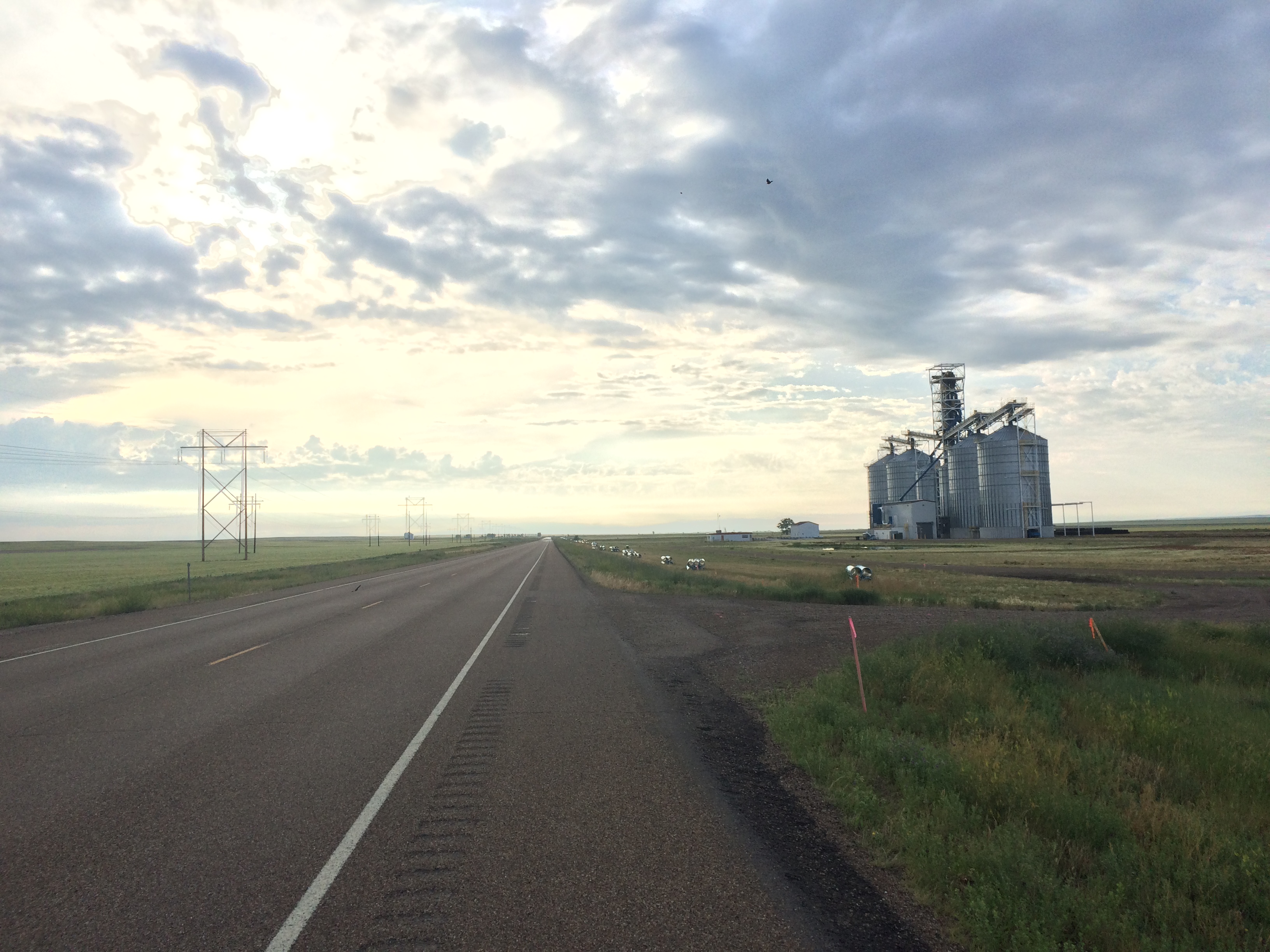
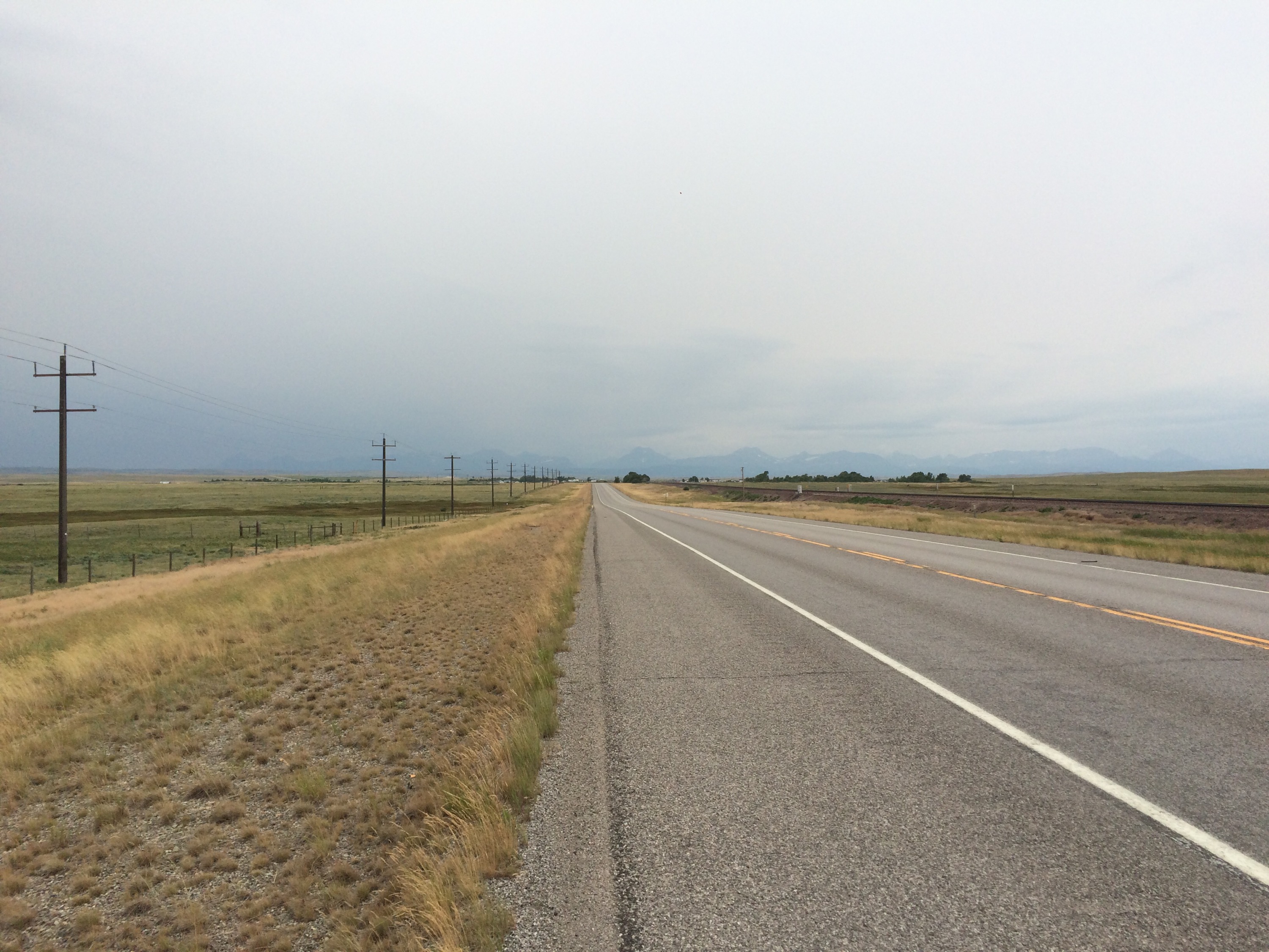
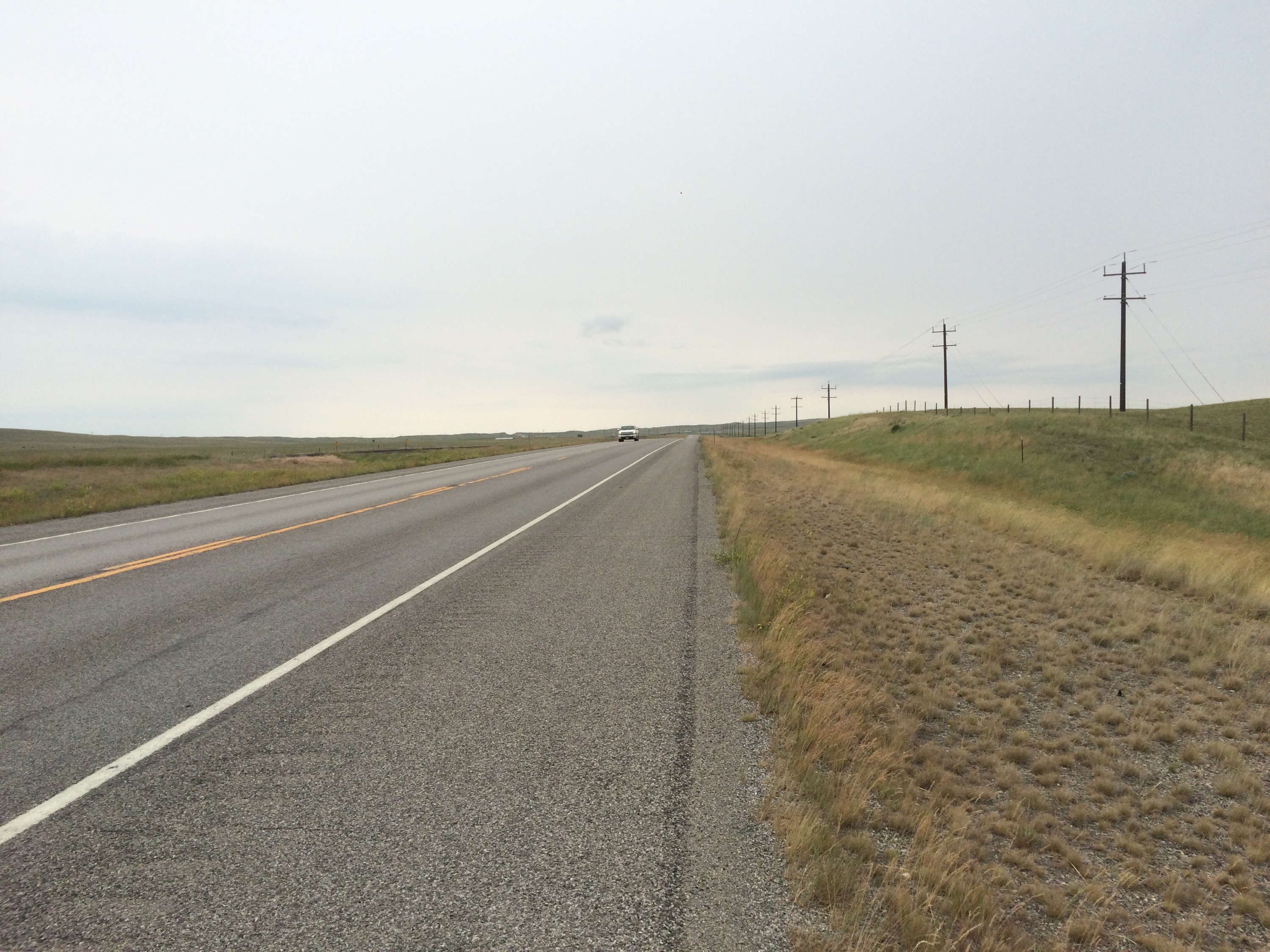
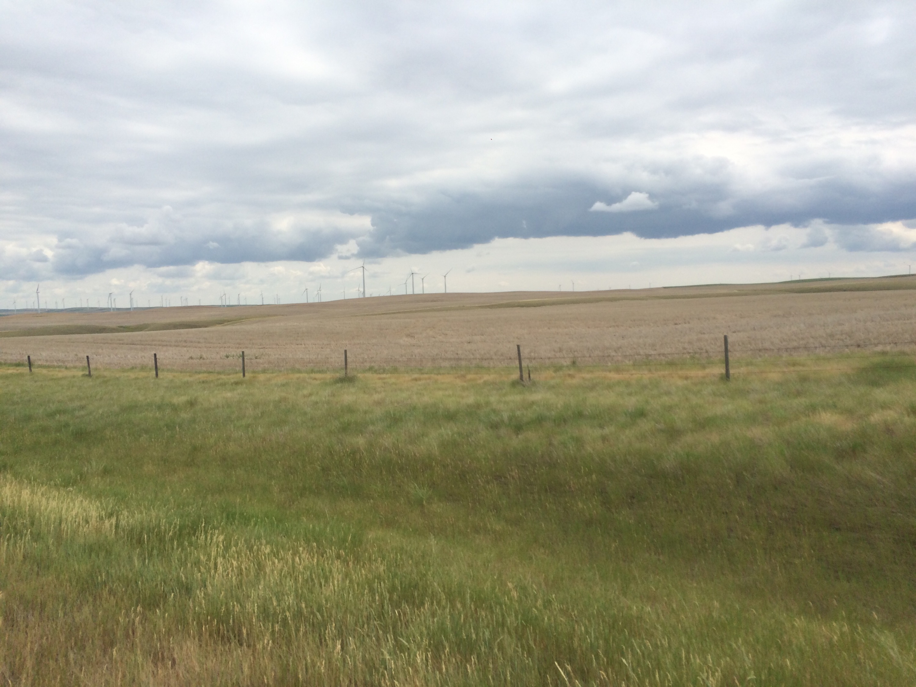
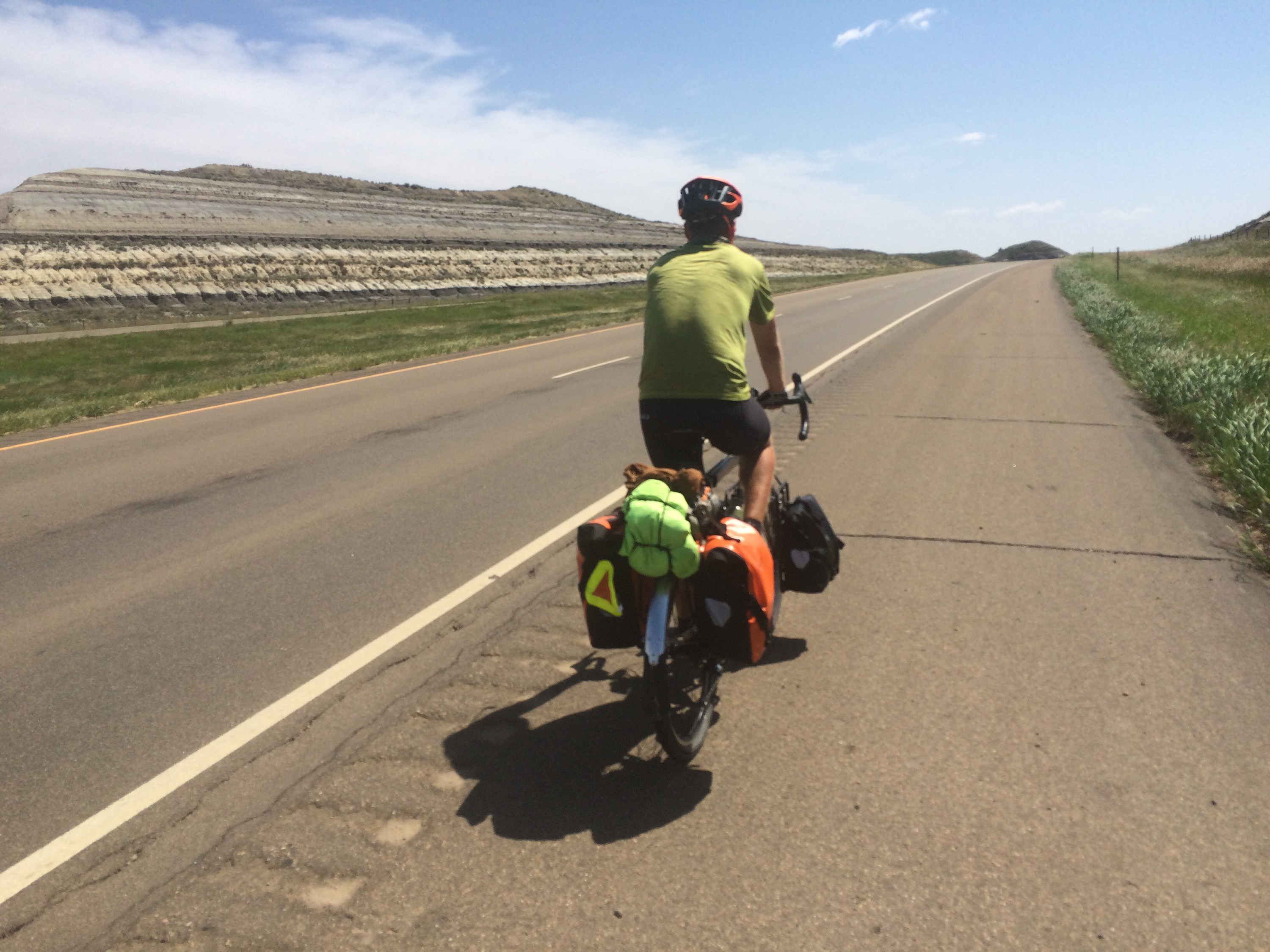
Glendive is at the bottom of the Yellowstone River Valley, and we started the day by climbing out. That in and of itself wasn’t a big deal; we’ve often started days with climbs. What made today special is that we were climbing on Interstate 94. There aren’t too many roads heading west out of Eastern Montana, so the ACA maps took us onto I-94 for the first 13 or so miles of the day.

  
We actually ended up riding on I-94 for a significant portion of the day. Riding our bikes on an interstate was not something we were looking forward to, but it wasn’t nearly as bad as we thought it would be. Pros of riding on the interstate: the hills are more gently graded, the shoulder is consistently huge, it’s usually the shortest distance between points a and b, and we always seem to ride faster when we’re on busier roads. Cons: traffic moves faster, taking breaks is not pleasant, it’s loud and stressful, and there is often sharp debris on the shoulder.

After 13 or so miles, we exited to ride a frontage road for another dozen miles. We took advantage of being off there interstate to stretch and eat, but shortly into our ride on the frontage road we decided they pros of the interstate outweighed the cons. The wind was already starting to pick up at our backs, and we wanted to take full advantage.

So we hopped back on I-94 at the earliest opportunity and we flew down the road to Medora. The wind was amazing. I don’t know much about gauging wind speeds, but I’m guessing it was guessing around 25 mph. We were riding 18-20mph uphill. When the wind gusted, we felt like it was carrying us over the hills. What a fun way to ride a bike.

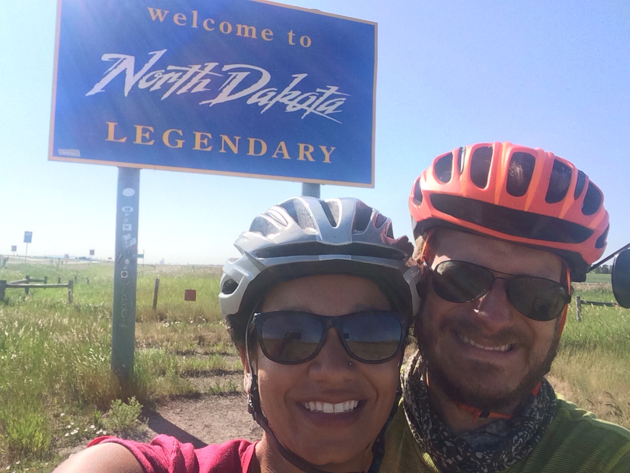
About 40 miles into the day, we finally left Montana and entered North Dakota. This goes into the obvious observation files, but Montana is a huge state. We spent the better part of 18 days in Montana (including our time stranded in Glacier), and we rode approximately 870 miles in the state. That’s over a fifth of our total trip in one state. A state with maybe a third of the population of Brooklyn.

  
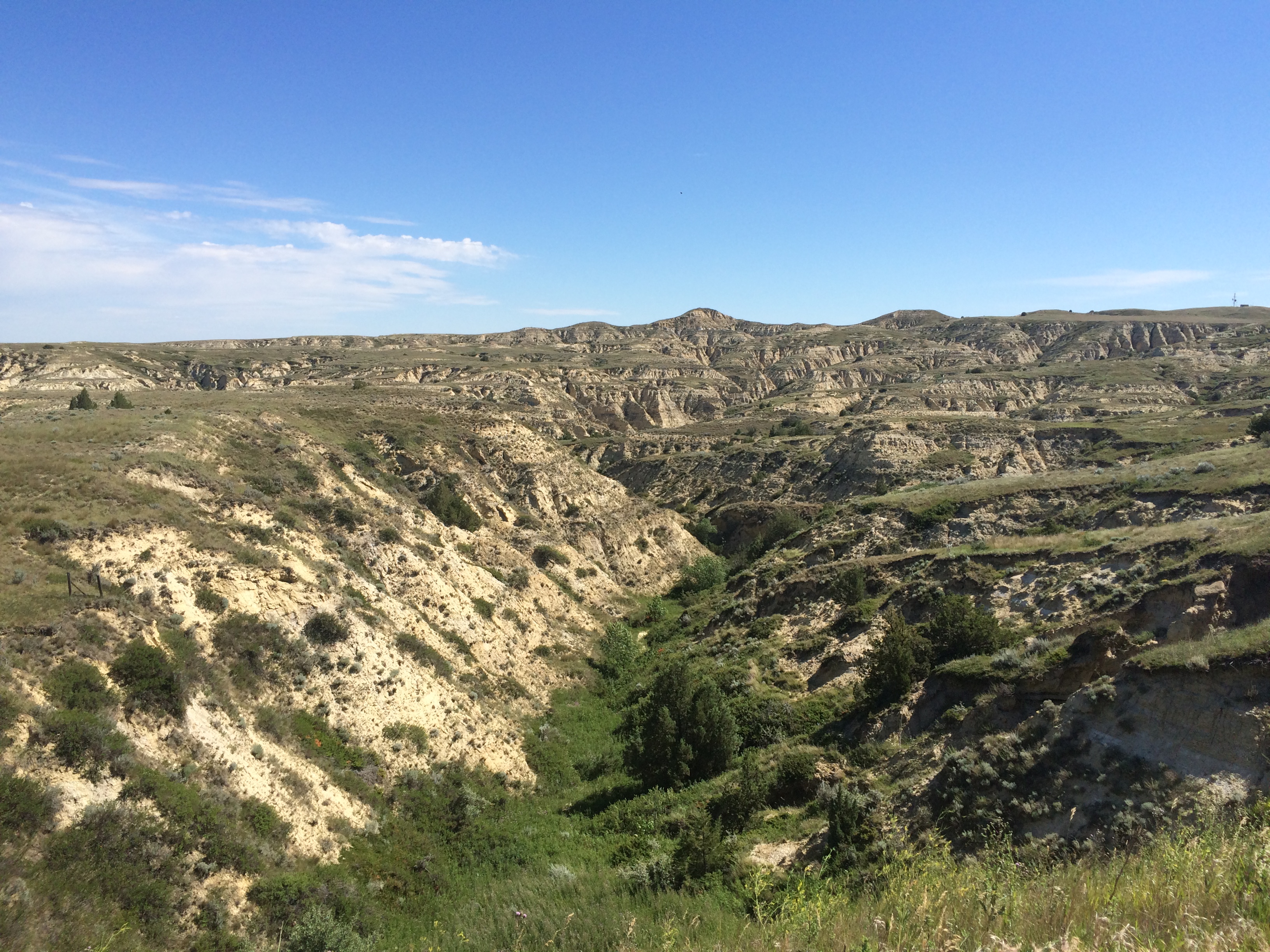
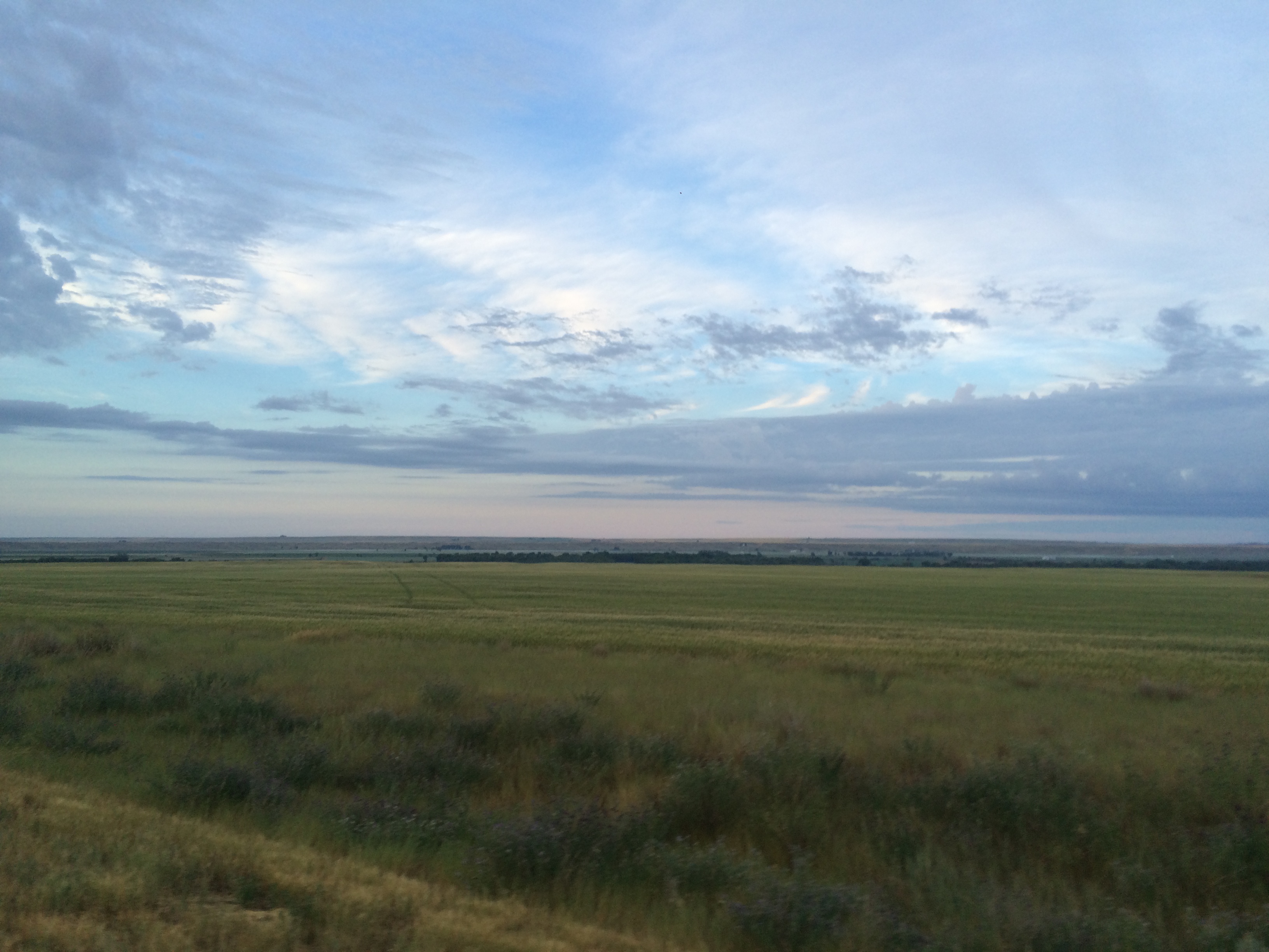
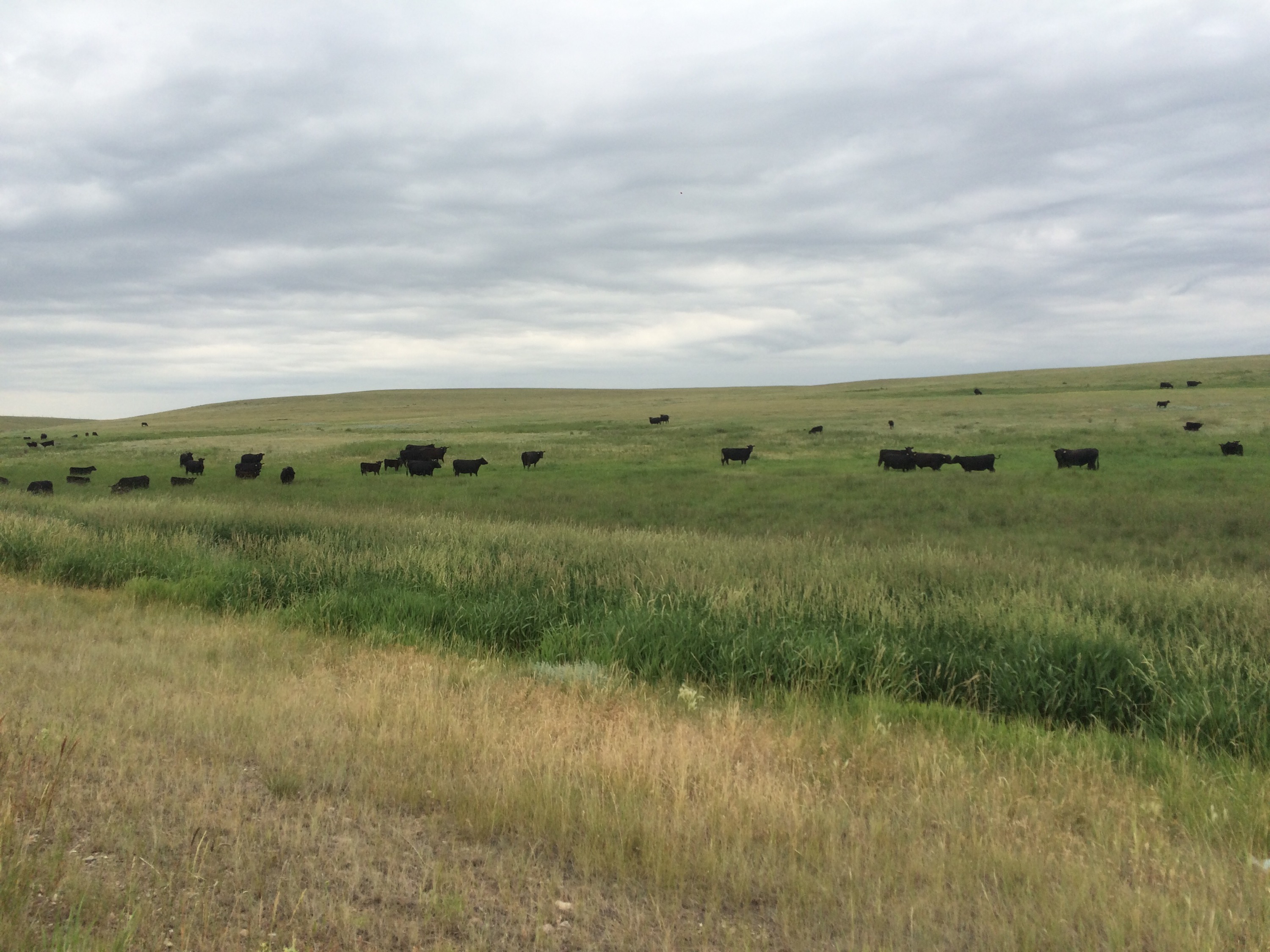
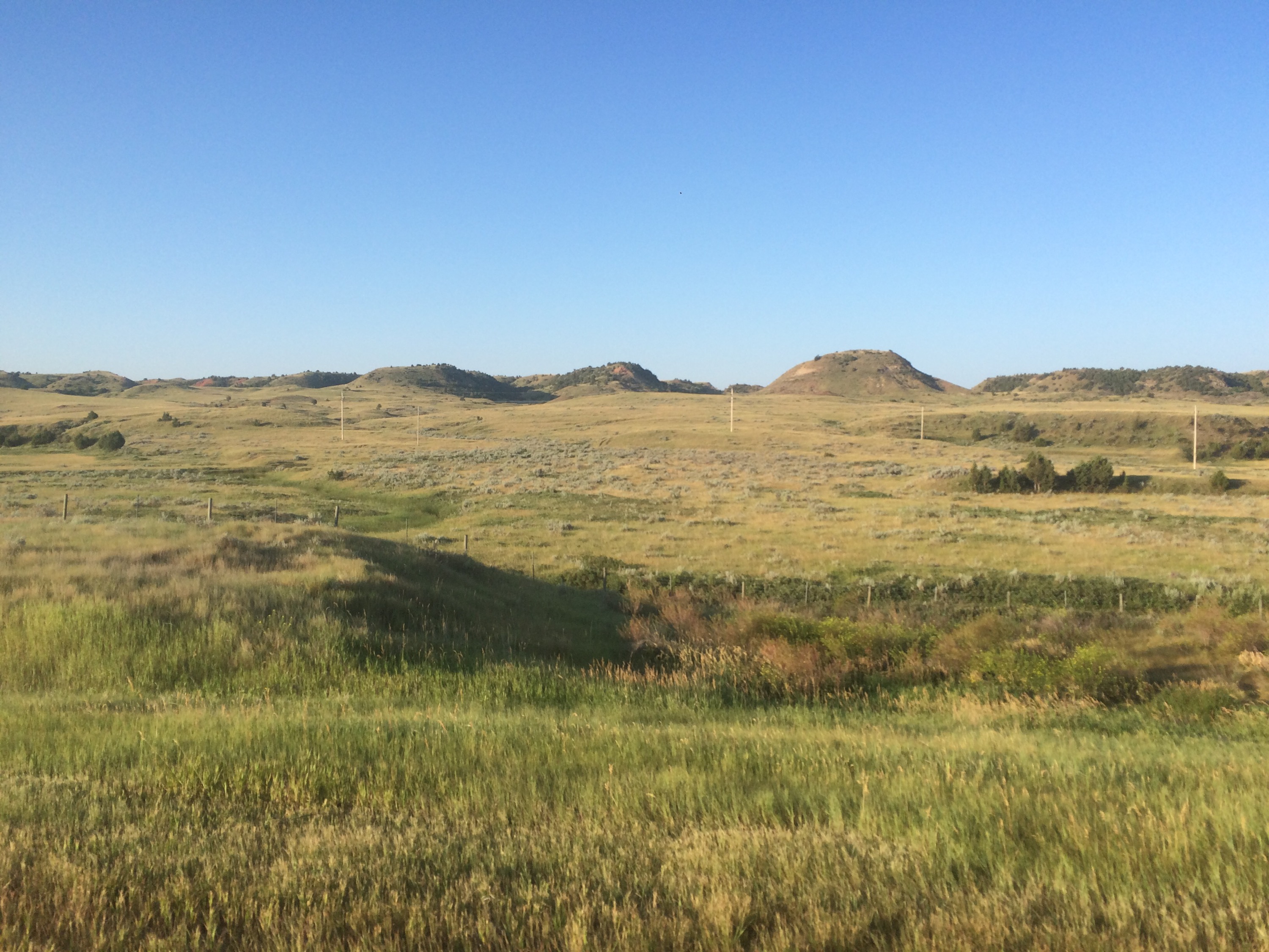
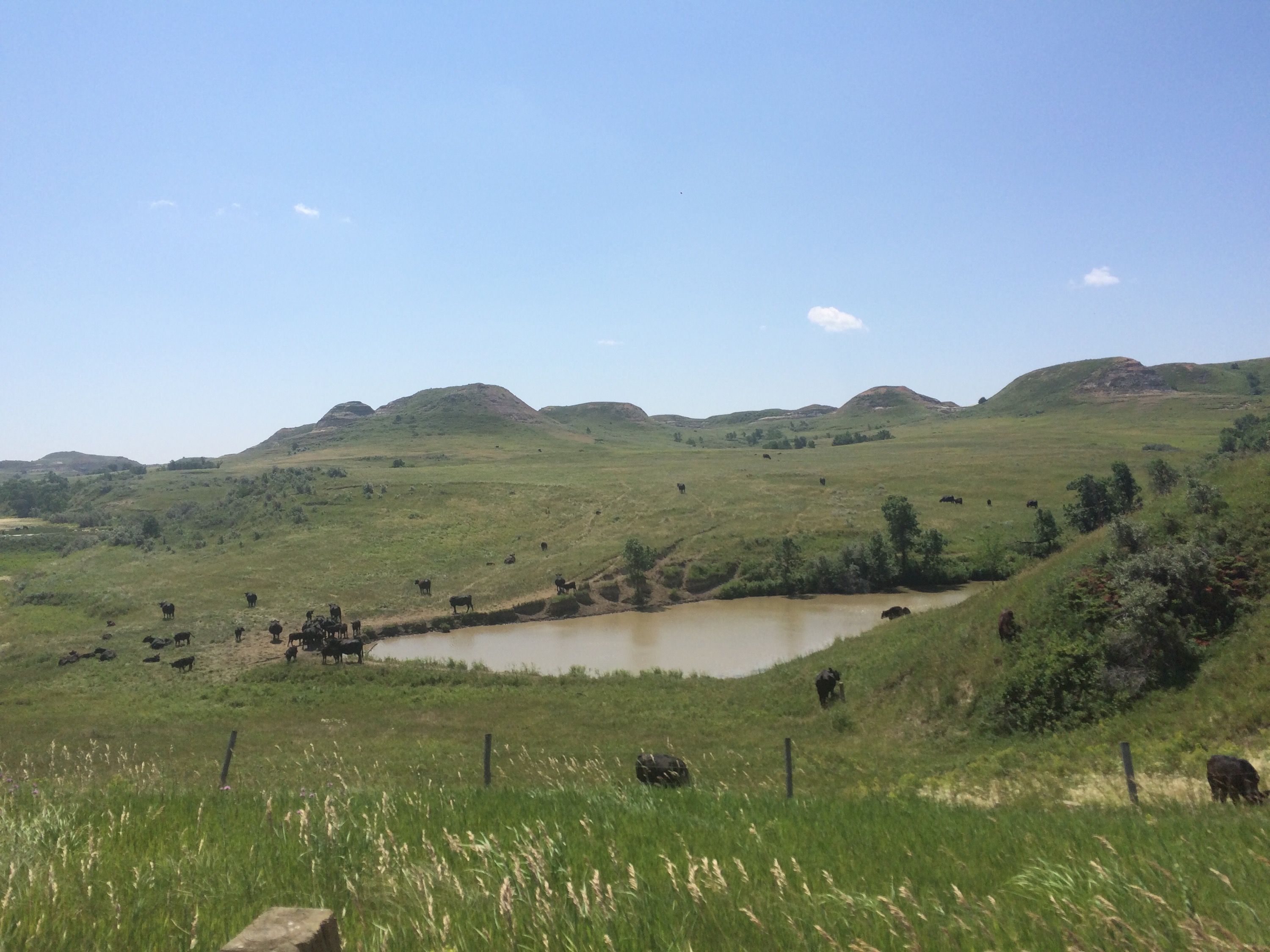
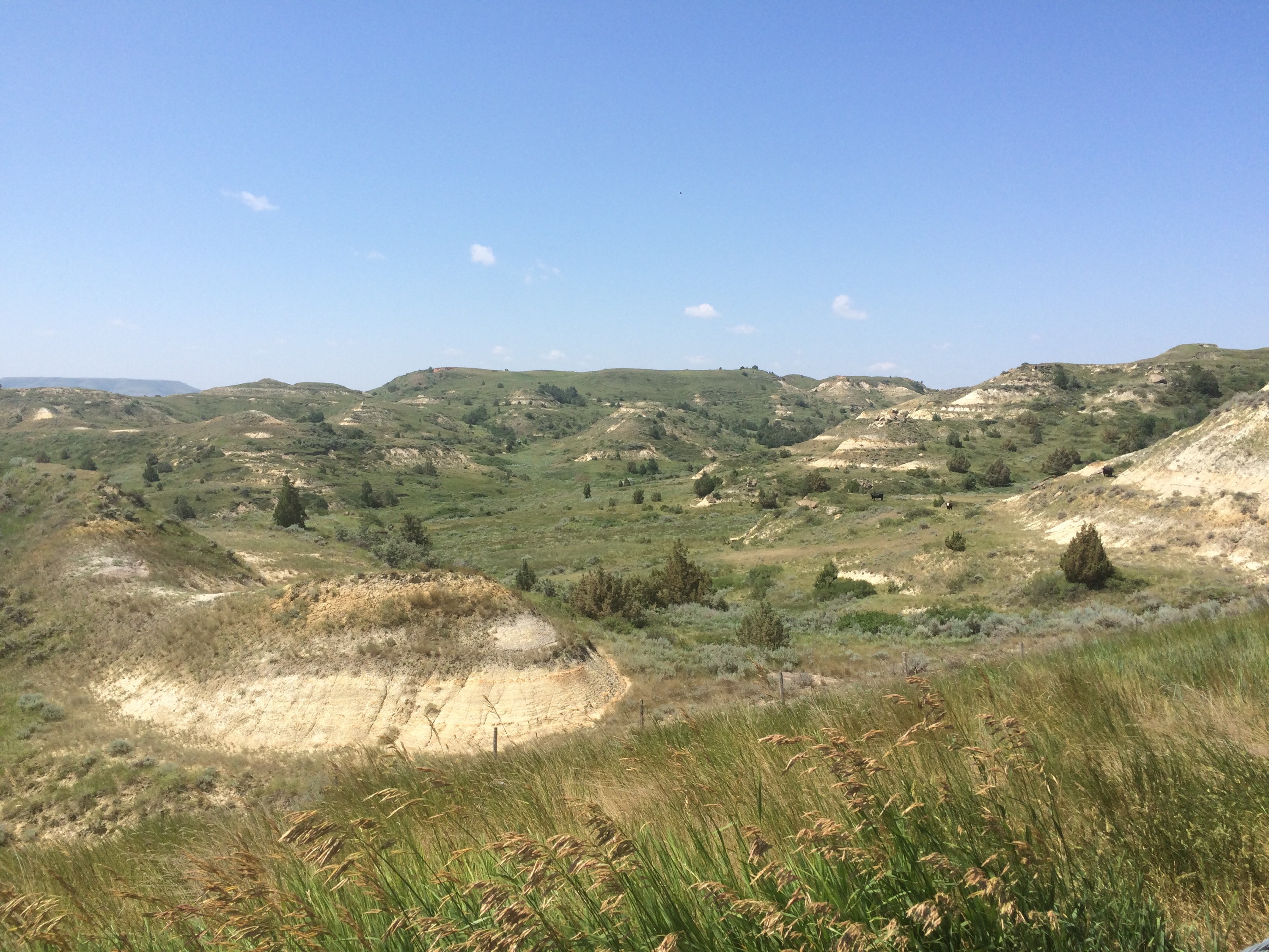
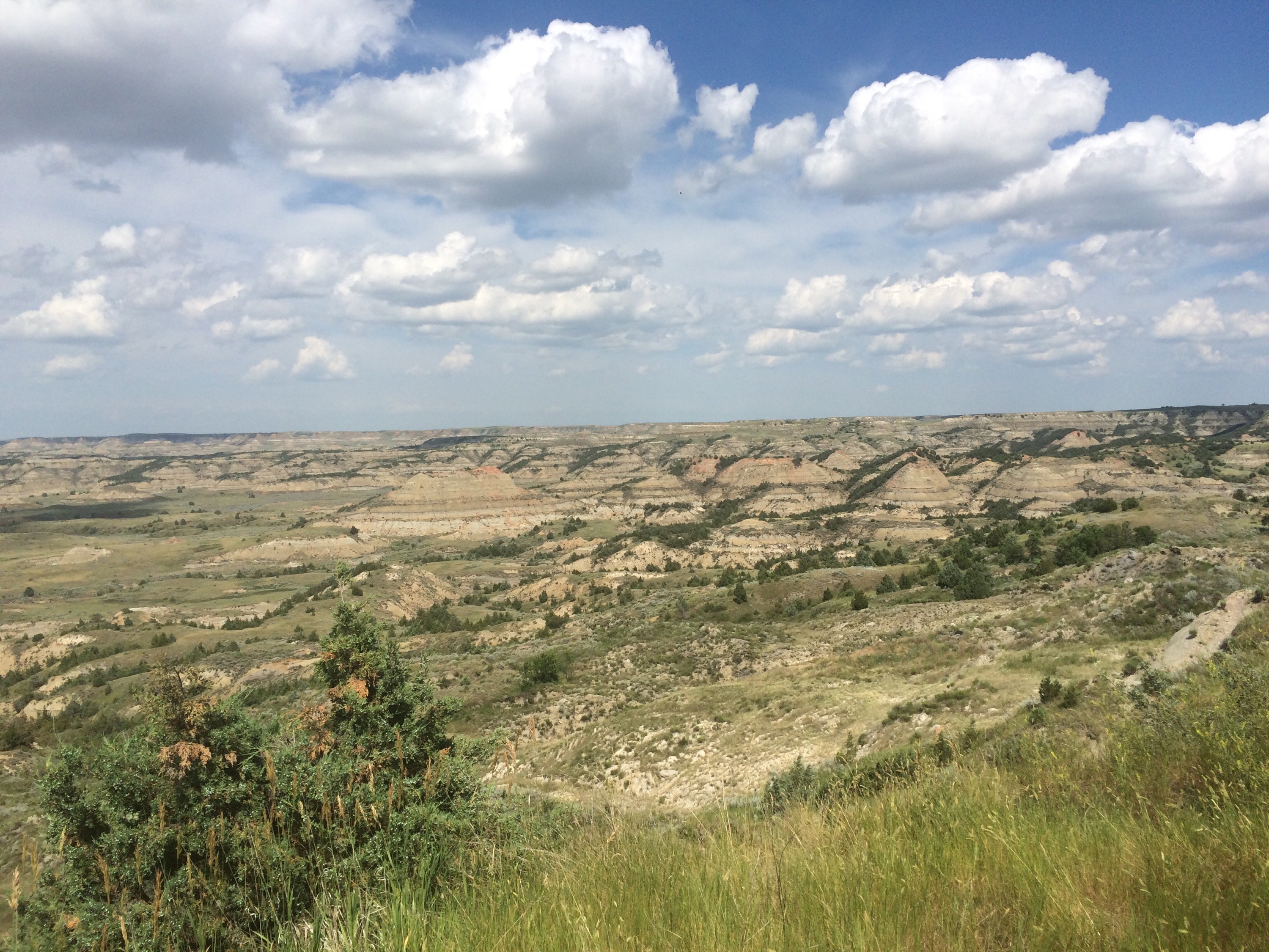
Anyways, I might not have had the greatest expectations for scenery in North Dakota, but the country in the western part of the state blew us away. We spent most of our day riding through the badlands, and they were unlike anything I’ve ever seen before.


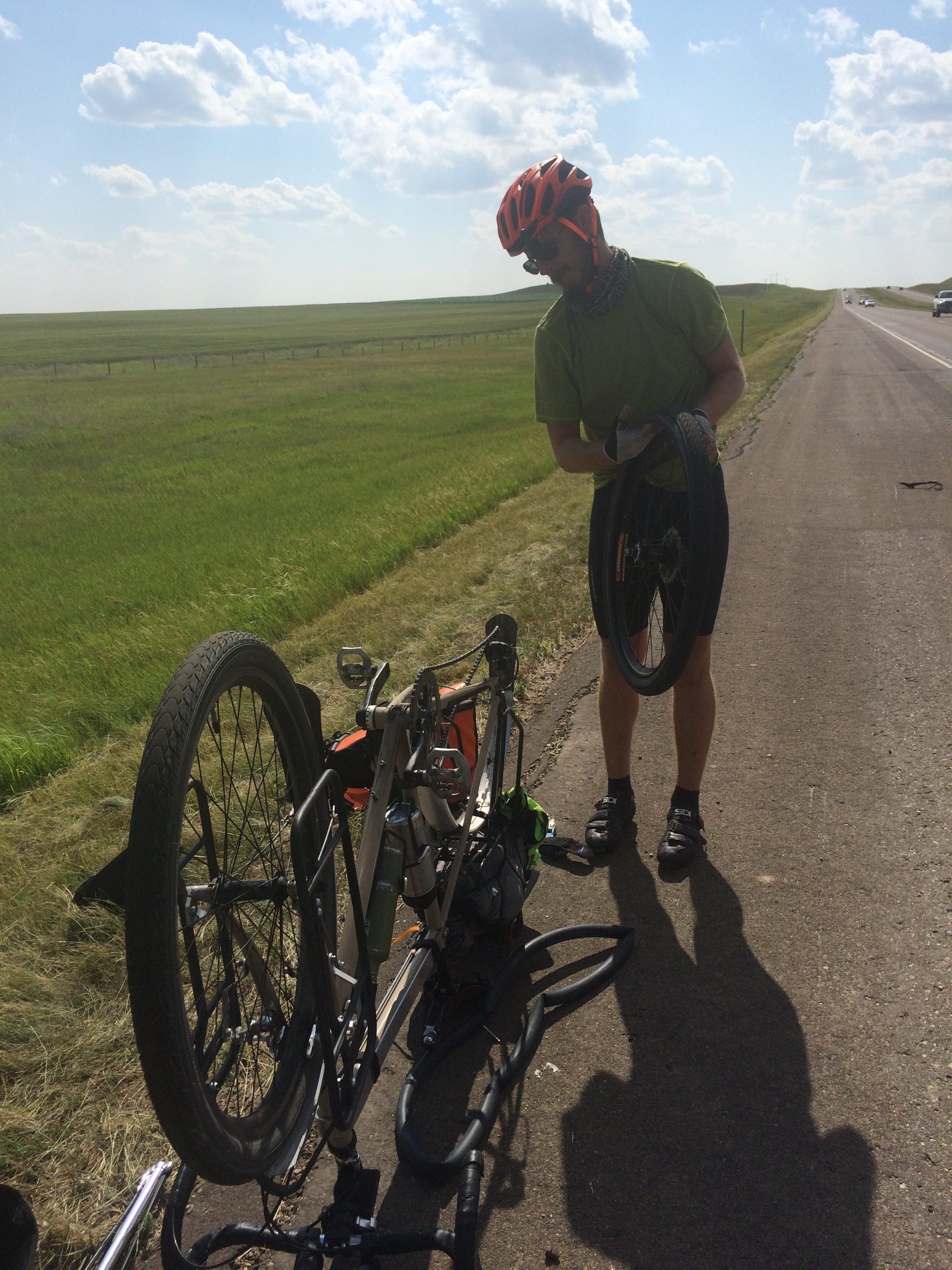
We were cruising along, making excellent time to Medora, when I heard Dani’s tire pop from a good 20 yards behind her. She had ridden over something nasty that sliced right through the sidewall of her tire. For those of you who don’t know, a gash to the sidewall is a death sentence for the structural integrity of a tire. Luckily we a) had a tire boot to use as an emergency fix (my bike tool kit is really getting some use!), and b) were close to Medora, which has a great bike shop. While we were changing the tube, a man named Chuck stopped to offer us help! He owns a bookshop in Seattle and is also riding across the country with his wife driving a support car. He was in the support car because his tire blew out in Vida and he had to go all the way to Medora to get a tire. He’s not going to cheat, though. His wife will drive him back to Vida to cover that section again. 

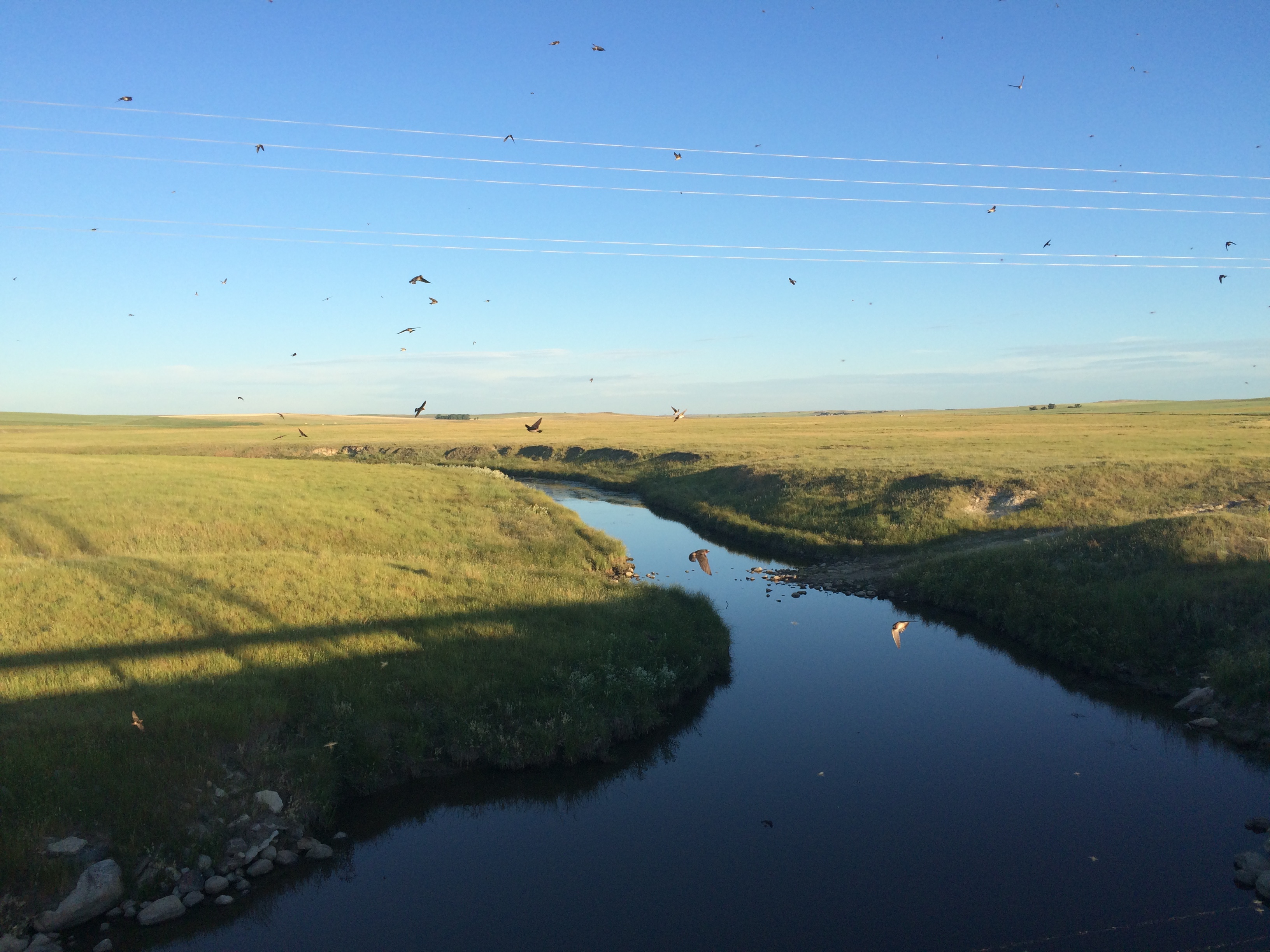
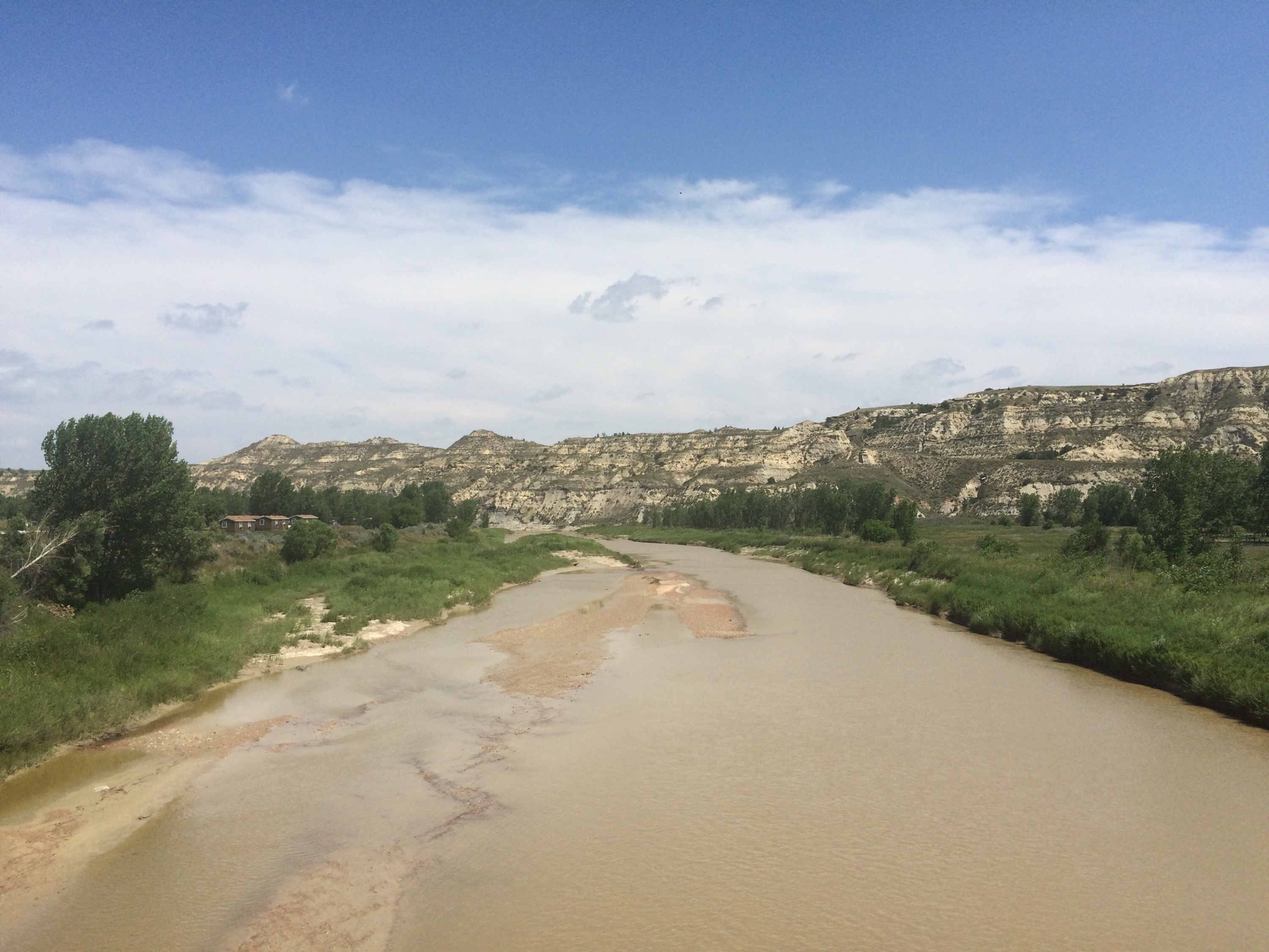
A few miles after Dani’s flat (and about 60 miles into the day) we exited I-94 and headed toward Medora, the launching-off point for Theodore Roosevelt National Park. There was a bike path that took us into town alongside a small stream. Oh man, so beautiful. It hurts my heart that we weren’t able to spend any real time in the park. We really wanted to take some time to explore, but our Glacier fiasco set us back and we just didn’t have time.


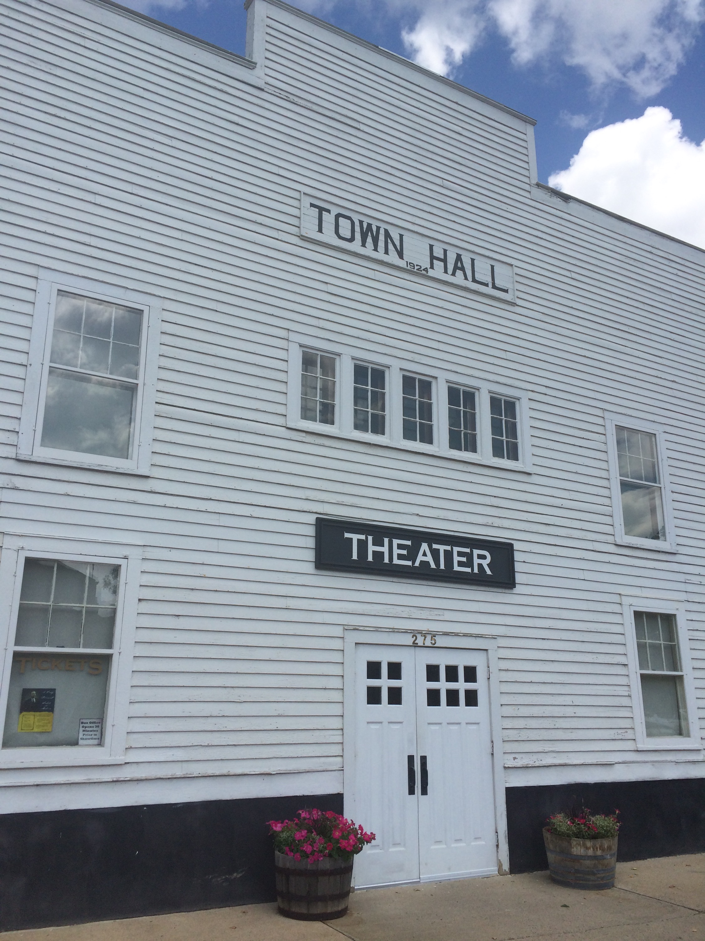
Medora is another faux-western tourist town, but I have a confession to make: we love tourist towns. We love all of the cute little shops and cafes, the ice cream, the assurance that there will be good food, and how clean and maintained everything looks. We know it isn’t “real,” but we love it anyway.


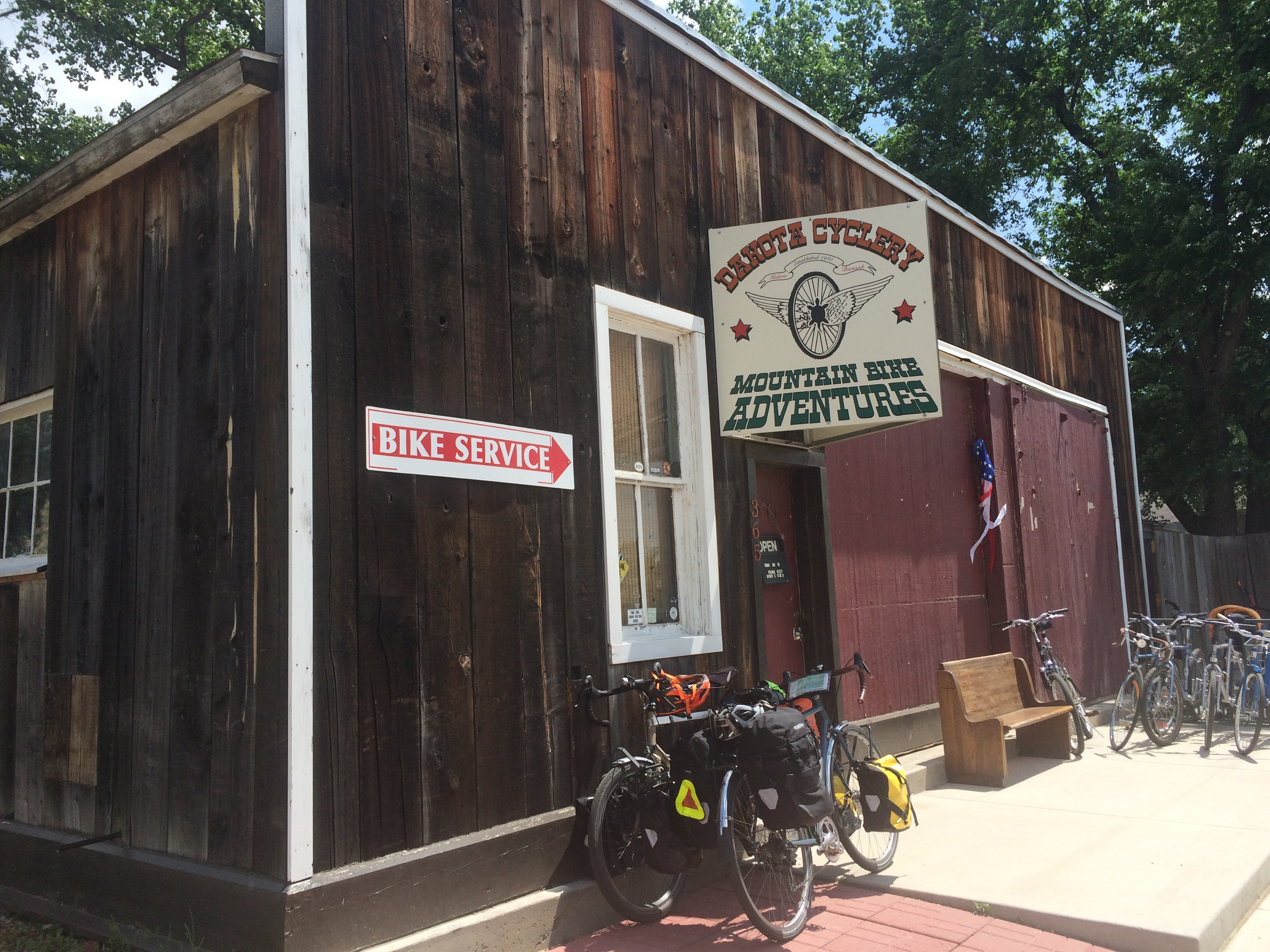
Our first stop in town was Dakota Cyclery, and I can’t recommend the shop enough. They were well stocked with high quality touring tires, and they were exceptionally friendly and helpful, completely lacking the snobbishness that is often a part of the bike shop experience.

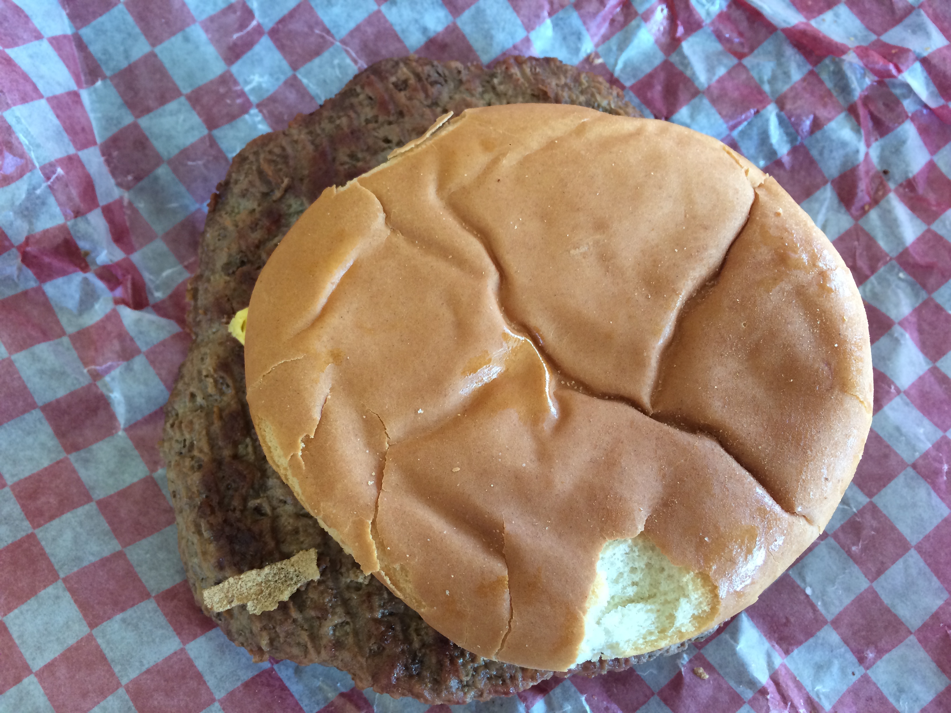
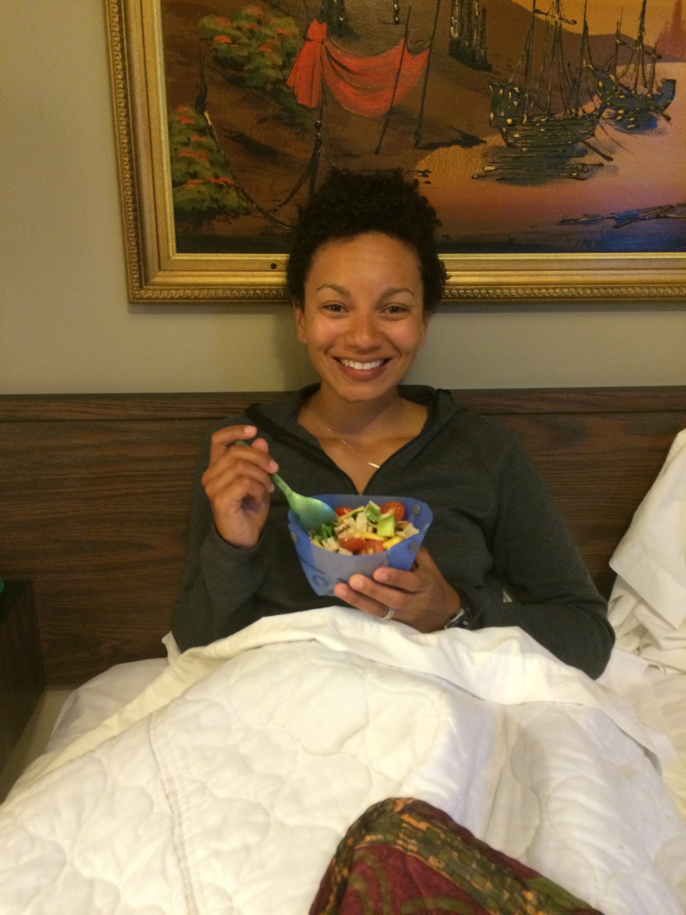
We decided to eat lunch before we bought the tire and hopped over to Boots Bar and Grill, where Dani had a fried fish basket and I had a steak sandwich that was delicious, but small.

Then we headed back to the bike store, bought a new tire, and changed the tire while we ate ice cream.

Then we headed out of town, trying to rack up some more miles with this lovely tailwind. Immediately after exiting town proper, we began to climb. It wasn’t too long of a hill, but it was steep. Holy moly. Maybe the steepest grade of the trip so far. But the wind was helping us, and we made it up the hill and back onto I-94.


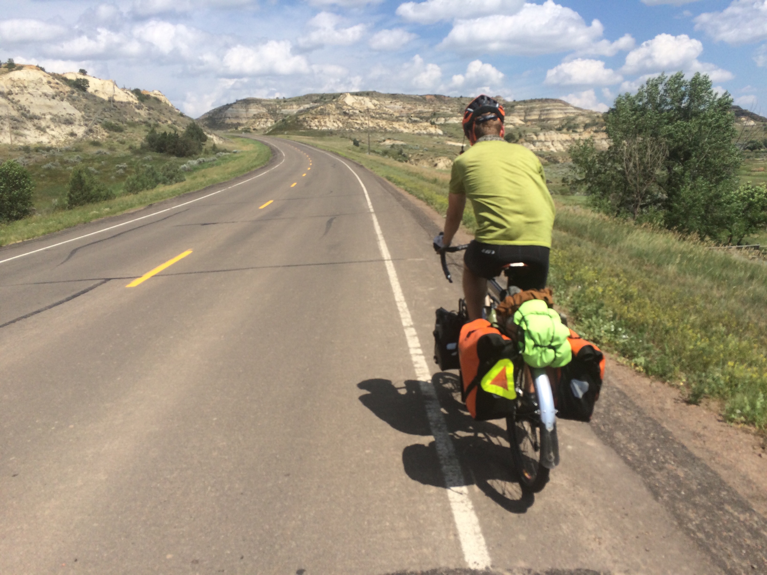
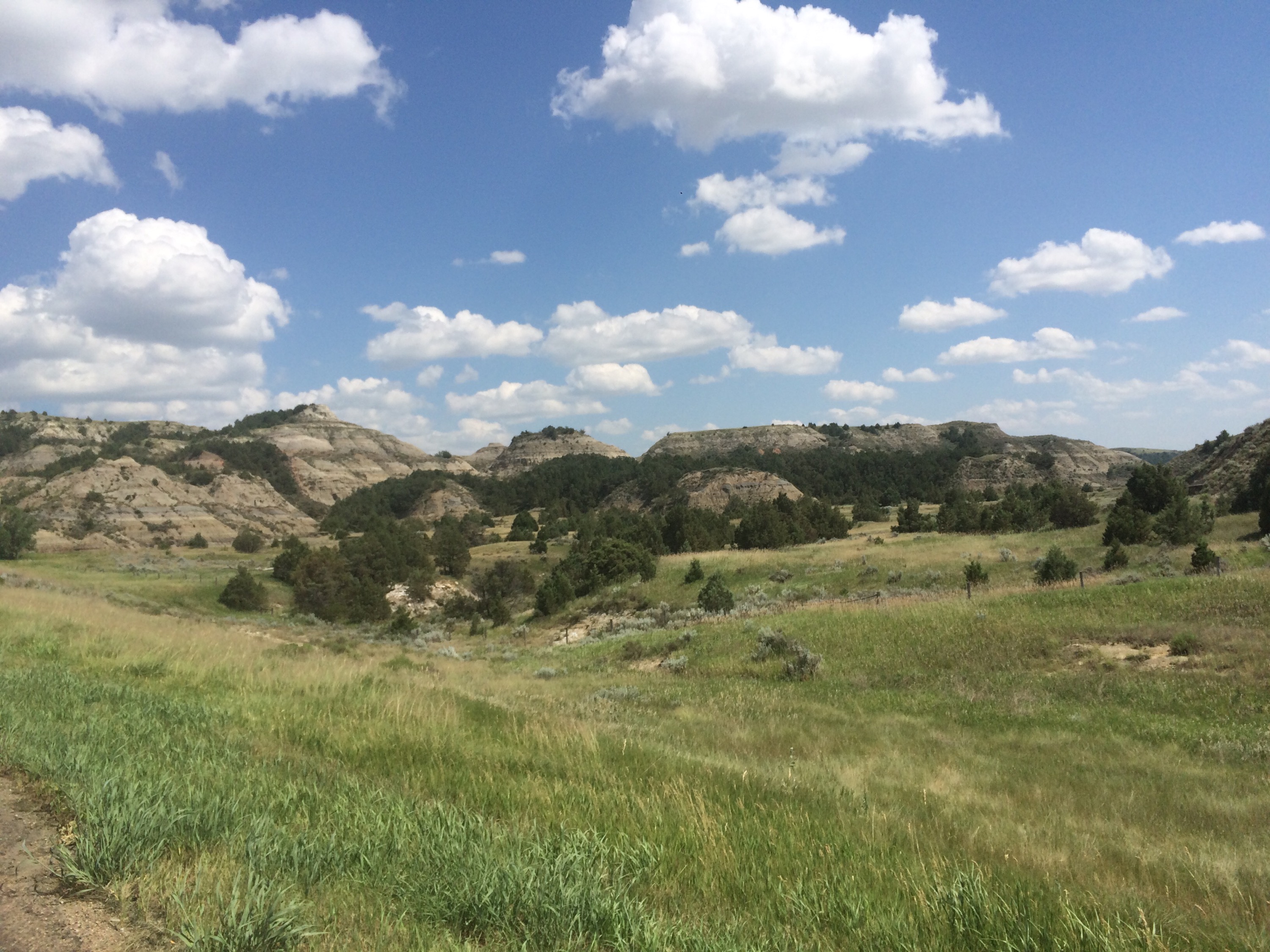
The ACA maps have you taking old highway 10 for this section of the day, but we heard that there was a lot of oil truck traffic on that part of 10, and we wanted to get as many miles in as possible, so we elected to stay on the interstate. A few miles after Medora, we pulled off at the Painted Canyon overlook. Yep. It was stunning.


Back on the road, we were trying to make it to Richardton, where there is an Abbey that extends its hospitality to touring cyclists. But I-94 had other plans for us, and shortly after we were congratulating ourselves for having the good fortune to lose a tire right before an excellent bike shop, my tire blew. I don’t know what I hit, but the tire went from full to flat in barely a second. Luckily, the tire itself remained intact, and all I had to do was switch out the tube. 


Pedaling again, we were starting to tire out despite the tailwind. Riding 100+ miles wears you out, even with a favorable wind! We rolled into Dickinson after 102 miles close to 5:00p.

We’ve found a few blogs of people who are doing the same trip as us, but are a few days ahead. These are great sources for tips on riding conditions, etc., but today we found perhaps the best tip ever: there’s a Qdoba in Dickinson.

Yay for giant burrito bowls and unlimited seltzer water! It was the perfect dinner to end the day.

Except the day wasn’t supposed to end yet. We were supposed to ride another 25 miles to free camping at the Abbey. But we were exhausted, so we decided to call it a day.

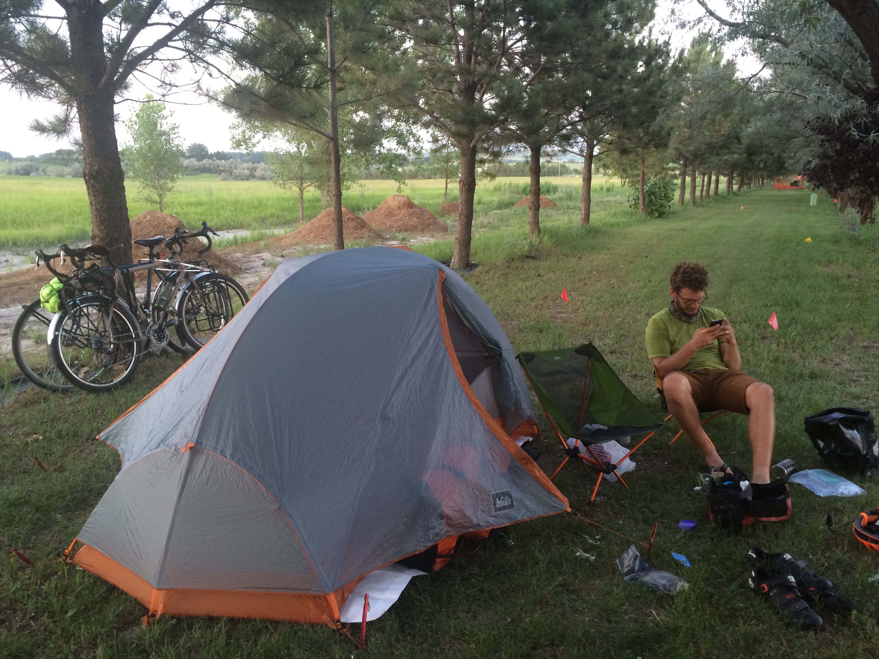
We ended up staying at an RV park in town. It was $25, but it had a nice shower, WiFi, shady trees, and it was quiet. It’s the most we’ve paid for camping so far, but the showers made it a better deal than the Montana Bike Hostel, in case you were wondering. 


We’re going to try to make it into Bismarck tomorrow, which would be another century ride!

Day 29: The day of the tailwind

Day 29, 7/12/15, Vida, MT to Glendive, MT: 80.2 miles, 3,949 ft. elevation gain, 13.5 mph average speed
Trip Totals: 1,426 miles (62 mile daily average), 71,030 ft. elevtion gain, 11.6 mph overall average speed

Four and a half days behind schedule.

(Note: at some point during each of the last three days, Ted’s phone lost GPS, so the stats for the day might not be completely accurate. The distance is at least close, but the daily average speeds are estimates.)

Tailwind! For 50 miles! 50 miles in less than 3 hours! After it took us 3.5 hours to complete the first 30 miles when that same wind was a headwind. What a difference wind makes!

IMG_4934

We woke up bright and early today (4:30a) to avoid those 20+ mph crosswinds we had at the end of the day yesterday. I was not happy about it. Our pace and sleep schedule feel unsustainable to me right now, but I’ll just keep chugging along until I feel confident we’ll make it to Niagara Falls in time to visit Ted’s family.

image

We started off at 5:30a and I could actually feel my heart sink when I noticed the grass blowing toward us about 6 miles in. We’ve not had to deal with headwinds this early in the day, and we still had 24 miles before we finished these rollers and reached a turn that we hoped would put the wind at our backs. With the wind and rolling hills, those first 30 miles were hard.

We got some low-quality processed sugar products for breakfast at the convenience store in Circle, MT, then made a 150 degree left turn, turning that crosswindy headwind into a tailwind!

This tailwind made me think I’ve never experienced a tailwind before. The first 15 miles after the turn were uphill and we cruised up at around 15 mph, and once we crested the hill we cruised into Glendive at around 25 mph. We got to town at 12:30p and felt we should take advantage of the wind and push on, but we had a warm showers place to stay, so we called it an early day.

IMG_4935

We were hoping for a cute coffee shop to sit at and blog all afternoon, but there were no coffee shops in town. We ate burgers and fries at a converted Dairy Queen (renamed Re-treat) because it was the only non-dive bar open on Sunday in town. Pretty divey town, that Glendive. The burger was huge and the bun was a normal size. It reminded me of Chris Farley singing “fat guy in a little coat.”

IMG_4938

There were two other groups of cyclists in this place, a couple cycling the northern tier from east to west on a supported charity ride to raise money for MS research and a family of three (a dad and 14-year-old girl on a tandem and a mom on a single) riding the northern tier to their home in Maine. We traded tips for our upcoming travels (we should expect rainstorms, more biting insects, humidity, and Midwestern hospitality) and we all ate lots of grease and ice cream.

IMG_4941

We then headed to our warm showers hosts’, Joy and Glen, house. They built a beautiful log cabin on the Yellowstone River and they let us stay in one of their guest rooms. This is their first year hosting on warm showers and they’ve gotten a deluge of guests so far. We very much appreciate their hospitality! There was another cyclist there, Jace, a 20-year-old who is cycling from Connecticut to Oregon for his sister’s wedding. He created his own panniers out of kitty litter buckets to cut costs and they are waterproof and fairly lightweight. Great idea, and he thinks it’s gotten him a lot of pity-related kindness.

We got to cook red beans and rice in a real kitchen and shared it with Jace while discussing jazz music. Then to bed because we have an early start tomorrow for a 100-mile day!

Day 28: The day of the lucky bathroom break

Day 28, Glasgow, MT to Vida, MT: 73 miles, 2,023 ft. elevation gain, 13 mph average speed.
Trip Totals: 1,345.8 miles (61.2 daily average), 67,081 ft. elevation gain, 11.5 mph overall average.

Four days behind schedule.

image

Hey! Guess what! We have a waterproof tent!

Tanja had warned us that there was a pretty fierce storm rolling in, and it landed sometime in the middle of the night. Rain, lightning, and lots and lots of wind. The wind repeatedly blew our tent over to a 45 degree angle before the tent snapped back into place.

It was a bit frightening, but not enough to keep me awake after fighting through that headwind all day. But then–and here’s the exciting part–we woke up in the morning and we were dry! All of us! And all of our stuff! Happy day!

IMG_4905

IMG_4893

IMG_4909

We were terrified of having to fight that headwind again, so the alarm went off at 4:30a and we were on the road by 5:20a. We spent most of the intervening time being eaten by mosquitoes. If these early morning mosquitoes stay this bad, we might have to toss this all natural, cruelty-free repellent and get some DEET. I’m tired of being breakfast before I eat breakfast.

Anyway, we got on the road and pedaled with the all of the strength of our fear of another headwind. Also biking fast keeps the mosquitoes away, so that was an extra motivator. We made it 30 miles by 7:30a before we stopped to eat first breakfast. We were on track to make it to Wolf Point (50 miles) before 9:00a, but then a shattered beer bottle introduced itself to my rear tire, and the interaction didn’t go too well.

image

image

I changed the tire in 20 or so minutes and we were back on our bikes and into Wolf Point at 9:31a (so close!), and we headed straight for McDonald’s.

I hope we’re not forming long lasting bad habits, but 1) McGriddles are delicious, and 2) since we were stupid enough to make this trip with T-Mobile, we are reliant on WiFi to plan, etc.

Here’s where our days typically fall apart. We have a great start to the morning and decide to congratulate ourselves with hot breakfast food, and then we sit. And sit. And talk about how we need to get going, but without making any effort to stop sitting. It ruins us.

After close to an hour and a half, we finally got ourselves out of McDonald’s and swung by the grocery store on our way out of town, where we found our favorite chocolate milk (Darigold Old Fashioned) probably for the last time.

Aside: Apparently we are now in TruMoo country, and I wouldn’t even wish that sorry excuse for chocolate milk on someone who decides to ship their house on a shoulderless two-lane highway.

We headed out of Wolf Point, leaving Rt. 2 behind after over 300 miles and we joined Rt. 13 south to take us to Circle.

Let’s talk a little about expectations here. I’ve seen a lot of people complain on the Internet about the hills coming out of Wolf Point after crossing the Missouri River (oh yeah, we did that), and I think it’s because they take people by surprise. The Adventure Cycling Association maps included an elevation profile for the first two sections, but not for the third section. I think people see this and assume that the whole ride is mostly flat. Then they ride for the first 300 miles of the section and it IS mostly flat. Then they cross the Missouri, and WHAM!

There are hills there. Lots and lots of hills. Hills that are rolling, but rolling consistently upward. I can see how these hills could be a bit demoralizing if you were expecting a flat ride, but we had the elevation profile on the route we uploaded to Ride With GPS, and I had been dreading these hills for days.
image

image

From that perspective, they really weren’t that bad. They weren’t the best thing ever, especially when a mostly headwind picked up around 12:00p, but they weren’t all that bad. And the country was just lovely. A little terrain variation can go a long way, aesthetically. And when we paused to recover from climbing into the wind, we noticed how cool that same wind looked moving through the fields. That “amber waves of grain” thing again, I guess.

Round about 1:45, we made it to the tiny town of Vida, 22 miles of rolling hills out of Wolf Point.

So. Vida. Not much there. A post office with limited hours (8:00-8:45 on Saturday), a community church, and a bar. The ACA map doesn’t even record it having a population. What it does have though is a wonderful shade tree standing over a wonderful bench that is wonderfully protected from the wind. It was wonderful.

image

We sat on the bench (and laid on the ground next to it), and ate peanut butter Oreos, Philly cheesesteak-flavored cured meat sticks, jalapeño potato chips, and pop tarts. A well-balanced lunch, in other words.

And then we fell victim to our sitting weakness. We had gone 72 miles and we were tired. And the wind was getting stronger. And the tree was so nice.

But there wasn’t any place to camp in Vida, so we had to move on. We packed our bags and were about to take off when nature started calling me. Loudly. The type of call that can’t be answered on the side of the road.

This was decidedly inconvenient, because there are three buildings in Vida and the bar and post office were definitely closed. So, with fingers crossed, I waddled up the hill to the church.

It was open! And there was a bathroom right next to the front door! Sweet relief!

Then, as I was leaving the church, I heard a shout from a group of people hanging out around two RVs behind the church. It was Cycling 4 Change!

Turns out they received permission from the pastor to spend the night at the church. They again piled us with gifts–sports drinks, chocolate milk, and leftover breakfast–and we got to chatting (and sitting, which I mentioned we love). We hadn’t met everyone the first time, but they were all here then: Sanoosh, Raj, Arool, Zuli, Hannah, Nitha, Lydia, Sarah, Josh, Daniel, Noah, Zachary, Julian, and Daniel (another one). I hope I spelled everyone’s name right!

We hung out for a while, listening to the kids play music and sing songs. Josh plays violin, guitar, and piano, which he taught himself, and is great at all of them. It was beautiful to hear them all sing together. What a talented, adorable family!

By that time it was even later AND even windier, and we really didn’t want to leave. So we asked if we could set up our tent behind the church and they said yes. We passed the rest of the evening talking and playing with the kids. They invited us to join them for dinner (pork chops, hamburgers, hot dogs, pasta, spicy rice and beans, and Israeli couscous salad), and everything was delicious.

After dinner we washed the dishes, and then we headed to bed.

I’m glad I had to poop!

Day 27: The day of the headwind

Day 27, Malta, MT to Glasgow, MT: 71 miles, 1,357 ft. elevation gain, 9.5 mph average speed.
Trip Totals: 1,273 miles (60.6 daily average), 65,058 ft. elevation gain, 11.4 mph overall average speed

Four days behind schedule.

Today’s synopsis is similar to yesterday’s, except I’d add headwind, hills, mosquitoes, and another hot. Today was the most miserable day since that 105 degree day into Eureka, MT. Also, sorry about the lack of photos. I was too hot and tired to bother with the phone.

We ended up turning down Terry’s exceptionally kind offer to drive us 26 miles up the road to Saco. You should be proud of us; this was hard to do and we sort of regretted it later. Terry gave us bagels and fruit for breakfast (thanks for feeding us so well, Terry!) and we got started early in hopes that we’d avoid the headwind and heat.

image

After 17 miles of rolling hills, we made it to Sleeping Buffalo, a sacred rock that I wish I could tell you more about, but I can’t because the moment we stopped there we were swarmed by mosquitoes. It was like something out of a Loney Tunes cartoon. We immediately applied our bug spray–our cruelty-free, all natural, citronella-based bug spray–and the mosquitoes didn’t give two craps about it. They were flying through the bug spray stream in search of blood. It was an ambush.

A lady pulled up and told us that we were entering the mosquito flats (which are actually the Saco Flats, but are known for their mosquitoes) and it would only get worse for the next 13 miles through Saco, which aligned perfectly with Terry’s warning. The mosquitoes can’t really bite us as much when we’re moving so we pushed on to Saco. A headwind had started while we took our break. We started regretting passing up that ride at this point. We continued regretting that decision for the rest of the day.

Terry gave us another amazing tip: there’s a butcher in Saco who cures his own meats and sells them in the grocery store in Saco. He wins all of the meat curing awards Montana has to give away, so this meat is apparently not to be missed. We stopped at the store and the lady working there was super friendly. She even opened a package of meat so we could try some (it lives up to the hype!) and she gave us the rest of the package for free! A bunch of people stopped in the store and grabbed armfuls of this meat and told us to stock up, that they come from 30 miles away just for this meat, etc. We bought as much meat as we could carry and a gallon of lemonade and stood outside to eat our second breakfast, consisting of that gallon of lemonade, Bloody Mary-flavored beef sticks, and Peanut Butter Oreos (a breakfast staple, naturally). As an aside: I’m really into the fact that I get to eat all of my guilty pleasure food in disgusting quantities and I’m not gaining 100 pounds. I hope I’m able to wean myself off when we’re not riding bikes all day.


 We started toward Nashua against that headwind and the terrain flattened out a bit. After 14 exhausting miles we entered Hinsdale, another small town with a convenience store where we bought Gatorade and sat at a table inside to escape the heat. An older local man was sitting at the table holding his dachshund and another man was drinking a coffee. We talked to them about the weather (i.e., complained about the heat and headwind) and left as soon as they told us the headwind gets worse throughout the day.

Not soon enough, though. The riding was miserable between Hinsdale and the rest stop 15 miles away. We were pooped by the time we reached the rest stop and decided to stop short of our goal destination, Nashua, at Glasgow, which was only 15 more miles. We scarfed down food, guzzled water, and I somehow managed to fall asleep on a concrete picnic table bench. That’s how exhausting it was.

image

Ted woke me up and had already packed up lunch and refilled our waters. What a sweetheart! Letting me sleep while he works! He is really carrying me through this trip. I would still be in Glacier if it wasn’t for him.

The wind and heat had both gotten worse, of course, so we really struggled through the final 15 miles. It took what felt like an eternity. The hills felt like personal insults and the winds sometimes stopped us in our tracks. We stopped at the first convenience store in Glasgow and bought cold drinks, then proceeded to the city’s civic center to see about camping in the city park. We found out that it was free to camp and there were dollar showers at the rec center around the corner.

We quickly showered then got on our bikes in search of wifi. We found a recently opened brewery, searched for  and found a wifi signal, then went in to drink beer while updating blogs. But there were too many friendly people inside who wanted to chat so we were not productive. Two of the people we met, Tanja and Mike, invited us to have dinner with them at a new Mexican restaurant in town. The food was delicious and the company was lovely. Tanja is a meteorologist, so it was also a very informative dinner. Among other things, she explained our headwind predicament. Apparently there’s a low pressure system in the Rockies and it circles the winds counterclockwise and up. Should end on Sunday or Monday, so that’s good news. She also said that these winds are pretty common and that it’s documented that Lewis and Clark complained about the wind, too. At least we’re in good company.

Mike is into cycling, and we’re hoping he tries out touring someday. They ended up treating us to dinner, which was so kind. We are meeting the most wonderful people on this trip. Montanans, on the whole, have been particularly kind.

Tanja warned us about a rain / wind storm tonight so we’ll get to really test out our new tent!

Day 24: The day of the cow

Day 24, St. Mary Campground to Shelby, MT: 91.8 miles, 4,139 ft. elevation gain, 13 mph average speed.
Trip Totals: 1,004 miles (55.8 daily average), 60,076 ft. elevation gain, 11.2 mph overall average speed

Five days behind schedule.

Yay! We’re back on the road!

We woke up to a light drizzle and packed up camp in 40 minutes. We’re getting much better at packing up quickly. It was pretty chilly this morning and we both had a hard time warming up our muscles, despite the fact that we started out with a 6-mile climb. I think we forgot what climbing is like. It’s hard. We stopped after 3 miles to stretch and eat breakfast and decided that our lofty 120 mile plans were, indeed, lofty and perhaps impossible.

We pushed on and Ted did some mental math about how many miles we’d actually need to average to make it home by August 15th. Perhaps he was a little too engrossed in his math because we missed our turn and ended up climbing an additional mile and a half. Luckily, a very nice guy driving to his job at a road work site ahead stopped us (at the top of the hill; important detail) and told us to turn around to avoid a muddy stretch of road (that was, by his estimation, impassable by bike), many more hills, and an extra 10 miles. Thank goodness for that guy! We turned around and sped downhill to our turn, and were pleased to find flats / downhill through the Blackfeet Reservation until Browning. We officially left the mountains and entered the plains and encountered many cows, many of which just hang out in the road. For some reason, cows are somehow threatened by us, but respond calmly to cars. When we roll up, there’s lots of mooing and stomping and standing their ground, then running away.


We got to Browning quickly and were happy that, even with big hills and a detour, we had finished 35 miles before 9:30a. Browning appeared to be the hub of the Blackfeet Nation and it had far and away the largest non-white population we’ve seen since Seattle. It was nice to see people who looked a little more like me for a change. Not for long, though; we were on a mission to complete 65 miles by lunch in Cut Bank so we sped through. Lots of dogs. Lots and lots of dogs. Luckily none of them chased us for too long.


We rode against a stupid sometimes headwind, sometimes crosswind until Cut Bank, where we plopped down at McDonald’s (stop judging us! Fast wifi, clean bathrooms, and unlimited refills are a touring cyclist’s best friend), ordered quarter pounder with cheese meals, and abused the free refill policy on flavored high fructose corn syrup (Dr. Pepper flavor for Ted, Orange Lavaburst Hi-C for me). We planned to rehydrate with water before soft drinks, but they didn’t even have water on tap! Just corn sugar! It was a fun indulgence, but we both felt really gross and sat in a corn sugar / grease coma for about 30 more minutes.

While we sat with free WiFi, we called around for campsites in Shelby and they were all sort of pricy (though still cheaper than the Montana Bike Hostel when including free showers, not that we’re dwelling on that experience or anything) so we called motels out of curiosity, found one for under $50, and decided to splurge. This seemed like a reasonable decision given the state of our tent and Ted’s sleeping pad (replacements will come to Havre tomorrow!) and the possible thunderstorms in the forecast.

We stocked up on Snickers bars, jerky, and fruit at Alberson’s, then headed out for our last 24 miles, which were easy downhill with no wind. We were both surprised by how much we enjoyed the scenery. All of the green and yellow grass tones, gentle rolling hills, and an overcast sky made for a different, unexpected type of pretty. I’m sure it will get old, but I’m glad we enjoyed our first day in plains, at least. Ted’s knee hurt all day, though, so we need to be careful not to push it too hard as we try to make up time.


Our motel is much nicer than we expected for the price. AC, fast wifi, ice, comfy bed, hot shower, clean and recently refurbished, has a fridge. What more could we ask for? Stay at the O’Haire Manor Motel next time you’re in Shelby.

So here we are, catching up on our blog, eating a salad as penance for lunch, and watching TV. And we are clean.

  
Heading to Havre tomorrow. 103-mile day and we’ve got to get there before the post office closes, so we’re planning for an early start.